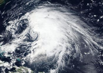
Lorenzo now a more organized and powerful hurricane on NASA satellite imagery
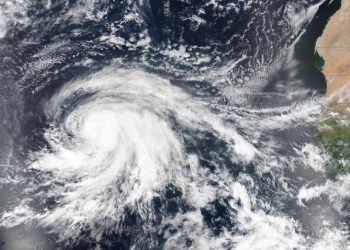
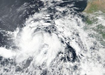
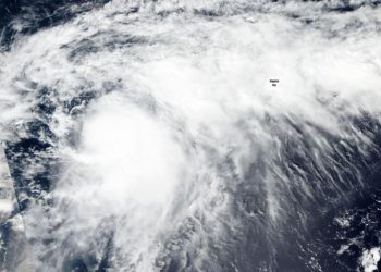
Credit: Credit: NASA/NRL NASA-NOAA's Suomi NPP satellite provided a full visible image of a strengthening Hurricane Lorenzo in the eastern ...
Credit: Credit: NASA/NRL NASA-NOAA's Suomi NPP satellite provided a full visible image of a strengthening Hurricane Lorenzo in the eastern ...
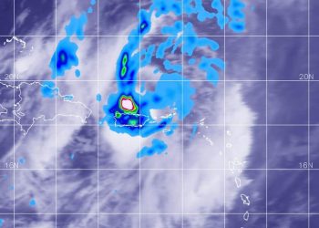
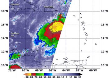
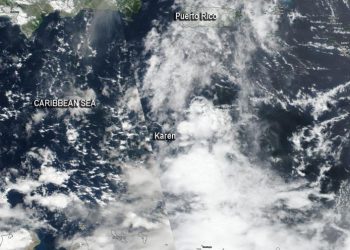
Credit: Credit: NASA/NRL Tropical Storm Karen has crossed over Puerto Rico and into the western Atlantic Ocean. Early on Sept. ...
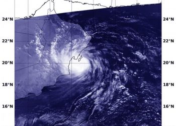
Credit: Credit: NASA/NRL Dropping cloud top temperatures from NASA-NOAA's Suomi NPP satellite indicated Hurricane Lorenzo was getting stronger in the ...
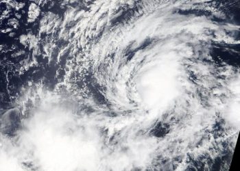
Credit: NASA/NOAA/NRL NASA-NOAA's Suomi NPP satellite passed over Jerry and provided forecasters with a view of its structure that helped ...
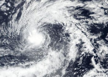
Credit: Credit: NASA/NRL Former Hurricane Kiko is now just a remnant low pressure area that has slid into the Central ...
Credit: NASA Worldview, Earth Observing System Data and Information System (EOSDIS) NASA's Aqua Satellite provides a variety of data on ...
Credit: NASA/NOAA/NRL Tropical Storm Lorenzo continued to strengthen and appeared more organized on visible imagery from NASA-NOAA's Suomi NPP satellite. ...
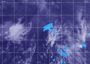
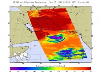
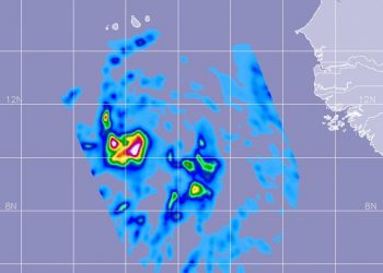
Credit: Credit: NASA/NOAA/NRL NASA-NOAA's Suomi NPP satellite passed over the Arabian Sea in the Northern Indian Ocean and provided forecasters ...
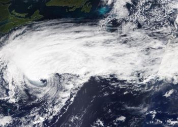
Credit: Credit: NASA/NOAA/NRL Tropical Storm Jerry continued to weaken as warnings were in effect for Bermuda on Sept. 24. Jerry ...
Credit: Credit: NASA/NOAA/NRL NASA-NOAA's Suomi NPP satellite passed over the Caribbean Sea and used infrared light to obtain temperature information ...
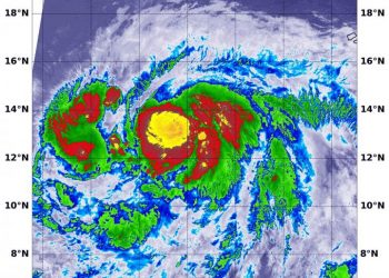
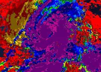
Credit: Credit: NASA JPL/Heidar Thrastarson The Northern Indian Ocean has generated a new tropical cyclone. NASA provided an infrared look ...
Credit: Credit: NASA Worldview, Earth Observing System Data and Information System (EOSDIS) NASA-NOAA's Suomi NPP satellite imagery revealed that Tropical ...
Credit: Credit: NASA/JAXA/NRL NASA calculated the rainfall rates in the Atlantic Ocean's newest tropical cyclone, Lorenzo. NASA has the unique ...
Credit: Credit: NASA Worldview, Earth Observing System Data and Information System (EOSDIS) Satellite imagery can be used to peer inside ...
Credit: Credit: NASA Worldview, Earth Observing System Data and Information System (EOSDIS) Forecasters use a variety of satellite imagery to ...
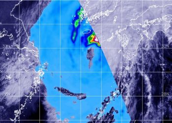
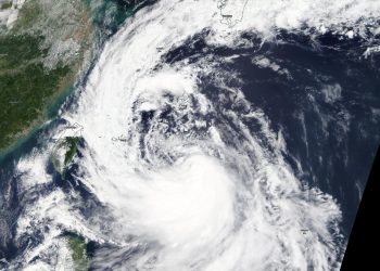
Credit: Credit: NASA/JAXA/NRL Tropical Storm Tapah had taken on an elongated shape as it moved through the Sea of Japan, ...
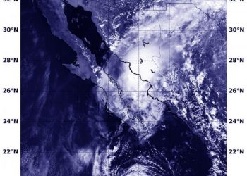
Credit: Credit: NASA Worldview, Earth Observing System Data and Information System (EOSDIS) As Tropical Storm Lorena was nearing landfall in ...
Credit: Credit: NASA Worldview Tropical Storm Tapah has a huge "tail" on NASA satellite imagery. NASA's Terra satellite captured an ...
Credit: Credit: NASA Worldview NASA's Terra satellite is one in a fleet of NASA satellites that provide data for research. ...
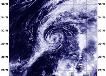
Credit: Credit: NASA Worldview, Earth Observing System Data and Information System (EOSDIS) Satellite data has confirmed that Humberto, once a ...
