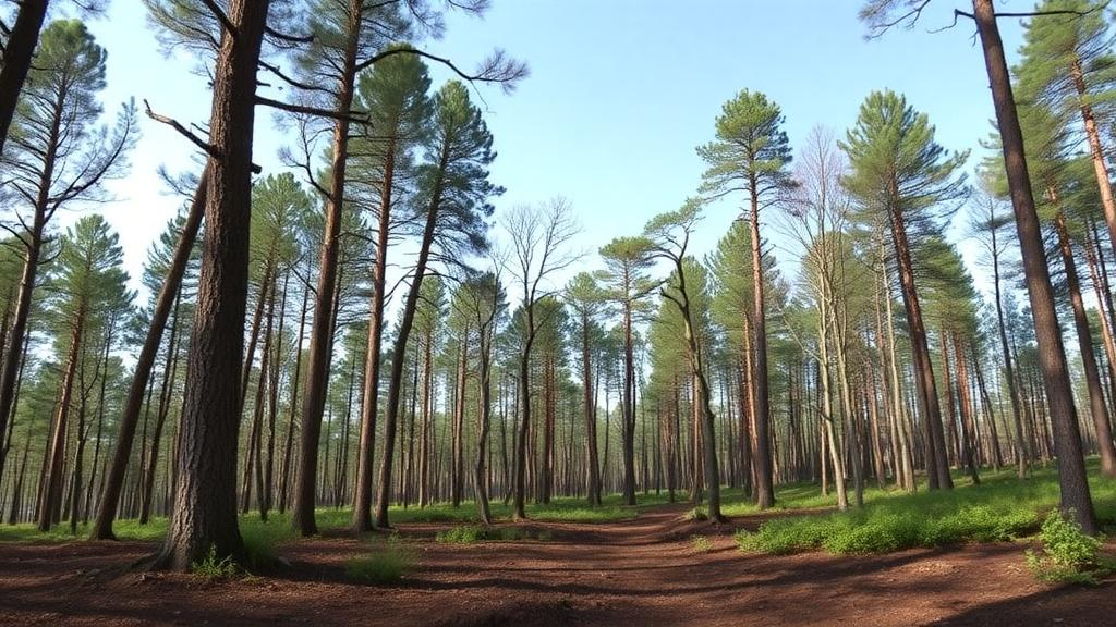
A new open-access database now describes forest stands at 583 forested sites of the French Soil Quality Monitoring Network, pairing repeated tree surveys conducted in 2006–2007 and 2024 with a detailed record of silvicultural practices spanning 1995 to 2024. The dataset, published as a data paper in Annals of Forest Science, was compiled so that the network’s extensive soil measurements can finally be interpreted in the light of the trees, stand structure and management history found above them.
The French Soil Quality Monitoring Network, known by its French acronym RMQS, monitors soil properties across mainland and overseas France on a systematic 16 by 16 kilometre grid of roughly 2,240 sites, each resampled on average fifteen years after its first survey. Of those sites, 583 are classified as forestland. The first soil sampling campaign ran between 2000 and 2009, and a second campaign began in 2016. Soil samples from the network undergo a wide range of physical, chemical and biological analyses, and the resulting data are freely available. What has been missing, the authors argue, is a coherent, site-level description of the forests themselves.
That gap mattered because forest inventory data are rarely coupled with concurrent soil measurements, which prevents a comprehensive assessment of total ecosystem carbon stocks. Forests are the primary terrestrial carbon sinks in the European Union, yet although total forest area in Europe is increasing, the rate of carbon sequestration in aboveground biomass is declining, driven by factors related to climate change and forest management. Forest soils often store more carbon than the aboveground biomass, making them the largest component of the European forest carbon pool, while the impacts of management changes, tree mortality and extreme disturbances on soil carbon dynamics remain poorly understood.
The forest inventories behind the new database were carried out in two waves. During 2006 and 2007, as part of the BioSoil project under the ICP Forests Level 1 programme, an inventory of the sites followed a harmonised European protocol focused on dendrometric measurements and biodiversity. A supplementary campaign in 2024 collected similar dendrometric and biodiversity data but added a strong focus on forest management practices. Because RMQS was designed to align geographically with the Forest Damage Monitoring Network, France’s contribution to ICP Forests Level 1, the vast majority of RMQS forest sites sit just a few metres from the corresponding monitoring plots, which have been visited annually by foresters since 1995 and each include approximately twenty dominant trees. Around sixty RMQS sites are not spatially colocated with such plots, and these were surveyed separately in 2024 by a dedicated team of technicians.
The 2024 inventory measured the circumference at breast height, 1.30 metres, of dominant and codominant trees, while understorey trees were quantified by diameter class from 7.5 centimetres upwards. Foresters also recorded a comprehensive assessment of stand characteristics, including structure and diversity, together with silvicultural management practices. The harmonised dataset reports tree densities by diameter class, total basal area, dominant tree height, stand origin, species diversity, forest structure, the presence of a management plan, thinning intervals, years since the last intervention and the type of that intervention. Exact site coordinates cannot be disclosed for legal reasons, so theoretical grid-cell centroids are provided instead, but an identifier allows cross-referencing with the ICP Forests network for colocated plots.
Perhaps the most technically interesting component is the estimation of aboveground volume, biomass and carbon stocks at each site. Because the RMQS protocols did not capture detailed tree-level measurements of circumference and height, conventional allometric equations could not be applied. The team instead trained a gradient boosting model, XGBoost, on data from 116,510 plots of the French National Forest Inventory, harmonised and aggregated to match the format of the RMQS site-level data. The model was tuned by fivefold cross-validation on eighty percent of the training set, with the remaining twenty percent reserved for internal validation. Alternative approaches, including K-nearest neighbours and random forest models, were tested but performed worse. Notably, the 2024 model relied on the basal area of dominant trees rather than total stand basal area, because relascope measurements can be unreliable in closed-canopy forests and mountainous terrain, an artifact that showed up in the 2024 data when dominant-tree basal area occasionally exceeded the total.
Both the 2006/2007 and 2024 models achieved an R-squared of 0.95 on internal validation sets, with an absolute RMSE below 41 cubic metres per hectare, a relative error under 19 percent. These figures reflect internal model performance on withheld National Forest Inventory data. For an independent check, nine RMQS plots in the Centre-Val de Loire region, chosen to represent coniferous and broadleaf stands and public and private ownership, were inventoried following the National Forest Inventory protocol, and their allometric volumes were compared with the model’s estimates, yielding an R-squared of 0.81 and a relative RMSE of 14.8 percent. The authors caution that this evaluation rests on nine plots from a single region of roughly 200 by 200 kilometres, and that full assessment of model transferability would require evaluation across a broader range of regions and stand conditions. Aboveground biomass was then derived by multiplying volume by wood density estimates for the main species, and aboveground carbon by applying a wood carbon concentration of 0.475 grams per gram.
Beyond the two snapshot inventories, the database includes a silvicultural monitoring file built on nearly three decades of annual observation. Dominant trees on the permanent plots have been tracked since 1995, and for every year in which one or more trees disappeared, the cause was recorded as cutting, storm damage, standing death, or other causes, most often fire, along with the proportion of basal area affected. This turns the dataset into a longitudinal record of how management and disturbance have reshaped the canopy at each site, not merely two still photographs.
The reuse potential is considerable. The data can help interpret associated soil properties within the RMQS network and identify forest covariates correlated with them, support the forcing and validation of mechanistic ecosystem models, and provide new covariates for studying the drivers of soil microbial diversity and functioning, including relationships between forest structural types and microbial assemblages such as fungal communities. Because silvicultural practices are known to influence soil organic carbon dynamics, yet datasets suitable for investigating these relationships at large spatial scales remain scarce, combining detailed forest descriptions with extensive soil measurements offers a route to better understanding the links between forest management and soil carbon stocks and fluxes.
The authors are candid about the limits. The aboveground dataset excludes dead wood and root biomass, both required for a complete forest carbon inventory, and the management dataset does not cover understorey vegetation, so accurate ecosystem carbon flux estimates would need additional assessments. The datasets are also not intended for producing national forest statistics: compared with the National Forest Inventory, the RMQS descriptions are less detailed and less suited to comprehensive descriptive assessments of French forests, and their major added value lies in the direct linkage with soil measurements at the same locations. Consistency checks did show broad agreement between RMQS volume distributions and National Forest Inventory ecoregion patterns, though two southeastern sites displayed high volumes in a generally low-volume region, a reminder of the coarser 16-kilometre sampling grid. Since most RMQS forest sites belong to the ICP Forests Level I network, extending comparable re-inventories to other participating countries could, the authors suggest, enable cross-country comparisons of forest-soil relationships and carbon dynamics. The database and its metadata are openly available through the Recherche Data Gouv repository.
Subject of Research: A database of forest stand descriptions and silvicultural management for 583 forest sites of the French Soil Quality Monitoring Network, from repeated surveys in 2006–2007 and 2024.
Article Title: Forest stand descriptions from the French Soil Quality Monitoring Network: repeated surveys (2006–2024) and documented silvicultural management
Article References: Pouységur, R., Fujisaki, K., Boulonne, L., Besic, N., Vega, C., Caroulle, F., & Saintonge, F.-X. (2026). Forest stand descriptions from the French Soil Quality Monitoring Network: repeated surveys (2006–2024) and documented silvicultural management. Annals of Forest Science, 83(1), Article 39. https://doi.org/10.1186/s13595-026-01353-7
Image Credits: AI Generated
DOI: 10.1186/s13595-026-01353-7
Keywords: forest soils, RMQS, soil quality monitoring, forest inventory, silviculture, aboveground biomass, carbon stocks, ICP Forests, machine learning, XGBoost, France, open data
News Source: Alan Morgan. (October 29, 2026). New French Database Links Forest Stands to Soil Quality at 583 Sites. Scienmag.