NASA estimates Imelda’s extreme rainfall
Credit: Credit: NASA Goddard NASA estimated extreme rainfall over eastern Texas from the remnants of Tropical Depression Imelda using a ...
Credit: Credit: NASA Goddard NASA estimated extreme rainfall over eastern Texas from the remnants of Tropical Depression Imelda using a ...
Credit: Credit: NASA/NOAA/NRL NASA-NOAA's Suomi NPP satellite passed over the North Atlantic Ocean and used infrared light to obtain temperature ...

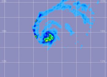
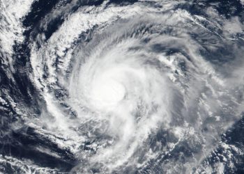
Credit: NASA/JAXA/NRL Two tropical cyclones are very close together near the coast of western Mexico. Hurricane Lorena was moving over ...
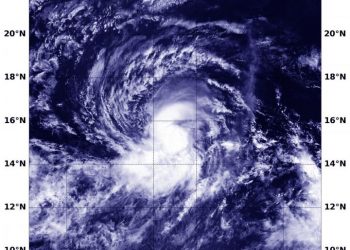
Credit: NASA/JAXA/NRL Tropical Storm Tapah formed quickly in the northwestern Pacific Ocean and as it was strengthening from a depression ...
Credit: NASA Worldview, Earth Observing System Data and Information System (EOSDIS) NASA-NOAA's Suomi NPP satellite imagery revealed Tropical Storm Mario ...
Credit: NASA Worldview, Earth Observing System Data and Information System (EOSDIS) Imagery from NASA-NOAA's Suomi NPP satellite found Tropical Storm ...
Credit: Credit: NASA Worldview, Earth Observing System Data and Information System (EOSDIS) Satellite imagery from NASA-NOAA's Suomi NPP satellite showed ...
Credit: Credit: NASA/JAXA/NRL NASA has the unique capability of peering under the clouds in storms and measuring the rate in ...
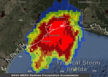
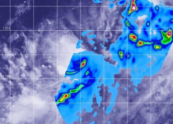
Credit: NASA Goddard/Owen Kelley Northeastern Texas has borne the brunt of Tropical Depression Imelda's heavy rainfall and NASA estimated that ...
Credit: NASA Worldview, Earth Observing System Data and Information System (EOSDIS). NASA's Aqua Satellite provided data on Major Hurricane Humberto ...
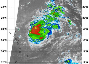
Credit: NASA/JAXA/NRL When the Global Precipitation Measurement mission or GPM core satellite passed over the Eastern Pacific Ocean, it flew ...
Credit: NASA JPL/Heidar Thrastarson One of the ways NASA researches tropical cyclones is using infrared data that provides temperature information. ...
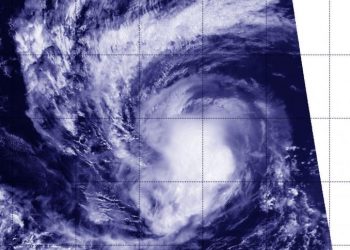
Credit: Credit: NASA Worldview, Earth Observing System Data and Information System (EOSDIS) Hurricane Kiko weakened to a tropical storm, but ...
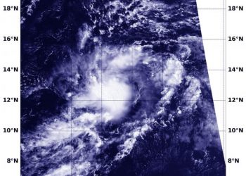
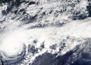
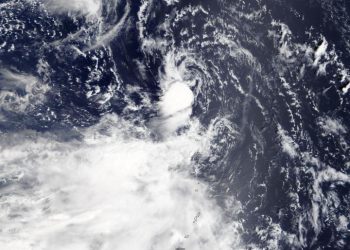
Credit: Credit: NASA/NOAA/NRL Tropical Storm Jerry is the latest in a line of tropical cyclones to develop in the North ...
Credit: Credit: NASA Worldview NASA's Aqua satellite is one in a fleet of NASA satellites that provide data for research. ...
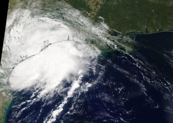
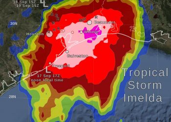
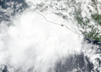
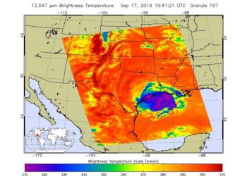
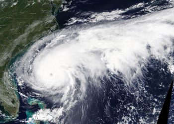
Credit: NASA Worldview NASA's Terra satellite passed over the western Gulf of Mexico during the early afternoon of Sept. 17 ...
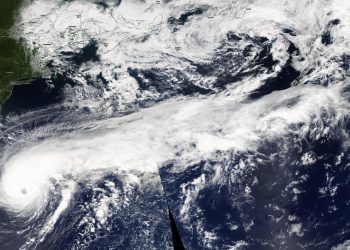
Credit: Credit: NASA/NOAA/NRL Hurricane Kiko continued to track west through the Eastern Pacific Ocean when NASA-NOAA's Suomi NPP satellite passed ...
Credit: Credit: NASA Worldview, Earth Observing System Data and Information System (EOSDIS). NASA's Terra Satellite provided a visible image of ...
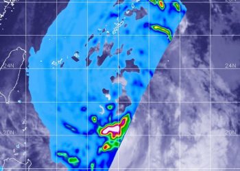
Credit: NASA Worldview, Earth Observing System Data and Information System (EOSDIS) NASA's Terra satellite passed over the northwestern Pacific Ocean ...
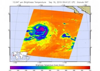
Credit: NASA JPL/Heidar Thrastarson NASA's Aqua satellite provided forecasters at the National Hurricane Center with infrared data and cloud top ...
