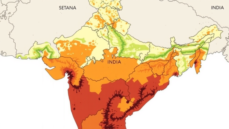
In the semi-arid farmlands of Banaskantha district in North Gujarat, two fields separated by only a few kilometers can behave like entirely different worlds. One may hold enough moisture and organic carbon to sustain healthy crops; the other may be so salty and alkaline that seedlings struggle to survive. A new district-wide study published in Discover Soil has now put hard numbers and detailed maps on that hidden diversity, offering one of the most comprehensive pictures yet of how soil fertility varies across a 12,703-square-kilometer agricultural landscape in western India.
The research team, led by Mukesh P. Chaudhari of Gujarat University’s Department of Chemistry together with Ruchi Nair, Pratik Chavda, Dharmik Patel and Divya R. Mishra, combined systematic field sampling with Geographic Information System (GIS) mapping and multivariate statistics. Their goal was straightforward but ambitious: to measure the spatial distribution of the major soil fertility indicators across all fourteen talukas of Banaskantha and to translate those measurements into practical guidance for sustainable land management in a region where salinity, nutrient depletion and drought are intensifying pressures.
To capture the district’s variability, the researchers collected 46 geo-referenced composite soil samples from agricultural fields using a systematic 15 by 15 kilometer grid, an approach aligned with internationally accepted spatial sampling guidelines from the Food and Agriculture Organization and the USDA-NRCS Soil Survey Manual. At each sampling point, five sub-samples were taken in a zig-zag pattern within a 10 to 15 meter radius and homogenized into a single representative composite. All samples came from the 0 to 15 centimeter plough layer, the zone most responsive to nutrient availability and management. Each sample was then analyzed in the laboratory for soil moisture, pH, electrical conductivity (EC), organic carbon (OC), and available nitrogen, phosphorus and potassium.
Turning those numbers into pictures required spatial interpolation. Using ArcGIS version 10.8.1, the team applied the Inverse Distance Weighting (IDW) technique, a deterministic method that estimates unknown values from the weighted average of nearby sampling points, assuming that closer observations carry more influence than distant ones. The resulting raster layers, classified into concentration ranges and overlaid on the district boundary, produced district-scale thematic maps of every fertility indicator. The authors are candid that these maps are intended for regional visualization rather than precise field-level prediction, and that formal cross-validation statistics were not performed; they recommend denser sampling networks and geostatistical validation in future work.
The findings reveal dramatic heterogeneity. Soil moisture ranged from less than 1 percent to more than 20 percent, with the highest values in Suigam (24.74 percent), Vav (13.92 percent) and Lakhani (12.87 percent), where finer clay- and silt-rich soils retain water through greater surface area and capillary action, and where shallow groundwater or capillary rise may contribute. In contrast, the coarse sandy soils of Dhanera, Deesa, Kankrej and parts of Tharad and Palanpur drain rapidly and lose moisture to intense evapotranspiration, leaving almost nothing in reserve. Soil pH spanned from slightly acidic (6.34) in the forest-influenced taluka of Danta, where higher rainfall leaches basic cations, to strongly alkaline (8.65) in Vav, Suigam and parts of Lakhani, where aridity and carbonate-rich parent materials drive salt accumulation.
Electrical conductivity told perhaps the starkest story. While some soils in Deesa, Palanpur and Vadgam showed EC values as low as 0.01 dS/m, samples from Suigam and Lakhani exceeded 200 dS/m, indicating severe salinity likely driven by saline groundwater, an arid climate and evaporitic concentration of salts at the surface. Such salinity lowers osmotic potential, hampers water uptake by plants and damages soil structure. The study also identified a persistent district-wide phosphorus deficit: available phosphorus ranged from just 0.25 to 7.97 mg/kg, with most talukas below 3 mg/kg, because alkaline conditions cause phosphorus to precipitate as insoluble calcium phosphates. Available potassium, by contrast, swung from 49 to 884 mg/kg, with very high values in Bhabhar, Deesa and Danta, likely reflecting mica-rich parent material or heavy fertilizer input. Available nitrogen ranged even more widely, from 78 to 2,100 mg/kg, with the highest levels in Bhabhar, Kankrej and Lakhani, probably tied to farmyard manure, nitrogen fertilizers and clay that retains ammonium.
Organic carbon emerged as a central thread running through the district’s fertility story. Levels ranged from a very low 0.10 percent to a high 3.50 percent, with the richest soils found in Danta’s forest-edge environments, where cooler microclimates, better moisture and greater biomass return slow decomposition and build humus. The intensively farmed alluvial plains of Deesa, Dhanera, Palanpur and Kankrej showed very low organic carbon, a consequence of sandy textures, rapid oxidation under high temperatures and continuous cropping with minimal residue return. Correlation analysis reinforced carbon’s pivotal role: organic carbon was positively associated with available phosphorus (r = 0.499) and available potassium (r = 0.444), while the strongest relationship in the entire matrix linked available phosphorus and potassium (r = 0.778), suggesting shared parent materials or similar fertilization histories.
Principal Component Analysis then distilled the district’s complexity into two dominant processes. Validated by a Kaiser-Meyer-Olkin statistic of 0.61 and a highly significant Bartlett’s test (p < 0.001), the PCA extracted two components with eigenvalues greater than 1 that together explained over 72 percent of the total variance. The first, accounting for 55.42 percent, loaded heavily on electrical conductivity, available potassium, available nitrogen and soil moisture, representing a salinity-nutrient enrichment factor typical of semi-arid regions where evapotranspiration exceeds precipitation and soluble ions accumulate at the surface. The second, explaining 17.32 percent, was dominated by pH, organic carbon and available phosphorus, capturing the organic matter-fertility relationship in which carbon-rich soils maintain more stable pH and better phosphorus availability.
The practical implications are as uneven as the soils themselves. The authors conclude that a single, uniform fertilizer recommendation is unlikely to optimize productivity across the district. Eastern and northeastern areas, including Danta, Bhabhar, Amirgadh and parts of Vav, show comparatively better soil health and should focus on conservation practices to maintain fertility. Nutrient-deficient zones in the central plains call for integrated nutrient management combining organic amendments, residue retention, biochar or farmyard manure with balanced fertilization. The severely saline talukas of Suigam and Lakhani require reclamation through gypsum application, improved drainage, optimized irrigation and salt-tolerant crops. In high-pH zones, phosphorus-solubilizing biofertilizers, split phosphorus doses and organic matter additions could unlock trapped nutrients, while high-nitrogen areas should be monitored to prevent nitrate leaching into groundwater.
The researchers emphasize that their nutrient management strategies remain preliminary decision-support recommendations. The agronomic effectiveness and economic feasibility of the proposals have not yet been tested through crop response experiments, fertilizer trials or cost-benefit analyses, and the study did not include indicators such as soil texture, cation exchange capacity, micronutrients or biological properties. Still, by fusing laboratory chemistry, GIS interpolation and multivariate statistics into a single framework, the study establishes an important baseline dataset for regional soil fertility assessment. In a state that contains some of India’s largest extents of saline and alkaline land, and a country where roughly 175 million hectares of agricultural area face soil-related constraints, showing precisely where a district’s soils are thriving and where they are failing may prove to be the first, indispensable step toward farming that fits the ground it stands on.
Subject of Research: Spatial variability of soil fertility indicators assessed with GIS and multivariate statistics for sustainable land management in a semi-arid Indian district
Article Title: Spatial variability of soil fertility indicators using GIS for sustainable land management in Banaskantha district western India
Article References: Chaudhari, M. P., Nair, R., Chavda, P., Patel, D., & Mishra, D. R. (2026). Spatial variability of soil fertility indicators using GIS for sustainable land management in Banaskantha district western India. Discover Soil, 3(1), Article 161. https://doi.org/10.1007/s44378-026-00320-y
Image Credits: AI Generated
DOI: 10.1007/s44378-026-00320-y
Keywords: soil fertility, spatial variability, GIS, Inverse Distance Weighting, soil salinity, organic carbon, soil pH, available nutrients, principal component analysis, precision agriculture, sustainable land management, semi-arid India
Cite Scienmag News
APA
MLA
Chicago
Alan Morgan. (September 21, 2026). Maps Reveal Hidden Soil Fertility Divide Across Semi-Arid Western India. Scienmag. https://scienmag.com/maps-reveal-hidden-soil-fertility-divide-across-semi-arid-western-india/
Alan Morgan. “Maps Reveal Hidden Soil Fertility Divide Across Semi-Arid Western India.” Scienmag, 21 September 2026, https://scienmag.com/maps-reveal-hidden-soil-fertility-divide-across-semi-arid-western-india/. Accessed 21 September 2026.
Alan Morgan. “Maps Reveal Hidden Soil Fertility Divide Across Semi-Arid Western India.” Scienmag. September 21, 2026. https://scienmag.com/maps-reveal-hidden-soil-fertility-divide-across-semi-arid-western-india/
Copy citation
Download RIS
Tags: available nutrientscomprehensive soil survey techniquesGeographic Information Systems in agricultureGISGIS soil analysisimpact of drought on soil healthinverse distance weightingorganic carbonorganic carbon in soilsprecision agriculturePrincipal Component Analysissalinity-affected farmlands in western Indiasemi-arid agriculturesemi-arid Indiasoil fertilitySoil fertility mapping in Indiasoil nutrient depletion in semi-arid regionssoil pHsoil salinitysoil salinity and alkalinityspatial variabilityspatial variability of soil nutrientssustainable land managementsustainable land management in Gujarat