In an era where climate change is exacerbating the frequency and intensity of extreme weather events, comprehending flood risks has become more critical than ever before. A groundbreaking study recently published in the International Journal of Disaster Risk Science unveils an innovative methodology for time-series flood risk assessment that bridges the gaps left by conventional data collection practices. By leveraging an ingenious combination of remote sensing technology and the vast, real-time data harvested from social media platforms, this new approach addresses the notorious challenge of time information loss—an issue that has historically hampered the accuracy of flood risk analyses.
Traditionally, flood risk assessments have relied heavily on hydrological models fed by data from meteorological stations and satellite imagery. While these sources provide valuable insights, they often suffer from data voids caused by temporal gaps or spatial sparsity, especially in developing regions where infrastructure may be limited. These gaps translate into what experts call “time information loss,” meaning that important transient events can go undocumented, leading to underestimations or miscalculations of risk. The researchers, led by Liu, Z., have developed a sophisticated compensation method that effectively fills these temporal gaps, creating a more continuous, high-resolution picture of flood dynamics.
The team’s approach is centered on time-series analysis that integrates remote sensing data—such as satellite radar and optical images—with dynamic, user-generated content collected from social media platforms during flood events. This fusion addresses the critical issue of timing, where remote sensing data may be captured at intervals too sparse to detect rapid changes, whereas social media offers a real-time pulse of environmental conditions as experienced and reported by on-the-ground populations. By combining these data streams, the model can reconstruct flood scenarios with remarkable temporal fidelity.
Social media, often dismissed as anecdotal or unstructured, emerges here as a powerful data complement. Platforms like Twitter, Facebook, and Instagram serve as instant reporting hubs during disasters, where citizens upload photos, videos, and status updates that carry embedded geospatial and temporal metadata. The researchers utilized advanced natural language processing (NLP) and machine learning algorithms to filter, validate, and categorize social media content relevant to flood occurrences. This curated flow of information helps compensate for remote sensing’s periodic blind spots, ensuring that no critical moments slip through the cracks.
One of the most compelling aspects of this research is its ability to operationalize the concept of time information loss compensation. The study introduces mathematical models that quantify the extent of temporal data loss and then refine the flood risk framework accordingly. By doing so, it achieves a dynamic synergy between different data types, rather than treating remote sensing and social media inputs as isolated or supplementary. This innovation is transformative, promising more accurate hazard mapping, real-time risk forecasting, and ultimately, better-informed disaster management decisions.
Remote sensing’s contribution remains indispensable, particularly through its objectivity and broad spatial coverage. Satellite platforms like Sentinel-1 and Landsat provide multi-spectral and radar data that reveal the geography and extent of floodwaters with impressive precision. However, these satellites operate on fixed revisit cycles, sometimes leaving critical hours or days unmonitored. Without supplementary real-time information, this temporal resolution limitation translates into blind spots. The novel model leverages social signals to patch these blind spots, turning what used to be asynchronous, disjointed datasets into a harmonious, continuous stream.
From a technical standpoint, the fusion process relies on temporal interpolation methods that utilize both deterministic and probabilistic models to estimate missing data points within the time series. These estimations are continuously refined by the influx of social media reports, which act as ground truth fuelling machine learning feedback loops. The result is a near-real-time flood risk assessment system that is adaptable to various geographical and climatic contexts. Such adaptability is particularly valuable in regions prone to flash floods, where rapid onset and short duration render traditional monitoring insufficient.
Beyond technical intricacies, the implications of this research are profound. Urban planners, emergency responders, and policymakers stand to benefit significantly from the enhanced situational awareness this model offers. Flood risk maps generated through this fusion method reveal not only where floodwaters have spread but also how quickly they evolve over time. This temporal depth is crucial for timely evacuations, resource allocation, and infrastructure reinforcement. Moreover, the methodology empowers communities to contribute actively to disaster monitoring, transforming social media usage during crises from mere communication into a potent sensor network.
The approach also champions a paradigm shift in the way data is perceived and employed for disaster risk reduction. Traditionally, social media data has been treated cautiously, often owing to concerns about misinformation, data quality, and representativeness. This study innovatively mitigates these concerns by incorporating robust filtering, verification, and weighting schemes tailored to maximize reliability. The fusion model thereby opens a new frontier where citizen-generated content is recognized as valid, actionable intelligence within formal scientific frameworks.
Furthermore, the study’s significance extends to the realm of climate adaptation. As global warming intensifies hydrological cycles, flood patterns are becoming less predictable and more volatile. Tools that can dynamically respond to evolving hazards in near real-time equip stakeholders with a crucial advantage. They allow for flexible, responsive risk management, potentially saving lives and reducing economic losses caused by flooding. Integrating social media responses with remote sensing creates a feedback mechanism where community experiences directly inform hazard assessments.
In addition, the researchers underscore the potential for scalability and customization of their framework. The modular nature of the model means it can be tailored to incorporate additional data sources, such as Internet of Things (IoT) sensors, weather station inputs, and crowdsourced reports beyond social media. This extensibility ensures the framework can adapt to the fast-changing digital and environmental landscapes, providing a resilient toolset for disaster risk scientists and emergency managers alike.
From an ethical perspective, the study also touches upon data privacy and user consent in social media data harvesting. While maximizing utility, the researchers emphasize anonymization protocols and adherence to platform policies, ensuring that individual rights are respected during data processing. This responsible approach aligns with growing calls for ethical data use in scientific research, balancing innovation with respect for personal privacy.
As to the future directions of this research, the study posits that integrating artificial intelligence-driven predictive analytics into the fusion model could further enhance forecast accuracy. Deep learning models trained on the fused datasets might eventually simulate flood progression scenarios with minimal human intervention. This progression heralds the dawn of autonomous flood monitoring systems capable of issuing early warnings based on continuously updated, multi-source data streams.
The work by Liu and colleagues is a clarion call for interdisciplinary collaboration. It melds geospatial science, data science, disaster management, and social computing into a unified framework that transcends traditional disciplinary boundaries. The result is not merely a sophisticated academic exercise but a pragmatically valuable innovation poised to transform flood risk assessment worldwide.
In conclusion, this pioneering study redefines what flood risk assessment can and should be in an increasingly interconnected world. By leveraging the complementary strengths of remote sensing and social media data, it addresses one of the most persistent problems in disaster science—time information loss—with elegance and efficacy. As floods continue to threaten millions globally, tools like these provide hope for smarter, faster, and more inclusive disaster resilience strategies. The future of flood monitoring and response may very well hinge on such dynamic data fusion, empowering societies to act decisively when it matters most.
Subject of Research: Time-series flood risk assessment integrating remote sensing and social media data with a focus on compensating for temporal information loss during flood events.
Article Title: Time-Series Flood Risk Assessment Based on Time Information Loss Compensation: Fusing Remote Sensing and Social Media Data.
Article References:
Liu, Z., Li, J., Wang, L. et al. Time-Series Flood Risk Assessment Based on Time Information Loss Compensation: Fusing Remote Sensing and Social Media Data. Int J Disaster Risk Sci (2025). https://doi.org/10.1007/s13753-025-00679-6
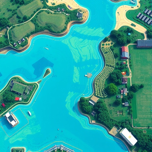
Image Credits: AI Generated
Tags: addressing data voids in developing regionsclimate change and extreme weather eventscontinuous monitoring of flood dynamicsflood risk assessment methodologieshydrological models and flood predictionimproving accuracy in flood risk calculationsinnovative flood risk analysis techniquesovercoming time information loss in flood studiesreal-time data integration for disaster responseremote sensing technology in flood analysissocial media data for disaster managementtime-series flood risk assessment