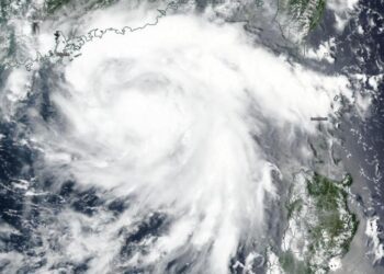
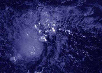
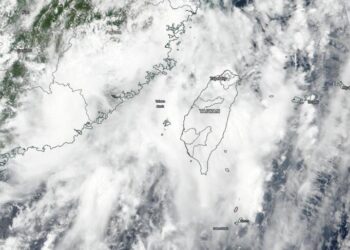
NASA-NOAA satellite snaps image of tropical storm Higos in South China Sea
Credit: Credit: NASA Worldview, Earth Observing System Data and Information System (EOSDIS) NASA-NOAA's Suomi NPP satellite passed over the South ...
Credit: Credit: NASA Worldview, Earth Observing System Data and Information System (EOSDIS) NASA-NOAA's Suomi NPP satellite passed over the South ...
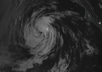
Credit: Credit: NASA/NRL Post-Tropical Storm Fausto faded fast in the Eastern Pacific Ocean. NASA's Terra satellite provided an infrared look ...
Credit: redit: NASA/NRL NASA's Terra satellite used infrared light to identify strongest storms and coldest cloud top temperatures and found ...
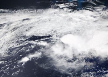
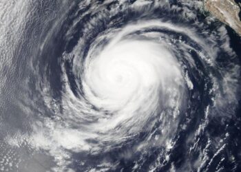
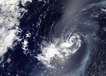
Credit: Credits: NASA/NRL Tropical Depression 10E weakened to a remnant low-pressure area in the Eastern Pacific Ocean. NASA's Terra satellite ...
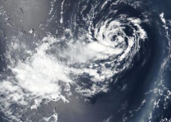
Credit: Image: NASA Worldview NASA's Terra satellite provided a visible image of the end of Post-tropical Storm Kyle in the ...
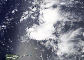
Credit: Image Courtesy: NASA Worldview, Earth Observing System Data and Information System (EOSDIS). Tropical Storm Josephine weakened on Aug. 16 ...
Credit: Credit: NASA Worldview, Earth Observing System Data and Information System (EOSDIS) NASA-NOAA's Suomi NPP satellite provided forecasters with a ...
Credit: Credit: NASA Worldview, Earth Observing System Data and Information System (EOSDIS) NASA-NOAA's Suomi NPP satellite provided forecasters with a ...
Credit: Credit: NASA Worldview, Earth Observing System Data and Information System (EOSDIS) The tenth named tropical cyclone of the Atlantic ...
Credit: Credit: NASA Worldview, Earth Observing System Data and Information System (EOSDIS) NASA-NOAA's Suomi NPP satellite provided a night-time image ...
Credit: Image Courtesy: NASA Worldview, Earth Observing System Data and Information System (EOSDIS). NASA's Aqua satellite obtained visible imagery of ...
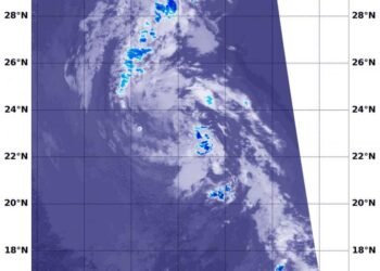
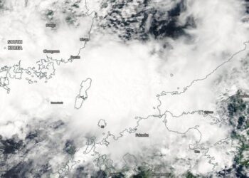
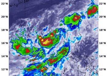
Credit: Credit: NASA Worldview, Earth Observing System Data and Information System (EOSDIS) Tropical Depression 06W has been around for days, ...
Credit: Credit: NASA Worldview, Earth Observing System Data and Information System (EOSDIS) NASA-NOAA's Suomi NPP satellite provided forecasters with a ...
Credit: Credit: NASA Worldview, Earth Observing System Data and Information System (EOSDIS) A new animation of night-time imagery from NASA-NOAA's ...
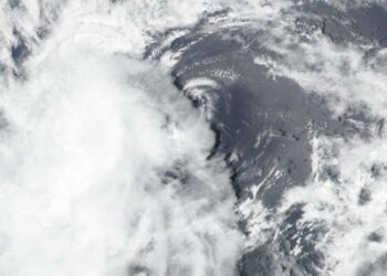
Credit: Credit: NASA/NRL NASA's Terra satellite revealed that a wispy looking Tropical Depression 06W in the Northwestern Pacific Ocean was ...

Clemson postdoc and a multi-institutional research team documented "surfer waves" in the upper atmosphere that create a pipeline of energy ...
Credit: Image Courtesy: NASA Worldview, Earth Observing System Data and Information System (EOSDIS). NASA's Aqua satellite obtained a visible image ...
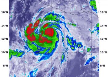
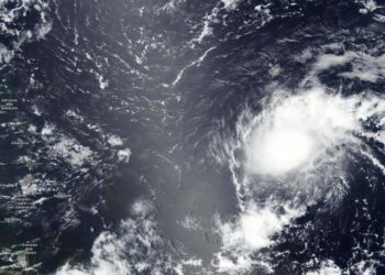
Credit: Credit: NASA/NRL After Tropical Depression 07W formed close to the western Philippines, it moved away and strengthened into a ...
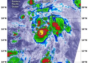
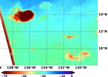
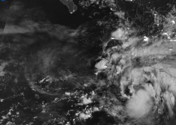
Credit: Credit: NASA/NRL After Tropical Depression 09E formed near the coast of southwestern Mexico, infrared data from NASA's Aqua satellite ...
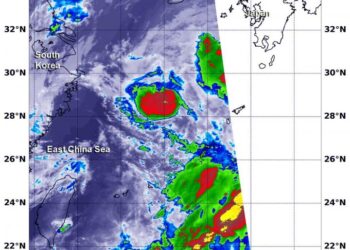
Credit: Credit: NASA/NRL Tropical Storm Jangmi was exiting the East China Sea and moving toward the Sea of Japan when ...
