NASA finds coldest cloud tops on hurricane Teddy’s western side
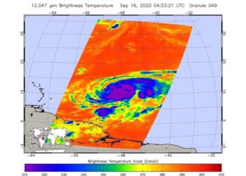
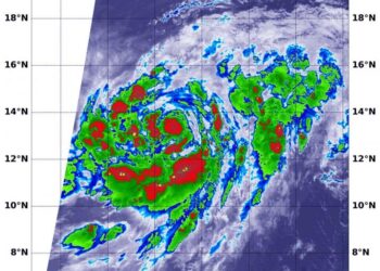
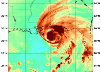
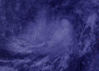
Credit: Credit: NASA JPL/Heidar Thrastarson NASA analyzed the cloud top temperatures in Hurricane Teddy using infrared light to determine the ...
Credit: Credit: NASA JPL/Heidar Thrastarson NASA analyzed the cloud top temperatures in Hurricane Teddy using infrared light to determine the ...
Credit: Credit: NASA/NRL Tropical cyclones can become post-tropical before they dissipate, meaning they can become sub-tropical, extra-tropical or a remnant ...
Credit: Credit: NASA Worldview, Earth Observing System Data and Information System (EOSDIS) Tropical Storm Karina was making night moves like ...
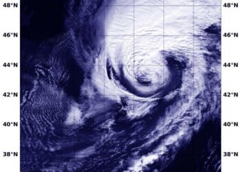
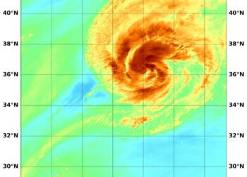
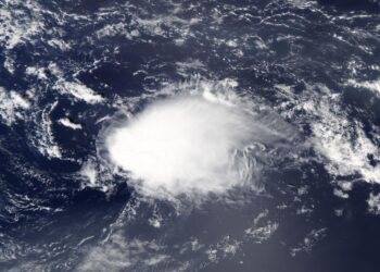
Credit: Image Courtesy: NASA/NRL NASA's Terra satellite obtained visible imagery of Tropical Storm Vicky as it continued moving through the ...
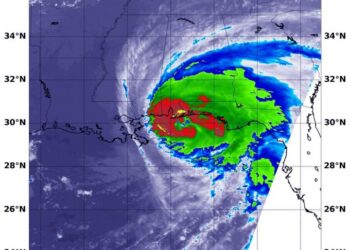
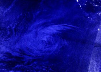
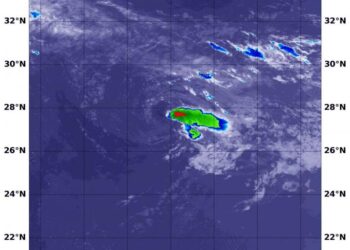
Credit: Credit: NASA/NRL NASA's Aqua satellite and the NASA-NOAA Suomi NPP satellite provided views of the strength, extent and rainfall ...
Credit: Credit: NASA Worldview, Earth Observing System Data and Information System (EOSDIS) NASA-NOAA's Suomi NPP satellite provided an infrared look ...
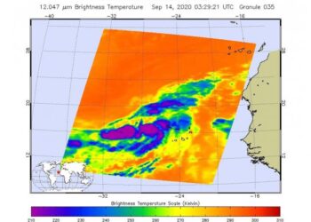
Credit: Credits: NASA/NRL NASA's Aqua satellite analyzed Hurricane Paulette's water vapor content as it continued to move away from Bermuda ...
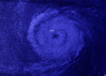
Credit: NASA/NRL When a tropical cyclone consolidates, it means that it is getting more organized and its circulation is improving. ...
Credit: Credits: NASA/NRL NASA's Aqua satellite analyzed the cloud top temperatures and water vapor content in Hurricane Sally as it ...
Credit: Image Courtesy: NASA Worldview, Earth Observing System Data and Information System (EOSDIS). NASA's Aqua satellite captured a visible image ...
Credit: Credit: NASA Worldview, Earth Observing System Data and Information System (EOSDIS) Infrared imagery is like having night vision, and ...
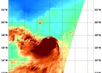
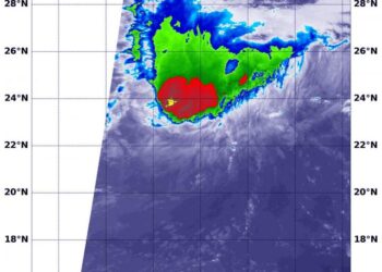
Credit: Credit: NASA JPL/Heidar Thrastarson NASA's Aqua satellite analyzed a low-pressure area in the far eastern Atlantic Ocean, and it ...
Credit: NASA Worldview, Earth Observing System Data and Information System (EOSDIS) NASA-NOAA's Suomi NPP satellite provided an infrared image of ...
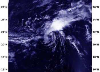
Credit: NASA/NRL When NASA's Aqua satellite passed over the Eastern Pacific Ocean, it gathered water vapor data on Tropical Storm ...
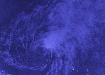
Credit: Credit: NASA Worldview, Earth Observing System Data and Information System (EOSDIS) Night-time imagery from NASA-NOAA's Suomi NPP satellite showed ...
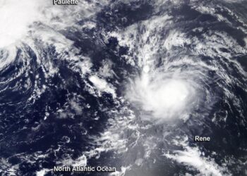
Credit: Credit: NASA/NRL Tropical Depression Rene continues to be the victim of strong wind shear and forecasters anticipate it will ...
Credit: Credit: NASA/NRL Wind shear was affecting both Tropical Storm Paulette and Rene in the Atlantic Ocean on Sept. 11. ...
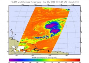
Credit: Credit: NASA/NRL Infrared imagery from NASA's Aqua satellite showed an elongated Tropical Storm Rene being battered by wind shear ...
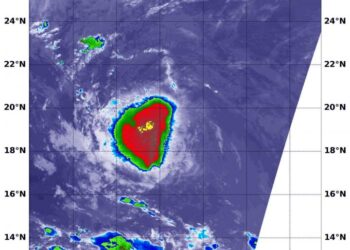
Credit: NASA JPL/Heidar Thrastarson NASA's Aqua satellite analyzed Tropical Storm Paulette in infrared imagery as it moved through the Central ...
Credit: Image Courtesy: NASA Worldview, Earth Observing System Data and Information System (EOSDIS). NASA's Terra satellite obtained visible imagery of ...
