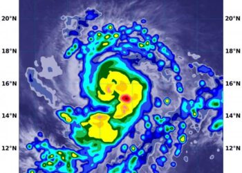
NASA analyzes Hurricane Delta’s water vapor concentration
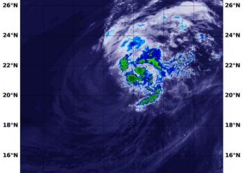
Credit: Credits: NASA/NRL When NASA's Aqua satellite passed over the Caribbean Sea on Oct. 7, it gathered water vapor data ...
Credit: Credits: NASA/NRL When NASA's Aqua satellite passed over the Caribbean Sea on Oct. 7, it gathered water vapor data ...
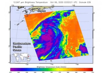
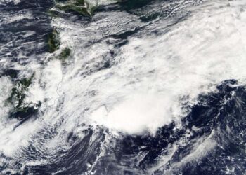
Credit: Credit: NASA JPL/Heidar Thrastarson NASA's Aqua satellite analyzed the large Tropical Storm Chan-hom as it tracked through the Northwestern ...
Credit: Credit: NASA Worldview, Earth Observing System Data and Information System (EOSDIS) NASA-NOAA's Suomi NPP satellite passed over the Eastern ...
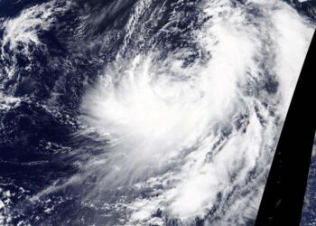
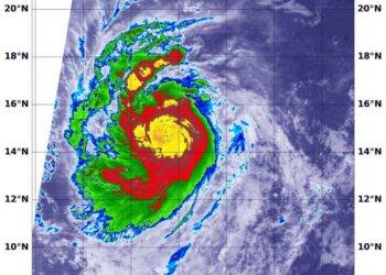
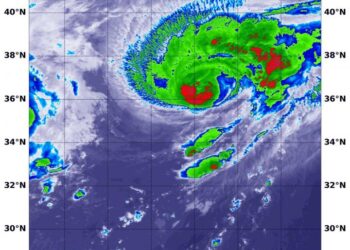
Credit: NASA/NRL Infrared imagery from NASA-NOAA's Suomi NPP satellite revealed that Hurricane Delta has been rapidly growing stronger and more ...
Credit: NASA/NRL NASA's Aqua satellite provided an infrared view of Tropical Storm Marie that revealed the effects of outside winds ...
Credit: Image Courtesy: NASA Worldview, Earth Observing System Data and Information System (EOSDIS). NASA's Terra satellite obtained visible imagery of ...
Credit: Image Courtesy: NASA Worldview, Earth Observing System Data and Information System (EOSDIS). NASA's Terra satellite obtained visible imagery of ...
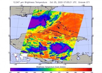
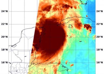
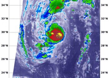
Credit: NASA JPL/Heidar Thrastarson NASA's Aqua satellite analyzed Tropical Storm Delta in infrared imagery as it moved through the Caribbean ...
Credit: NASA/NOAA/NRL Imagine being able to look down at a storm from orbit in space, and provide data that lets ...
Credit: NASA/NRL NASA infrared imagery revealed that Hurricane Marie is rapidly growing stronger and more powerful. Infrared imagery revealed that ...
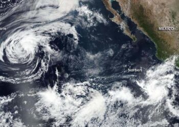
Credit: Credit: NASA/NOAA/NRL Tropical Storm Marie has formed in the Eastern Pacific Ocean and NASA satellite data helped confirm the ...
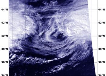
Credit: Credit: NASA/NRL Tropical cyclones can become post-tropical before they dissipate, meaning they can become sub-tropical, extra-tropical or a remnant ...
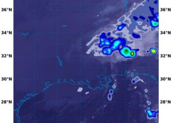
Credit: Credit: NASA/NRL NASA's Terra satellite used infrared light to identify strongest storms and coldest cloud top temperatures in Typhoon ...
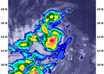
Credit: NASA/NRL NASA analyzed the cloud top temperatures in Tropical Storm Kujira using infrared light to determine the strength of ...
Credit: Image Courtesy: NASA Worldview, Earth Observing System Data and Information System (EOSDIS). NASA's Terra satellite obtained visible imagery of ...
Credit: Credit: NASA/NRL NASA's Aqua satellite provided an infrared view of Tropical Storm Lowell that revealed the effects of outside ...
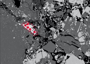
Credit: Modified after Koike et al. (2020) EPSL Researchers have shaken up a once accepted timeline for cataclysmic events in ...
Credit: NASA Worldview, Earth Observing System Data and Information System (EOSDIS) NASA-NOAA's Suomi NPP satellite provided an infrared image of ...
Credit: Image Courtesy: NASA Worldview, Earth Observing System Data and Information System (EOSDIS). NASA's Aqua satellite caught a visible image ...
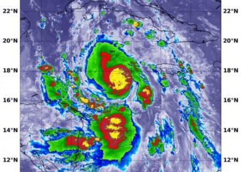
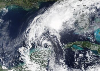
Credit: Credit: NASA/NOAA/NRL Using a NASA satellite rainfall product that incorporates data from satellites and observations, NASA estimated Post-tropical Cyclone ...
