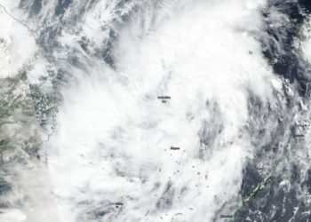
NASA finds Tropical Storm Matmo consolidating off Vietnam coast
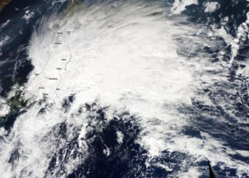
Credit: NASA Worldview, Earth Observing System Data and Information System (EOSDIS) NASA-NOAA's Suomi NPP satellite captured an image of Tropical ...
Credit: NASA Worldview, Earth Observing System Data and Information System (EOSDIS) NASA-NOAA's Suomi NPP satellite captured an image of Tropical ...
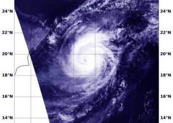
Credit: Credit: NASA Worldview NASA's Aqua satellite captured an image of Tropical Cyclone Kyarr in the Arabian Sea is it ...
Credit: Credit: NASA/JAXA/NRL Tropical Cyclone Kyarr is moving through the central Arabian Sea and NASA provided forecasters with an analysis ...
Credit: NASA Worldview Pablo is a tropical cyclone that formed late on Oct. 25 and strengthened into a hurricane for ...
Credit: NASA Worldview Tropical Depression 17 strengthened briefly into a tropical storm on the same day it formed, Oct. 25. ...
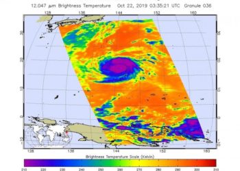
Credit: NASA/NOAA/UWM-CIMSS, William Straka III NASA-NOAA's Suomi NPP satellite and NASA's Aqua satellite both passed over the Northwestern Pacific Ocean ...
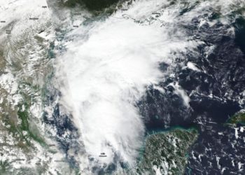
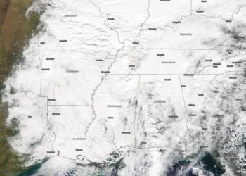
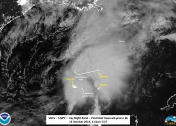
Credit: NASA/NOAA/NRL NASA-NOAA's Suomi NPP satellite passed over the Gulf of Mexico and revealed that a low pressure area was ...
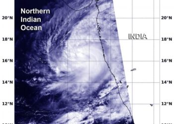
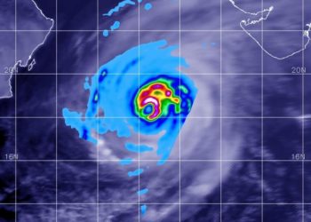
Credit: NASA/NRL Tropical Storm Kyarr formed near the southwestern coast of India, and NASA's Aqua satellite provided forecasters with a ...
Credit: NASA Worldview, Earth Observing System Data and Information System (EOSDIS) NASA-NOAA's Suomi NPP satellite passed over the Northwestern Pacific ...
Credit: Credit: NASA JPL/Heidar Thrastarson Typhoon Bualoi was lashing the Marianas Islands in the Northwestern Pacific Ocean when NASA's Aqua ...
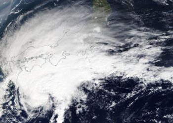
Credit: Credit: NASA Worldview, Earth Observing System Data and Information System (EOSDIS). Formerly a typhoon, now an extra-tropical storm, Neoguri ...
Credit: NASA Worldview, Earth Observing System Data and Information System (EOSDIS) Tropical Storm Priscilla was short-lived because it formed on ...
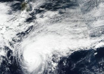
Credit: NASA Worldview, Earth Observing System Data and Information System (EOSDIS) NASA's Terra satellite passed over the Northwestern Pacific Ocean ...
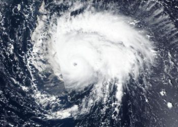
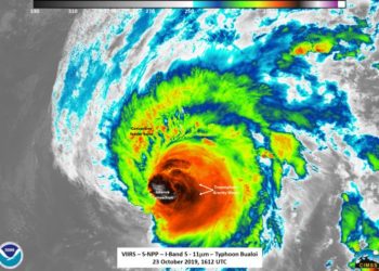
Credit: Credit: NASA Worldview, Earth Observing System Data and Information System (EOSDIS) Typhoon Bualoi rapidly intensified over 24 hours and ...
Credit: Credit: NASA/NOAA/UWM-CIMSS, William Straka III NASA-NOAA's Suomi NPP satellite provided night-time and infrared views of developing Tropical Storm Nestor ...
Credit: Credit: NASA /NRL NASA-NOAA's Suomi NPP satellite provided forecasters at the Joint Typhoon Warning Center with a visible image ...
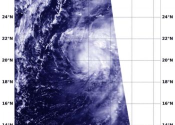
Credit: Credit: NASA/NRL NASA-NOAA's Suomi NPP satellite provided infrared data that showed the development of Tropical Storm Octave in the ...
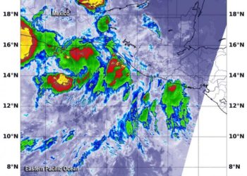
Credit: Credit: NASA/NRL NASA-NOAA's Suomi NPP satellite passed over Mexico and found two small areas of very strong thunderstorms near ...
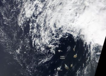
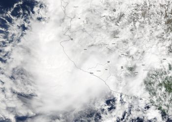
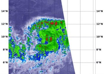
Credit: Credit: NASA Worldview Tropical Depression Fifteen or TD15, developed off the west coast of Africa on Oct. 14 by ...

Better tools to assess natural disaster damageCredit: UT Arlington A civil engineer at The University of Texas at Arlington will ...
