Credit: Credits: NOAA/NASA
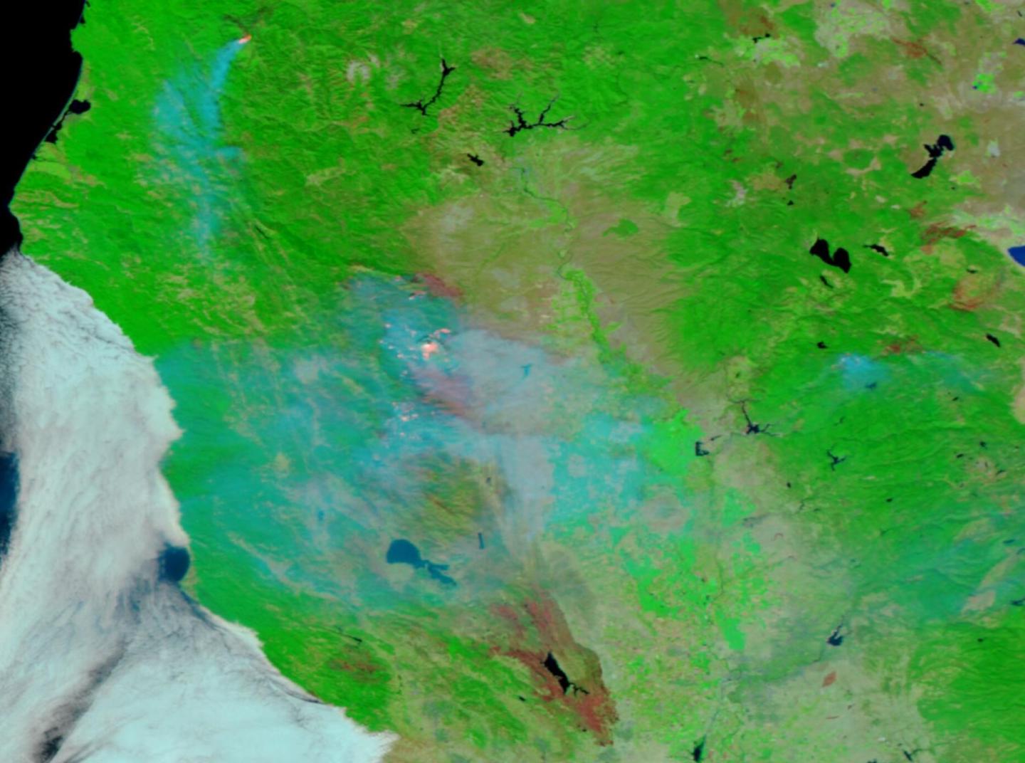
Imagery from the VIIRS instrument aboard NASA/NOAA’s Suomi NPP satellite highlights the burn scars from the Elkhorn Fire in northern California on Sep. 01, 2020. This false-color image of the firescape made by using the reflective solar bands on Suomi NPP highlights those areas which have been burned. Suomi NPP’s corrected reflectance solar bands (Bands M11-I2-I1) are most useful for distinguishing burn scars from naturally low vegetation or bare soil. In addition, these reflectance bands are able to show the following: “Burned areas or fire-affected areas are characterized by deposits of charcoal and ash, removal of vegetation and/or the alteration of vegetation structure. When bare soil becomes exposed, the brightness in Band I1 may increase, but that may be offset by the presence of black carbon residue; the near infrared (Band I2) will become darker, and Band M11 becomes more reflective. When assigned to red in the image, Band M11 will show burn scars as deep or bright red, depending on the type of vegetation burned, the amount of residue, or the completeness of the burn.”
This information is from the Worldview application website where the images in this story were downloaded. Another interesting point to note is that in this image, the fire line can be seen about a third of the way down the image. At this point the smoke is the heaviest and there is a demarcation line marking where the fires have burned and also where the fires are heading. Using the reflective bands on Suomi NPP vegetation shows up as a bright green color. All of this information is very valuable to both firefighters and scientists in finding out the line of the fire and where that fire is heading.
Lastly, this second image taken by the true-color image bands of Suomi NPP’s satellite of the same exact area show huge smoke plumes pouring off the fire. This image is of natural-looking land surface, oceanic and atmospheric features.
The Elkhorn Fire began on Aug. 17, 2020 with a lightning strike that occurred during the very aggressive storms that hit northern California on that weekend (Aug. 15-17). At present the Elkhorn Fire is 40,495 acres which will continue to threaten communities to the north east. Personnel will continue to plan and implement evacuation plans as needed. The Elkhorn Fire is currently 42% contained. Crews continue to engage with the fire on the northwest, west, south west, and south flanks of the fire.
NASA’s satellite instruments are often the first to detect wildfires burning in remote regions, and the locations of new fires are sent directly to land managers worldwide within hours of the satellite overpass. Together, NASA instruments detect actively burning fires, track the transport of smoke from fires, provide information for fire management, and map the extent of changes to ecosystems, based on the extent and severity of burn scars. NASA has a fleet of Earth-observing instruments, many of which contribute to our understanding of fire in the Earth system. Satellites in orbit around the poles provide observations of the entire planet several times per day, whereas satellites in a geostationary orbit provide coarse-resolution imagery of fires, smoke and clouds every five to 15 minutes. For more information visit: https:/
NASA’s Earth Observing System Data and Information System (EOSDIS) Worldview application provides the capability to interactively browse over 700 global, full-resolution satellite imagery layers and then download the underlying data. Many of the available imagery layers are updated within three hours of observation, essentially showing the entire Earth as it looks “right now.” Actively burning fires, detected by thermal bands, are shown as red points. Image Courtesy: NASA Worldview, Earth Observing System Data and Information System (EOSDIS). Caption: Lynn Jenner with information from Worldview and Inciweb.
###
Media Contact
Lynn Jenner
[email protected]
Original Source
https:/


