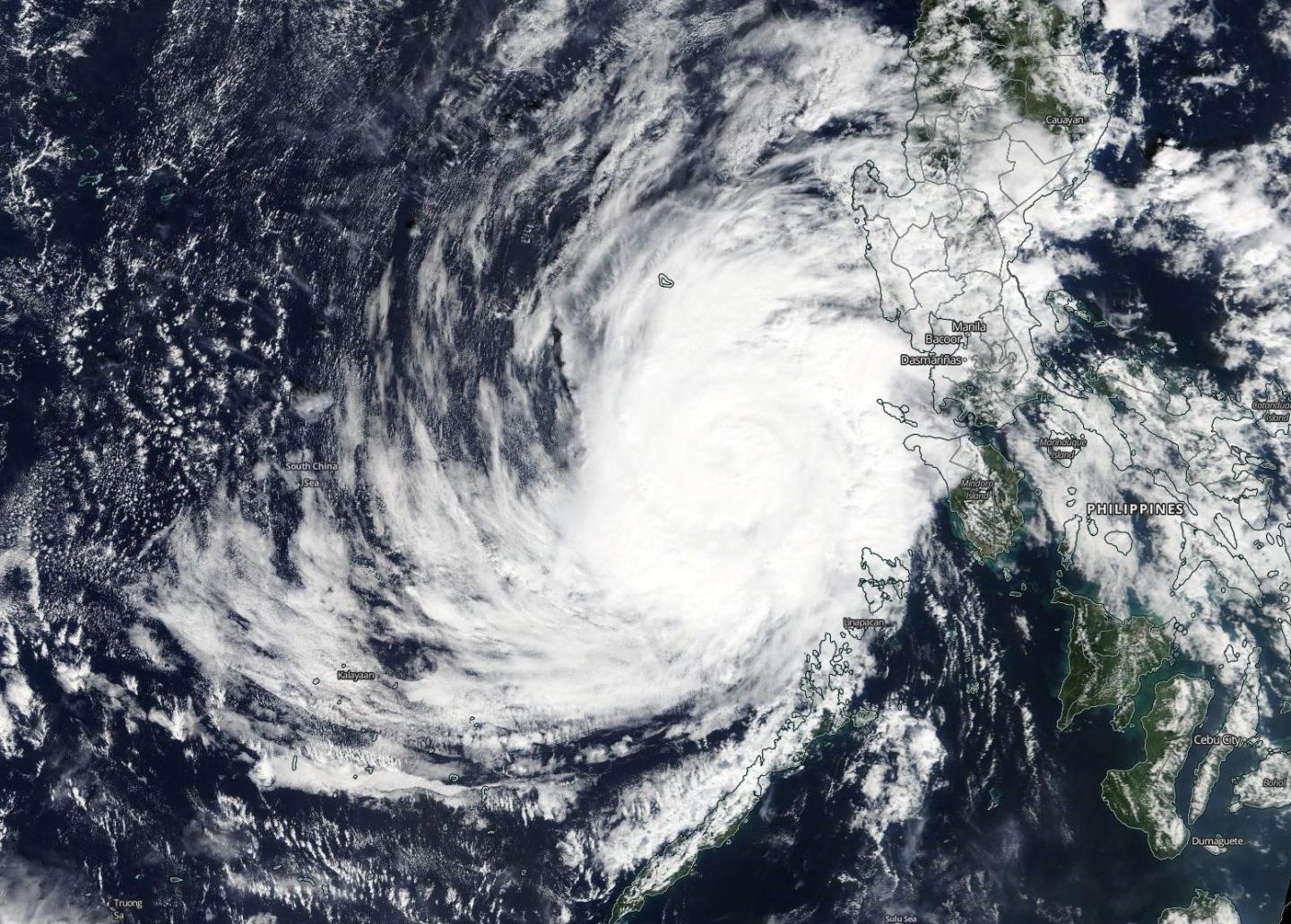
Credit: NASA Worldview
Tropical Storm Phanfone brought typhoon-force winds and heavy rains across sections of the Philippines on Christmas Eve and Christmas day. Phanfone is known as Ursula in the Philippines. Now the storm has moved into the South China Sea and NASA’s Terra satellite captured an image of the tropical cyclone.
Phanfone’s maximum sustained winds peaked near 95 knots on Dec. 25 at 4 a.m. EST (0900 UTC) as it passed through the Philippine archipelago.
On Dec. 26, 2019, the Moderate Imaging Spectroradiometer or MODIS instrument that flies aboard NASA’s Terra satellite provided a visible image of Phanfone that showed the storm maintained its circular shape after crossing the Philippines. A rounded shape of a tropical cyclone indicates an organized storm. The MODIS image revealed bands of thunderstorms spiraled into the low-level center of circulation.
At 10 a.m. EST (1500 UTC) on Dec. 26, the Joint Typhoon Warning Center noted that Tropical Cyclone Phanfone was located near latitude 14.0 degrees north and longitude 117.4 degrees east, about 554 nautical miles east-southeast of Da Nang, Vietnam. Maximum sustained winds were 75 knots (86 mph/139 kph). Phanfone is moving to the northwest.
Phanfone is forecast to begin a weakening trend and move toward Hainan Island, China. After two days, the storm is expected to weaken to a tropical depression.
NASA’s Terra satellite is one in a fleet of NASA satellites that provide data for hurricane research.
Tropical cyclones and hurricanes are the most powerful weather events on Earth. NASA’s expertise in space and scientific exploration contributes to essential services provided to the American people by other federal agencies, such as hurricane weather forecasting.
###
Media Contact
Rob Gutro
[email protected]
Original Source
https:/


