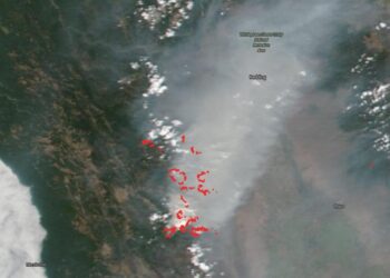
California’s August Complex largest fire in state’s history
Credit: NASA Worldview, Earth Observing System Data and Information System (EOSDIS). NOAA/NASA's Suomi NPP satellite captured another startling image of ...
Credit: NASA Worldview, Earth Observing System Data and Information System (EOSDIS). NOAA/NASA's Suomi NPP satellite captured another startling image of ...
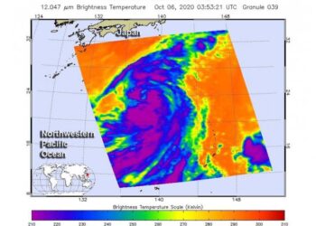
Credit: Credit: NASA JPL/Heidar Thrastarson NASA's Aqua satellite analyzed the large Tropical Storm Chan-hom as it tracked through the Northwestern ...
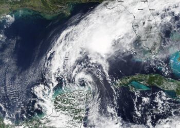
Credit: Credit: NASA Worldview, Earth Observing System Data and Information System (EOSDIS) NASA-NOAA's Suomi NPP satellite passed over the Eastern ...
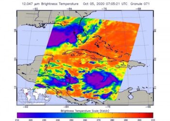
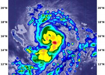
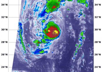
Credit: NASA/NRL Infrared imagery from NASA-NOAA's Suomi NPP satellite revealed that Hurricane Delta has been rapidly growing stronger and more ...
Credit: NASA/NRL NASA's Aqua satellite provided an infrared view of Tropical Storm Marie that revealed the effects of outside winds ...
Credit: Image Courtesy: NASA Worldview, Earth Observing System Data and Information System (EOSDIS). NASA's Terra satellite obtained visible imagery of ...
Credit: Image Courtesy: NASA Worldview, Earth Observing System Data and Information System (EOSDIS). NASA's Terra satellite obtained visible imagery of ...
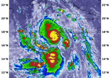
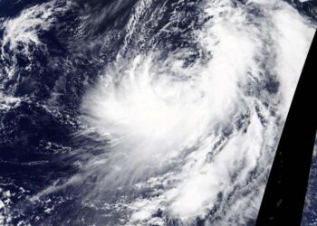
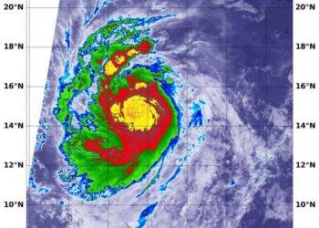
Credit: NASA JPL/Heidar Thrastarson NASA's Aqua satellite analyzed Tropical Storm Delta in infrared imagery as it moved through the Caribbean ...
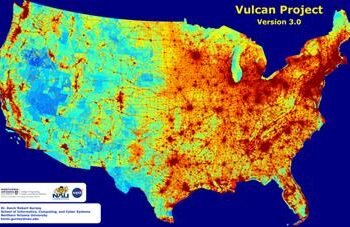
Map features greenhouse gas emissions across the entire US landscape at high space- and time-resolution with details on economic sector, ...
Credit: NASA/NOAA/NRL Imagine being able to look down at a storm from orbit in space, and provide data that lets ...
Credit: NASA/NRL NASA infrared imagery revealed that Hurricane Marie is rapidly growing stronger and more powerful. Infrared imagery revealed that ...
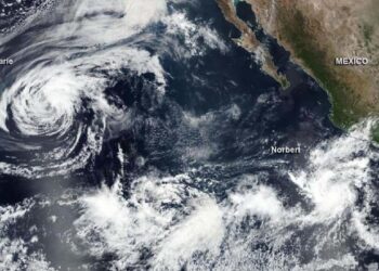
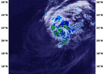
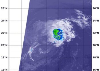
Credit: Credit: NASA/NOAA/NRL Tropical Storm Marie has formed in the Eastern Pacific Ocean and NASA satellite data helped confirm the ...
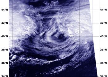
Credit: Credit: NASA/NRL Tropical cyclones can become post-tropical before they dissipate, meaning they can become sub-tropical, extra-tropical or a remnant ...
Credit: Credit: NASA/NRL NASA's Terra satellite used infrared light to identify strongest storms and coldest cloud top temperatures in Typhoon ...
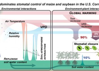
Credit: Hyungsuk Kimm, University of Illinois URBANA, Ill. - As the climate trends warmer and drier, global food security increasingly ...
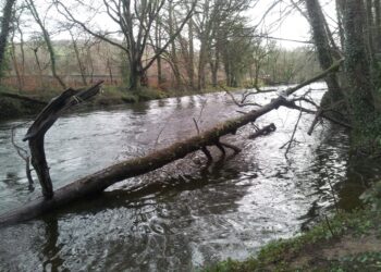
Credit: Buckfastleigh Flood Action Group The planting of woodlands in upland areas could play a significant role in preventing the ...
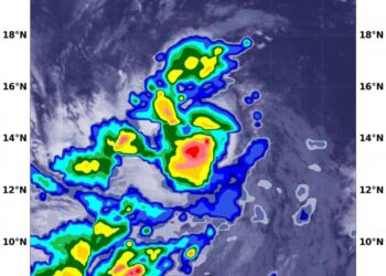
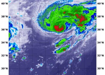
Credit: NASA/NRL NASA analyzed the cloud top temperatures in Tropical Storm Kujira using infrared light to determine the strength of ...
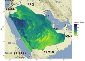
Credit: © 2020 Amanda Lenzi Optimizing the integration of wind energy into a country's power network requires reliable forecasts of ...
Credit: Image Courtesy: NASA Worldview, Earth Observing System Data and Information System (EOSDIS). NASA's Terra satellite obtained visible imagery of ...
Credit: Credit: NASA/NRL NASA's Aqua satellite provided an infrared view of Tropical Storm Lowell that revealed the effects of outside ...
