Credit: NASA Worldview, Earth Observing System Data and Information System (EOSDIS)
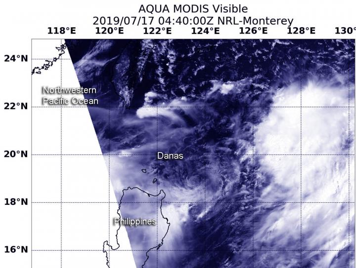
NASA’s Aqua satellite provided a visible image of Tropical Storm Danas as it continued to move north and away from the Philippines.
On July 17 at 12:40 a.m. EDT (0440 UTC), the Moderate Resolution Imaging Spectroradiometer or MODIS instrument aboard NASA’s Aqua satellite captured a visible look at Danas. The strongest thunderstorms appeared southeast of the center of circulation in the MODIS image. Danas was located northeast of Luzon, Philippines, in the Philippine Sea.
At 11 a.m. EDT (1500 UTC) on July 17, the center of Tropical Storm Danas was located near latitude 21.1 degrees north and longitude 124.0 degrees east. The center of Danas was about 421 nautical miles south-southwest of Kadena Air Base, Okinawa Island, Japan. Danas was moving to the north-northeast and had maximum sustained winds near 35 knots (40 mph/74 kph).
Danas is forecast to move north over the next couple of days and strengthen. Its center is expected to pass near Ishigakijima island on July 18.
###
By Rob Gutro
NASA’s Goddard Space Flight Center
Media Contact
Rob Gutro
[email protected]
Original Source
https:/


