Credit: Virginia Tech
Look out your window or step outside and look around you. Depending on where you live, you’re sure to see trees, grass, bushes, mountains, perhaps palm trees and sand. All of this is part of a layer of the Earth that geoscientists call the “critical zone.”
This critical zone supports all terrestrial life. Yet much of it is hidden from us, tens of meters or more below the surface of everything we see. Below all the soil, flora and fauna, there is the gradual breakdown of rock to soil, the flow of groundwater, and chemical interactions between roots and minerals — processes that sustain surface life, but about which much remains to be learned. Steve Holbrook, a professor and department head in the Department of Geosciences in the Virginia Tech College of Science, wants to bring what’s hidden out into the open.
“The critical zone provides crucial services to humans and ecosystems, including the production of soil, storage of plant-available water, filtering of contaminants from groundwater, maintenance of streamflow, and long-term regulation of Earth’s climate,” Holbrook said.
“These services are maintained by a delicate and complex balance of processes — physical, hydrological, biological, and chemical — that are vital to human societies. Changes in the critical zone can therefore have far-reaching implications for resource management and consumption by humans. In this time of changing climate, increasing population, and widespread land-use changes, it is vital to understand how the critical zone functions from top to bottom — from treetop to bedrock.”
As part of a new, $5.3 million five-year National Science Foundation (NSF) grant, Holbrook and collaborators at eight other universities in the U.S. and Canada will conduct field work and modeling at seven sites that span the continental U.S. from Maryland to Southern California. The team hopes to better understand the connections between the deep critical zone and ecosystem resilience, watershed hydrology, and erosion. The project includes an ambitious program of drilling deep holes, geochemical sampling, geophysical surveying, hydrology, and numerical modeling.
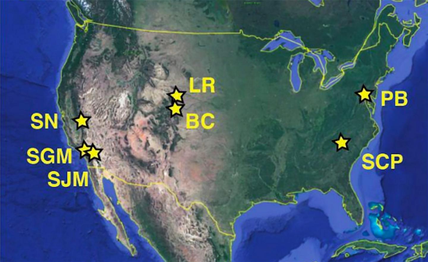
In this illustration of the continental United States, the field sites in Professor Steve Holbrook’s study are marked with stars at the following locations: Pond Branch, Maryland, a suburb of Baltimore; Clinton, South Carolina; Laramie Range, Wyoming; Boulder Creek, Colorado; and the Southern Sierra Nevada, the San Jacinto Mountains, and San Gabriel Mountains, all in California.
“Our central hypothesis can be summed up by two catchphrases,” Holbrook said. “First, geology matters, and second, what happens at depth doesn’t stay at depth. We think that bedrock composition and geologic history imposes underappreciated controls on surface ecosystems and hydrology.”
Virginia Tech will receive about $1.6 million as the lead institution on the project, which is one of nine new five-year projects from NSF’s Critical Zone Collaborative Network program.
The field sites will be located at Pond Branch, Maryland, a suburb of Baltimore; Clinton, South Carolina; Laramie Range, Wyoming; Boulder Creek, Colorado; and the Southern Sierra Nevada, the San Jacinto Mountains, and San Gabriel Mountains, all in California. Collaborating universities include Clemson University, the Colorado School of Mines, Dickinson College, Johns Hopkins University, the University of California Los Angeles, Concordia University in Canada, and the University of Wyoming.
Virginia Tech research scientists Ivan Rabak and Sean Bemis will work on the project with Holbrook. As the project progresses and gains more funding, Holbrook said graduate and undergraduate students will be brought on board for research paid summer field work. A full-time outreach coordinator also will be hired to help communicate scientific results to the general public, including K-12 schools via a set of online “virtual critical zone” demonstrations.
As with scores of projects across academia and countless other professions, work on the project has been stalled by the COVID-19 pandemic. In-person meetings are moot and field work has been delayed.
“We had to submit a detailed COVID response plan to NSF in order to receive the funding, in which we outlined how we will change our plans under various scenarios of severity of the pandemic,” Holbrook said. “The field work is scheduled to start in earnest next summer, so we are hoping for the best, but planning for the worst.”
Holbrook and his team’s study of the critical zone builds on the nationwide Critical Zone Observatories established by NSF in 2007. Additionally, a loose international network of geoscientists working in the Critical Zone Exploration Network are also exploring the structure of the shallow subsurface environment.
But Holbrook’s efforts will probe deeper than these other efforts. “What’s unique about our project is that we are focusing on the deeper parts of the critical zone, which are by far the most difficult to access – hence all the drilling and geophysics,” Holbrook said.
###
Media Contact
Steven Mackay
[email protected]
Original Source
https:/


