Credit: Credit: NASA Worldview, Earth Observing System Data and Information System (EOSDIS).
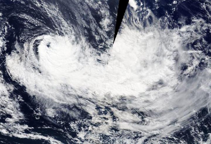
NASA’s Terra satellite passed over the Southern Pacific Ocean and captured a visible image of extra-tropical cyclone Harold.
On April 10, the visible image captured by the Moderate Resolution Imaging Spectroradiometer or MODIS instrument that flies aboard NASA’s Terra satellite showed that extra-tropical cyclone Harold was elongated from strong northwesterly wind shear. Wind shear had pushed the bulk of clouds and convection (rising air that forms the thunderstorms that make up a tropical cyclone) to the southeast of the center. Sheared convection and initial frontal features indicate that the system is undergoing extra-tropical transition.
In general, wind shear is a measure of how the speed and direction of winds change with altitude. Tropical cyclones are like rotating cylinders of winds. Each level needs to be stacked on top each other vertically in order for the storm to maintain strength or intensify. Wind shear occurs when winds at different levels of the atmosphere push against the rotating cylinder of winds, weakening the rotation by pushing it apart at different levels.
When a storm becomes extra-tropical, it means that a tropical cyclone has lost its “tropical” characteristics. The National Hurricane Center defines “extra-tropical” as a transition that implies both poleward displacement (meaning it moves toward the north or south pole) of the cyclone and the conversion of the cyclone’s primary energy source from the release of latent heat of condensation to baroclinic (the temperature contrast between warm and cold air masses) processes. It is important to note that cyclones can become extra-tropical and retain winds of hurricane or tropical storm force.
The Joint Typhoon Warning Center or JTWC issued the final warning on this system on April 9. On April 10, extra-tropical cyclone Harold continued to move through the South Pacific Ocean and weaken. The storm is no threat to land areas.
Tropical cyclones/hurricanes are the most powerful weather events on Earth. NASA’s expertise in space and scientific exploration contributes to essential services provided to the American people by other federal agencies, such as hurricane weather forecasting.
###
Media Contact
Rob Gutro
[email protected]
Original Source
https:/


