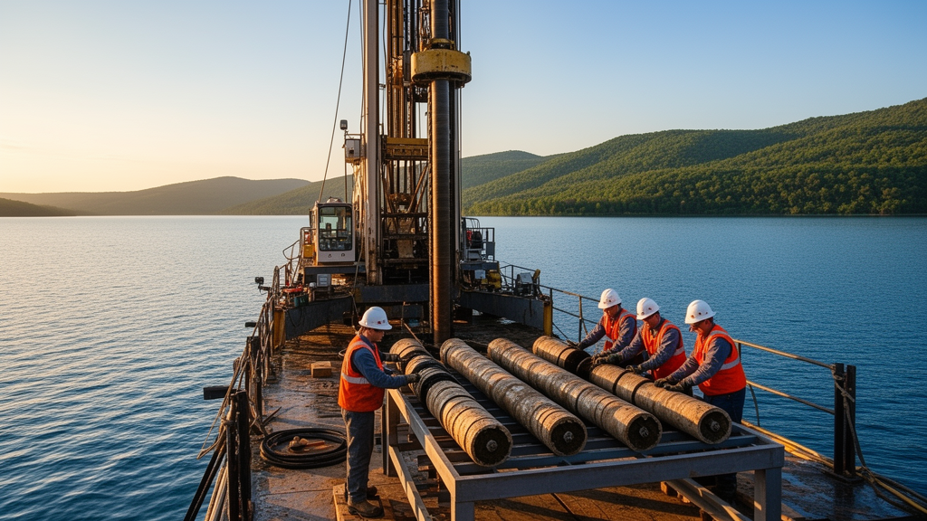
Beneath the freshwater expanse of Lake Kinneret, better known to many as the Sea of Galilee, lies what an international team of scientists believes could be one of the longest and most finely resolved climate archives on Earth. At a workshop convened in July 2025 in Potsdam, Germany, 61 researchers from 12 countries refined plans for the Lake KINneret Drilling project, or KIND, an initiative funded by the International Continental Scientific Drilling Program that aims to pull a continuous deep sediment core from the lake’s tectonically subsiding basin. The target: a chronostratigraphic reference record stretching from the Pliocene through the Quaternary, potentially reaching back as far as 9 to 10 million years.
The scientific case rests on an unusual geological setup. Lake Kinneret sits along the Dead Sea Transform, a roughly 1000-kilometer-long left-lateral strike-slip plate boundary that separates the Arabian plate from the Sinai sub-plate and links the Red Sea’s opening in the south to the collision zone at the Taurus Mountains in the north. Pull-apart basins along this boundary host both the hypersaline Dead Sea and the freshwater Lake Kinneret, whose precursors have been depositing lacustrine sediments since the late Miocene. Seismic reflection profiles across the basin show sedimentary sequences bounded by two north–south striking longitudinal faults that generally maintain stratigraphic order, a structural gift for anyone hoping to read a continuous history from the mud.
The proposed Kinneret-1 borehole would be drilled in the depocenter of the modern lake, at a water depth of 38 meters in the northern sub-basin known as the Kursi Basin. That basin is an asymmetric half-graben filled with roughly 5 kilometers of lacustrine sediments and basaltic flows, including the Cover Basalt unit whose top has been dated to about 4.5 million years ago. Reaching the top of that basalt layer would deliver a continuous record spanning the last 4.5 million years; drilling deeper toward a seismic marker correlated with the Cover Basalt in the onshore Zemah-1 borehole could extend coverage into the Miocene. The existing Zemah-1 borehole, drilled on land immediately south of the lake, recovered a 4.2-kilometer-thick section of lacustrine sediments, volcanics and halite that accumulated over the last 10 million years, providing crucial lithological and chronological constraints for the new site.
What makes the sediment itself so valuable is its composition. The column is dominated by primary authigenic calcite, whose chemical and isotopic composition documents regional hydrology and lacustrine conditions from at least the Pliocene onward. For the younger portions of the record, sedimentation rates may reach up to 1 meter per thousand years, raising the prospect of sub-centennial resolution in the calcite-dominated intervals. That resolution would allow researchers to trace hydroclimate variability, paleoseismicity and geomagnetic field behavior at a temporal fineness that few continental archives can match.
The region the record would illuminate is climatically pivotal. The southern Levant extends between the hyperarid Sahara–Arabia Desert belt in the south and the temperate Mediterranean climate zone in the north, making regional hydroclimate extremely sensitive to even small perturbations of global climate. Climate models consistently project that the Mediterranean basin, already identified as a hotspot of hydroclimate change, will become gradually drier and warmer during the 21st century under rising greenhouse gas concentrations, and both climate models and tree-ring records indicate an overall drying trend since the 19th century. A long paleorecord from this transition zone would let researchers examine how ecosystems and hydrology responded to past greenhouse forcing, complementing instrumental observations and climate modeling.
The targeted interval encompasses some of the most dramatic climate transitions in Earth’s recent history. During the Pliocene, global temperatures ran roughly 2 to 3 degrees Celsius above pre-industrial levels, peaking up to 4 degrees higher during the mid-Pliocene Warm Period, with atmospheric carbon dioxide between 350 and 550 parts per million and global sea level likely 12 to 20 meters above the present. The period may serve as a partial analogue for current and near-future anthropogenic warming. Afterward came the intensification of Northern Hemisphere Glaciation around 2.7 million years ago, the Mid-Pleistocene Transition between roughly 1.2 million and 600 thousand years ago, when glacial cycles shifted from a 41,000-year periodicity to the higher-amplitude 100,000-year cycles, and the pervasive millennial-scale variability documented over the last 800,000 years.
The project’s working hypotheses give that record a regional storyline. The team proposes that the Levant and eastern Mediterranean were relatively drier during the warm Pliocene and became gradually wetter during the Quaternary, driven by two large-scale processes: the Northern Hemisphere Glaciation, which initiated as early as 3.6 million years ago, and the long-term landscape evolution associated with the Dead Sea Transform, which built the central mountain ridge and imposed a strong local orographic effect. Currently, the researchers note, scarce evidence exists to test these hypotheses because appropriate climate archives are lacking. Lake Kinneret also occupies a distinctive position in what the team calls a chained lake system, a cascade of tectonically linked freshwater and hypersaline lakes each nourished by distinct sources, allowing a north-to-south transect across two climate zones. The new record would extend the 220,000-year hydroclimate and paleoseismic archive retrieved by the ICDP Dead Sea Deep Drilling Project by more than an order of magnitude.
Because the lake lies directly on an active plate boundary, the same sediments double as a seismological instrument. Lake Kinneret deposits are susceptible to earthquake shaking, producing deformed layers known as seismites that document seismic-tectonic evolution without significantly disrupting the overall continuity of the sequence. The Kinneret area shows moderate to high recent seismicity, frequent low-magnitude microseismicity below magnitude 3.0, and occasional moderate swarms concentrated along the basin’s boundary faults. Historical records attest to destructive earthquakes in 749, 1033 and 1202 CE, and paleo- and archeo-seismic studies trace these events to the Dead Sea Transform. A long paleoseismic record, the team argues, would give policymakers a basis for preparing for a major hazard to infrastructure and human life, while planned permanent borehole sensors would establish a unique observatory along the plate boundary.
The core would also carry a geomagnetic payload. Continuous, precisely dated sediments spanning reversals and excursions since the Pliocene, read at sub-centennial resolution, could resolve longstanding ambiguities in the global paleomagnetic record and clarify the temporal dynamics of geomagnetic field transitions, with implications for chronostratigraphic correlation worldwide. And because the Levantine Corridor served as a primary route for hominin dispersal out of Africa, the environmental record sits in immediate context with early human sites. The Kinnarot Basin just south of the lake hosts the ‘Ubeidiya site, one of the earliest records of Early Pleistocene tool-making outside Africa, now dated by a recent study to more than 1.9 million years ago, while Gesher Benot Ya’aqov, occupied roughly 800,000 to 700,000 years ago, preserved exceptional botanical remains and one of the world’s oldest wooden tools. The nearby Ohalo II site, a 23,000-year-old submerged fisher camp, contains the earliest known brush huts and evidence of wild cereal processing long before the Neolithic Revolution.
The workshop participants reached a consensus that the KIND project is uniquely positioned to answer primary scientific questions spanning paleoclimate, paleoecology, paleoseismicity, tectonics, paleomagnetism, hydrology and archeology. The record would also slot into a meridional transect of ICDP-drilled lakes along the East African Rift–Dead Sea Transform corridor, from Lake Malawi in the south through Turkana, Chew Bahir and the Dead Sea to Lake Van in the north, and comparisons with Lake Van’s 600,000-year sequence and marine core ODP Site 967 would integrate three climate zones. For a region projected to grow increasingly arid over the coming century and already burdened by severe geopolitical strife and water scarcity, the team concludes, these records are critical for identifying regional climate change patterns, assessing seismic risks and evaluating the ecological impacts of both.
Subject of Research: A scientific drilling project to reconstruct Pliocene–Quaternary hydroclimate and seismic history of the Levant from Lake Kinneret sediments
Article Title: Workshop report: Lake KINneret Drilling (KIND) – reconstructing Pliocene–Quaternary hydroclimate and seismic history of the Levant
Article References: Torfstein, A., Aizenshtat-Soffer, E., Armon, M., Beck, C. C., Goldstein, S. L., Hartung, H., Kiro, Y., Langgut, D., Litt, T., Marco, S., Mischke, S., Morellón, M., Noren, A., Nuriel, P., Park Boush, L. E., Paytan, A., Pierdominici, S., Robakiewicz, E., Shaar, R., … the KIND consortium (2026). Workshop report: Lake KINneret Drilling (KIND) – reconstructing Pliocene–Quaternary hydroclimate and seismic history of the Levant. Scientific Drilling, 35(2), 255-273. https://doi.org/10.5194/sd-35-255-2026
Image Credits: AI Generated
Keywords: Lake Kinneret, KIND project, ICDP, Dead Sea Transform, paleoclimate, Pliocene, Quaternary, paleoseismicity, geomagnetism, Levant, scientific drilling, human evolution
News Source: Violet Maxwell. (October 29, 2026). Deep Drill Planned Beneath Sea of Galilee to Unlock 4.5 Million Years of Levant Climate and Quake History. Scienmag.