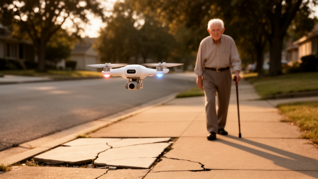
A quadrotor that hovers a metre above an older adult’s shoulder, watches the pavement ahead through a depth camera and buzzes when it spots a stair edge, a red light or a pedestrian has been unveiled as a research prototype called EmboDrone. The system, described in the journal Architectural Intelligence, is not a product but a deliberately mid-fidelity design experiment intended to test a new idea the authors call Proximal Spatial Intelligence, or PSI: the notion that assistive intelligence should not sit fixed in smart homes and street furniture, but should travel with the user, operating continuously within the body’s immediate surroundings.
The motivation is grounded in well-documented injury statistics. Falls are a major source of unintentional injury among older adults, and walking accounts for 47.3 percent of fall-related activities, according to figures cited in the study. Most outdoor falls, around 73 percent, are attributable to environmental factors such as uneven surfaces or steps. Road traffic injuries remain the leading cause of unintentional injury death worldwide, with pedestrians representing 23 percent of those fatalities, and older pedestrians show nearly double the fatality rate of younger age groups. Crucially, the researchers argue, many of these risks materialise within the near-body space, where small changes in the environment directly affect balance and stability.
Existing assistive technologies each leave gaps, the team contends. Smart canes and smart glasses offer immediate guidance but impose physical burdens and demand manual operation. Walking companion robots remove that burden, and studies suggest older adults walk more willingly when accompanied by a steady robot, yet their ground-level mobility and limited field of view constrain awareness in complex outdoor settings. Assistive drones have been explored for companionship, delivery, navigation and hazard perception, often pairing onboard cameras with deep-learning models, but most are built around a single task, behave in a command-driven way and rarely account for older adults’ cognitive tendencies or the perspectives of caregivers and experts.
EmboDrone was developed through a Research-through-Design process, in which the artefact serves as a design exemplar for a concept rather than an engineering system judged purely on performance. The prototype is built on a FanciSwarm Pro quadrotor with a 240 millimetre wheelbase and a 5,000 milliampere-hour lithium-ion battery. An NVIDIA Jetson Orin NX with 8 gigabytes of memory handles onboard perception, fed by an Intel RealSense D435 RGB-D camera that captures both colour images and depth. A UM982 high-precision GNSS module provides outdoor positioning, complemented by a laser optical-flow module that measures horizontal motion and ground distance, while an Mcontroller V7 flight unit manages stabilisation and trajectory planning. Detection results reach the flight controller over MAVLink, and a buzzer delivers auditory alerts when a hazard is confirmed.
The perception pipeline is a YOLOv5s model trained on data from the open Roboflow Universe platform and deployed on the Jetson with TensorRT. The system recognises seven classes: stair steps, cones, barriers, people, and red, yellow and green traffic lights. Images are resized to 640 by 480 pixels before inference, detections are filtered with non-maximum suppression at a confidence threshold of 0.5, and depth readings within each bounding box estimate the distance to the object. Only a red-light detection triggers the auditory warning in the current version; the yellow-light class exists purely to strengthen traffic-light recognition. The same vision stack drives automatic human following, converting horizontal and vertical image offsets into yaw and altitude commands and using depth to hold a following distance of roughly one metre as a safety constraint.
Offline validation on a workstation with an RTX 5090 GPU produced an overall mAP of 0.911 at the 0.5 intersection-over-union threshold and 0.610 at the stricter 0.5:0.95 threshold, with precision of 0.890 and recall of 0.886. Traffic lights, cones and barriers scored above 0.94 in average precision, but person detection reached only 0.778 and stair steps 0.763, with errors dominated by missed detections: 22 percent of person instances and 21 percent of stair-step instances were assigned to the background. The authors stress these are upper-bound estimates from controlled conditions, not indicators of onboard performance. On the Jetson itself, TensorRT-path latency averaged 11.77 milliseconds per frame across four runs of 1,000 frames, a figure that covers execution and synchronisation but not end-to-end system latency.
The user evaluation took an unusual form. Because internal testing showed that propeller noise and close physical proximity could discomfort or endanger older adults, the team showed 39 participants AI-generated videos of the drone’s intended behaviour rather than letting them interact with the flying hardware. The participants comprised 12 older adults aged 60 or over, 13 family caregivers and 20 experts, with six people holding dual caregiver-expert roles. Each completed an 18-item questionnaire on a 7-point Likert scale after viewing three scenario videos covering obstacle awareness, traffic-light recognition and pedestrian awareness, followed by open-ended questions and brief interviews with a small subgroup.
The quantitative results were broadly convergent. Overall scale reliability was high, with Cronbach’s alpha of 0.94, and one-way ANOVA found no statistically significant differences between stakeholder roles on any of the three dimensions measuring assisted companionship and safety, multi-scenario spatial coverage, or proximal spatial intelligence. The sharpest signal came from within-group comparisons: only the older adults showed a significant difference across dimensions, and post hoc tests revealed they rated multi-scenario spatial coverage significantly lower than proximal spatial intelligence. Qualitative responses explained why. Older adults questioned whether one drone could handle many tasks at once, worried it might strike a tree in a park or falter in crowds, while caregivers and experts pressed on following accuracy, performance in rain or darkness, and long-term maintenance and acceptance.
The authors are candid about limits. The evaluation says nothing about spatial comfort, coordination experience or safety in real outdoor environments, since participants never stood beside a flying drone; airflow, noise and moment-to-moment coordination cannot be conveyed through video. Deployment observations add practical cautions: GNSS quality degraded among dense urban structures, the depth camera is reliable only within about five metres, and propeller noise was noticeable at close range, with physical protective measures needed before any exposure of older adults. Regulatory approval, collision-risk management and fail-safe behaviour under signal loss or tracking failure remain unresolved prerequisites for public-space operation, even though all visual data are processed onboard without external transmission or storage.
What the study offers, within those constraints, is a conceptual and empirical starting point. The PSI framework, the EmboDrone exemplar and the multi-stakeholder data together suggest three design directions: safety cues that are immediately legible without training, progressive disclosure of multi-scenario capabilities as users gain experience, and coordination that is both predictable and adaptive to an individual’s pace. The finding that older adults judge such systems through what they can directly see, rather than what they must imagine, may prove the most transferable lesson for the growing field of body-proximal assistive machines.
Subject of Research: A mid-fidelity assistive drone prototype and Proximal Spatial Intelligence framework for supporting older adults' outdoor walking safety
Article Title: EmboDrone: towards mobile proximal spatial intelligence for elderly outdoor assistance
Article References: Zhang, X., Yan, Y., Liang, J., & Xu, L. (2026). EmboDrone: towards mobile proximal spatial intelligence for elderly outdoor assistance. Architectural Intelligence, 5(1), Article 29. https://doi.org/10.1007/s44223-026-00138-2
Image Credits: AI Generated
DOI: 10.1007/s44223-026-00138-2
Keywords: assistive drones, older adults, Proximal Spatial Intelligence, YOLOv5s, RGB-D sensing, human-following, outdoor mobility, fall hazards, Research-through-Design, multi-stakeholder evaluation, edge computing, human-robot interaction
News Source: Denise Maddox. (October 28, 2026). Assistive drone prototype shadows older adults to warn of outdoor hazards. Scienmag.