NASA sees Hurricane Laura’s nighttime landfall
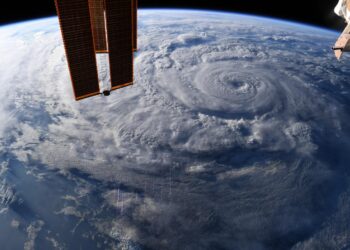
Credit: Credit: NASA/Chris Cassidy Many NASA assets were used to provide forecasters with information to incorporate into their analysis of ...
Credit: Credit: NASA/Chris Cassidy Many NASA assets were used to provide forecasters with information to incorporate into their analysis of ...
Credit: Credit: NASA Worldview During the afternoon of Aug. 26, as major Hurricane Laura nears landfall near the Texas/Louisiana border, ...
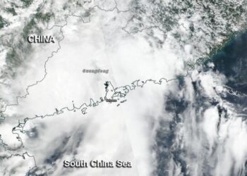
Credit: Credit: NASA/NOAA Typhoon Bavi is a large storm moving through the Yellow Sea. A NASA camera captured an image ...
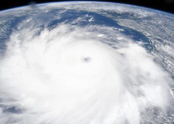
Credit: Credit: NASA/Chris Cassidy Astronauts aboard the International Space Station provided images of Hurricane Laura as it continues to strengthen ...
Credit: Gregory Schill When fossil fuel or biomass burns, soot - also known as black carbon - fills the air. ...
New study suggests fewer resources are depleting than previously estimated, but authors urge caution in unsustainable extraction levelsCredit: Mohammed Shamshudda/Richard ...
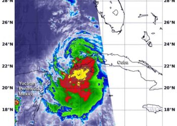
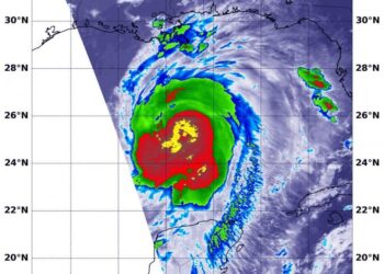
Credit: NASA/NRL Tropical Storm Laura strengthened to a hurricane in the morning hours of Aug. 25, and NASA provided infrared ...
Estimates of mosquito abundance four weeks outCredit: DiSera et al., GeoHealth, 2020 A new study demonstrates for the first time ...
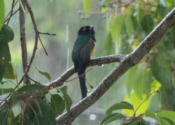
Credit: Cristian Bonilla Poveda URBANA, Ill. - Imagine a tropical forest and you might conjure up tall trees hung with ...
Credit: Credit: NASA/NRL NASA's Terra satellite passed over the Gulf of Mexico early on Aug. 25 and found a very ...
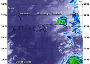
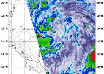
Credit: NASA Worldview As Tropical Storm Laura continues to move through the Caribbean Sea NASA satellites are providing forecasters with ...
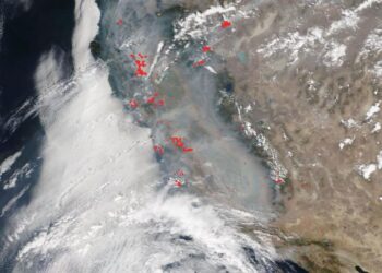
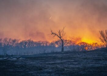
Credit: NASA Worldview More than 650 wildfires are blazing in California after unprecedented lightning strikes, storms, and a heatwave that ...
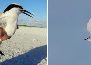
Credit: Kiyoaki Ozaki, Yamashina Institute for Ornithology Six black-naped terns -- a coastal seabird found in the Pacific and Indian ...
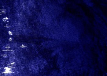
Credit: Credit: NASA Worldview, Earth Observing System Data and Information System (EOSDIS) NASA-NOAA's Suomi NPP satellite provided forecasters with a ...
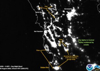
Credit: Credits: NOAA/NASA/William Straka U of W-Madison/CIMSS/SSEC Striking images of the California wildfires are seen in these nighttime satellite images ...
Credit: Credit: NASA/NRL NASA's Terra satellite gathered infrared data on Tropical Depression 14 as it moves through the Caribbean Sea. ...
Credit: Credit: NASA Worldview, Earth Observing System Data and Information System (EOSDIS) Nighttime imagery from NASA-NOAA's Suomi NPP satellite found ...
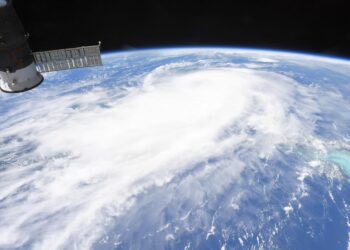
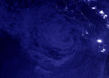
Credit: Credit: NASA/ISS/Chris Cassidy NASA provided a series of photos of Hurricane Genevieve as it affected Mexico's southern Baja California ...
Credit: Credit: NASA Worldview, Earth Observing System Data and Information System (EOSDIS) NASA-NOAA's Suomi NPP satellite kept an eye on ...
Credit: Credit: NASA Worldview, Earth Observing System Data and Information System (EOSDIS) NASA-NOAA's Suomi NPP satellite provided forecasters with a ...
