Credit: Credit: NASA/NRL
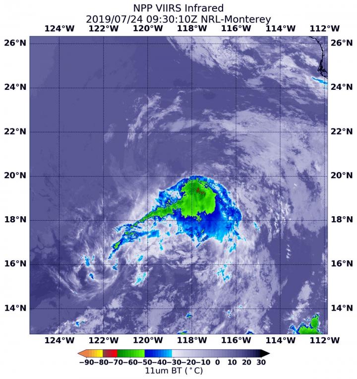
NASA-NOAA’s Suomi NPP satellite provided a visible image of weakening Tropical Depression Dalila in the Eastern Pacific Ocean.
Suomi NPP passed over Dalila on July 24 and the Visible Infrared Imaging Radiometer Suite (VIIRS) instrument provided a visible image of the storm. The VIIRS image showed that strong convection and developing thunderstorms associated with the cyclone has continued to decrease in coverage this morning. Suomi NPP saw a limited area of strong thunderstorms where cloud top temperatures were as cold as minus 70 degrees Fahrenheit (minus 56.6 Celsius). The National Hurricane Center said that there is still a broken band of convection over the southeastern portion of the circulation.
At 11 a.m. EDT (1500 UTC) on July 24, the National Hurricane Center or NHC said the center of Tropical Depression Dalila was located near latitude 20.5 degrees north and longitude 119.0 degrees west. That’s about 605 miles (975 km) west-southwest of the southern tip of Baja California, Mexico. The depression is moving toward the northwest near 7 mph (11 kph), and this motion is expected to continue today. A turn toward the west-northwest is forecast to occur by Thursday, and that general motion should continue until the system dissipates in a few days. Maximum sustained winds are near 35 mph (55 kph) with higher gusts.
The NHC noted that Dalila will be moving into an area where sea surface temperatures are too cold to maintain the tropical cyclone and into a dry and more stable airmass. NHC said, “This should result in weakening, and the system is expected to degenerate into a remnant low within 24 hours.”
Weakening is forecast during the next couple of days, and Dalila is expected to become a post-tropical remnant low tonight.
###
Media Contact
Rob Gutro
[email protected]
Original Source
https:/


