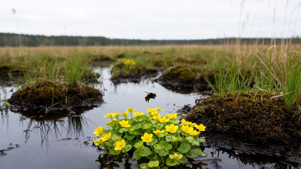
A landscape-scale simulation study investigating drained lowland fen peatlands in northeastern Germany reveals that rewetting interventions designed to curb agricultural greenhouse gas emissions may substantially reduce the potential abundance of wild pollinators. The investigation, conducted for the Upper Rhinluch region in the federal state of Brandenburg, evaluated how future land-use transformations alter landscape heterogeneity, habitat connectivity, and resources critical to wild insect communities. Researchers found that while rewetting degraded fens increased compositional landscape heterogeneity by replacing uniform agricultural tracts with wetland habitats, it simultaneously caused widespread decreases in the modelled potential abundance across four major pollinator functional groups: bumblebees, mining bees, hoverflies, and butterflies. Rather than the specific spatial configuration of patches or the post-rewetting agricultural management approach, the overall spatial extent of rewetting emerged as the dominant driver of these landscape changes and ecological trade-offs.
Peatlands occupy approximately 3% of the terrestrial surface of the Earth yet constitute the planet’s largest terrestrial carbon reservoir, storing an estimated 500 ± 100 gigatonnes of carbon. Worldwide, roughly 10% of peatlands have experienced degradation, largely driven by drainage for agricultural cultivation and forestry, peat harvesting, burning, and changing climatic conditions. In Europe, more than 50% of peatlands are drained due to prolonged land-use histories and high agricultural pressure, transforming historical carbon sinks into substantial sources of greenhouse gases. Minerotrophic fens comprise over half of Europe’s peatland area, forming extensive lowland expanses that are prioritized for climate mitigation under international frameworks such as the Paris Agreement, which targets the rewetting of approximately 500,000 square kilometres globally. Restoring drained fens requires ditch blocking, bund construction, and surface reprofiling to raise local groundwater tables and re-establish anaerobic conditions, yet implementing these measures across agricultural lowlands introduces profound transformations in vegetative composition and structural landscape characteristics.
The study focused on a 13,414-hectare territory in the Upper Rhinluch, an area delineated by water management unit boundaries that exemplifies lowland fen peatlands drained over centuries. Part of the broader European Union Birds Directive Species Protection Area Rhin-Havelluch, organic soils cover 10,641 hectares, or 79.3%, of the designated area. The Integrated Administration and Control System registers 8,704 hectares, or 64.8% of the total area, under agricultural use, predominantly managed as extensive grasslands for grazing and hay cutting. Because high groundwater tables frequently depress agricultural productivity, these lands are classified as marginal. Because rewetting cannot proceed arbitrarily across terrain but requires existing hydraulic infrastructure such as ditches and floodgates to control hydrological levels, the authors identified 2,124 hectares of marginal agricultural peatlands with rewetting potential for year-round or seasonal winter water saturation. This designated zone formed the basis for evaluating future restoration pathways and their broader spatial effects.
To model future ecological shifts, the researchers formulated ten distinct landscape scenarios integrating three core dimensions: rewetting spatial extent aligned with regional greenhouse gas targets, post-rewetting land management regimes, and patch spatial configurations. Targets established under Germany’s National Peatland Protection Strategy and Brandenburg regional policies aim to rewet 25,000 to 37,500 hectares of degraded peatlands by 2030 and an additional 18,200 to 27,750 hectares by 2045. Applied locally, these objectives translated into scenarios covering approximately 30% of suitable lands under half-target attainment (RW30), 60% to meet 2030 goals (RW60), and 100% to satisfy 2045 commitments (RW100), contrasted against a baseline scenario (BASE) maintaining current agricultural usage. Spatial configurations within sixteen sub-catchment water management units were categorized into large aggregated patches (AGG), medium-sized connected patches (CON), and small isolated patches (ISO), acknowledging that ditch blocking regulates water tables at hydrologic block scales rather than individual field levels.
The scenarios evaluated two primary post-rewetting management alternatives alongside business-as-usual extensive haymaking and pasture management. The first involved paludiculture through the cultivation of reed canary grass (Phalaris arundinacea), a wetland-adapted graminoid capable of yielding biomass for energy production or industrial fibre while reducing greenhouse gas emissions. The paludiculture regime assumed a raised mean water level ranging from −5 to −20 centimetres beneath the surface, corresponding to Soil Moisture Class 4+, with an estimated global warming potential reaching up to 8 tonnes of carbon dioxide equivalent per hectare per year, compared to 15 to 40 tonnes under business-as-usual grassland drainage (Soil Moisture Class 2+ to 3+). The second alternative represented agricultural abandonment leading to semi-natural wetland succession. Because recovering historical fen states requires more than three decades due to altered soil chemistry and hydrology, abandoned sites transition into tall graminoid and helophyte communities. The researchers assessed recently rewetted abandoned lands of six years or less (REC) and long-term rewetted tracts exceeding eleven years of abandonment (LTW), characterized by an expected Soil Moisture Class of 5+ and global warming potentials around 6 to 7 tonnes of carbon dioxide equivalent per hectare per year.
Potential pollinator abundance was evaluated using the crop pollination module of the Integrated Valuation of Ecosystem Services and Trade-offs (InVEST) model, version 3.15.0. The framework incorporates high-resolution land use and land cover maps, expert-derived assessments of floral and nesting resource availability across seasons, and pollinator-specific ecological traits including maximum flight distance, seasonal activity windows, and nesting preferences. The input geospatial baseline integrated field block agricultural records from 2018 to 2022, CIR biotope data buffered to 2.5 metres to delineate linear corridors, and groundwater depth maps differentiating moist from moderately moist grasslands. Model surfaces were rasterized at a five-metre spatial resolution to preserve linear features like hedgerows and field margins. Resource capacities and guild traits were evaluated by three regional experts using species lists from 71 historical vegetation sampling sites, supplemented by monthly empirical field surveys of a seven-year-old P. arundinacea stand conducted between July 2024 and July 2025 across five one-square-metre plots. Changes were tracked using the Pollinator Abundance Index (PAI), summarizing potential activity across spring and summer.
Landscape metric analyses performed with the R package landscapemetrics demonstrated that expanding rewetting extent consistently increased compositional heterogeneity while reducing landscape connectivity. Shannon’s diversity index rose across all scenarios as new wetland land-cover types entered the landscape matrix. However, configurational heterogeneity measures showed slight declines in mean patch size and edge density, while landscape fragmentation increased substantially, as reflected by sharp reductions in effective mesh size. The current baseline landscape supported the highest potential pollinator abundance, exhibiting the greatest mean PAI across all guilds and seasons. As rewetting expanded from 30% to 60% and 100% of suitable lands, total PAI exhibited an incremental decline. Ground-nesting taxa, specifically bumblebees and mining bees, experienced the sharpest relative decreases, with slightly greater losses recorded during summer than spring. Decreases were strongly localized within rewetted areas along major watercourses but extended several kilometres into surrounding terrestrial landscapes depending on the flight foraging ranges of individual guilds.
The pronounced decline in potential pollinator abundance was driven primarily by reductions in habitat quality following water table elevation. In the baseline agricultural landscape, extensively managed, moderately moist hay meadows and pastures along the eastern boundary of the study area provided abundant floral resources, supporting nectar- and pollen-rich species such as Potentilla anserina, Cirsium arvense, Ranunculus repens, Plantago lanceolata, Achillea millefolium, Glechoma hederacea, and Linaria vulgaris. Following rewetting, these communities were replaced by wetland vegetation dominated by tall helophytes and graminoids, including Typha latifolia, Phragmites australis, Glyceria maxima, and P. arundinacea. These dominant species are anemophilous (wind-pollinated), producing flowers that lack nectar and offer little accessible pollen to wild insects. Furthermore, prolonged surface waterlogging directly eliminated subterranean nesting habitats essential for ground-nesting bees, while standing water and dense vegetation cover suppressed low-growing flowering herbs and mosses through light competition.
Variations in post-rewetting management and patch configuration exhibited limited capacity to counteract the overall reductions driven by rewetting extent. Full deployment of P. arundinacea paludiculture (RW100-PAL) and short-term abandoned fen succession (RW100-REC) yielded nearly identical PAI declines, differing by less than 1%, although paludiculture retained slightly higher mean values. Conversely, long-term abandoned rewetted fens (RW100-LTW) significantly mitigated declines across almost all guilds, yielding a 3.8% seasonal increase for butterflies and hoverflies during summer as secondary succession introduced heterogeneous microhabitats with scattered flowering dicots and cavity-nesting structures. A localized exception to the overall downward trend occurred in the northwestern corner of the study area, where converting intensive maize fields into paludiculture or wetland habitats improved floral and nesting scores, demonstrating that baseline conditions dictate localized responses. Regarding spatial arrangements, medium-sized connected patches (RW60-CON) proved superior to aggregated (AGG) or isolated (ISO) configurations by mitigating landscape fragmentation, whereas massive aggregated wetland blocks formed continuous dispersal barriers between northern and southern terrestrial habitats.
The authors emphasized that their modelled findings apply specifically to drained lowland fens and must be extrapolated cautiously to montane, pre-alpine, or sloping fens where pronounced geochemical and topographical gradients foster diverse microclimates and resilient floral communities. While the InVEST model provides an established spatially explicit tool, expert-based parameter scoring retains potential subjectivity, and fine-scale structural features like hedgerows may exert stronger compensatory connectivity than represented by the model equations. To reconcile aggressive climate goals with insect conservation, the researchers recommend adaptive management strategies, including phased strip-cutting regimes in paludiculture to suppress dominant graminoids and maintain structural diversity, sowing native flowering plants along elevated field margins and ditches, establishing heterogeneous groundwater targets across sub-catchments, and configuring rewetting in medium-sized hydrologically viable units that preserve terrestrial corridors across the agricultural matrix.
Subject of Research: Landscape and wild pollinator responses to lowland fen peatland rewetting scenarios
Article Title: Landscape and pollinator responses to lowland fen peatland rewetting: effects of land management, spatial extent, and configuration in the Upper Rhinluch, Germany
Article References: Kašpar, V., Reger, J., Wendt, M., & Glemnitz, M. (2026). Landscape and pollinator responses to lowland fen peatland rewetting: effects of land management, spatial extent, and configuration in the Upper Rhinluch, Germany. Landscape Ecology, 41(9), Article 154. https://doi.org/10.1007/s10980-026-02447-3
Image Credits: AI Generated
DOI: 10.1007/s10980-026-02447-3
Keywords: lowland fen peatlands, peatland rewetting, wild pollinators, InVEST model, Upper Rhinluch, paludiculture, Phalaris arundinacea, bumblebees, mining bees, hoverflies, butterflies, landscape connectivity, compositional heterogeneity, greenhouse gas mitigation, habitat quality, soil moisture classes, Brandenburg Germany
News Source: Julie Wynn. (November 20, 2026). Rewetting Lowland Fen Peatlands May Substantially Reduce Wild Pollinator Potential Abundance. Scienmag.