Credit: Credit: NASA Worldview, Earth Observing System Data and Information System (EOSDIS)
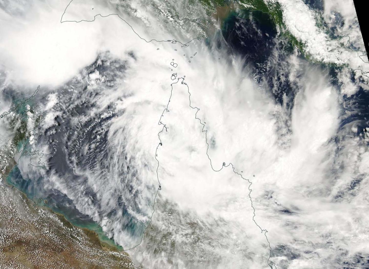
Tropical Cyclone Trevor appeared to have a cloud-filled eye in visible imagery from NASA-NOAA’s Suomi NPP satellite.
On March 19, 2019 the Visible Infrared Imaging Radiometer Suite (VIIRS) instrument aboard NASA-NOAA’s Suomi NPP satellite captured visible image of Tropical Cyclone Trevor as it continued moving west through the Coral Sea, Southern Pacific Ocean, and toward a landfall in Queensland, Australia’s Cape York Peninsula. VIIRS imagery showed powerful thunderstorms wrapping into the low-level center. At the time of the image, Trevor’s western quadrant was already over the Peninsula, and the eye appeared covered by high clouds.
After the Suomi NPP image, Trevor crossed the coast in the evening (local time) and remains slow moving just south of Lockhart River.
On March 18 (EDT), the Australian Bureau of Meteorology or ABM posted a warning from Orford Ness to Cape Melville, including Lockhart River and Coen, and Pormpuraaw to Cape York, including Weipa and Aurukun.
At 8:51 a.m. EDT (10:51 p.m. AEST local time, Australia), the ABM noted that maximum sustained winds near the center were 130 kilometers per hour (80 mph). Trevor’s center was located near 12.9 degrees south and 143.3 degrees east, about 15 kilometers (8 miles) south of Lockhart River and 160 kilometers (9 miles) east southeast of Weipa. Trevor was moving to the west.
ABM said “The cyclone will weaken as it crosses the northern Peninsula tonight and Wednesday, but is expected to remain a category 1 cyclone until it enters the Gulf of Carpentaria later on Wednesday. It is expected to re-intensify rapidly once it enters the Gulf of Carpentaria and track towards the Northern Territory.”
For updated forecasts from ABM, visit: http://www.
###
Media Contact
Rob Gutro
[email protected]
Original Source
https:/


