Credit: Credit: NASA Worldview
As Tropical Cyclone Irondro continues to move through the Southern Indian Ocean, NASA’s Terra satellite saw the storm developing an eye as it continued to intensify.
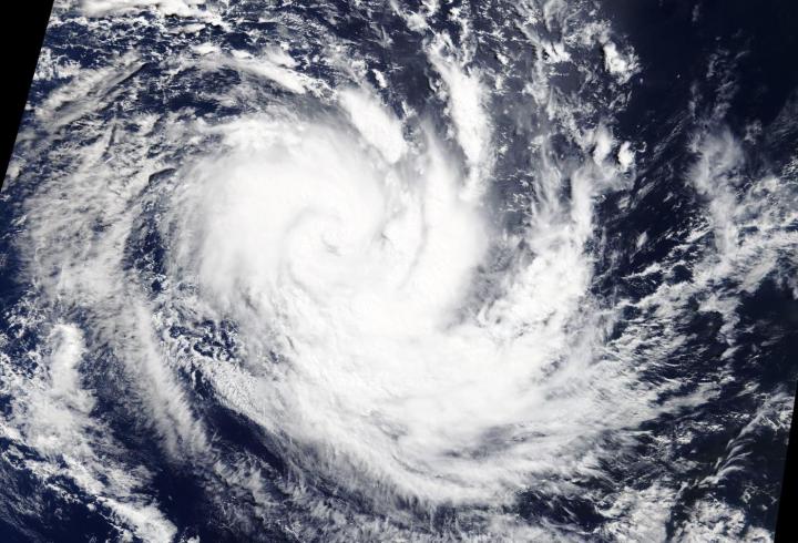
On April 3, 2020, the Moderate Resolution Imaging Spectroradiometer or MODIS instrument that flies aboard NASA’s Terra satellite provided a visible image of Irondro that showed the storm had taken on a classic appearance of an organized tropical cyclone. Bands of thunderstorms were spiraling into a low-level center and MODIS imagery showed what appeared to be a developing cloud-filled eye.
The Joint Typhoon Warning Center or JTWC issues forecasts for tropical cyclones in various parts of the world, and the Center noted at 5 a.m. EDT (0900 UTC) that Irondro had maximum sustained winds near 55 knots (63 mph/102 kph) and was strengthening. Irondro was located near latitude 17.5 degrees south and longitude 73.3 degrees east, about 626 nautical miles south of Diego Garcia.
The tropical cyclone is expected to intensify to hurricane status with maximum sustained winds near 75 knots (86 mph/139 kph) on April 4. Irondro is later forecast to turn east-southeast and become extra-tropical.
NASA’s Terra satellite is one in a fleet of NASA satellites that provide data for hurricane research.
Tropical cyclones/hurricanes are the most powerful weather events on Earth. NASA’s expertise in space and scientific exploration contributes to essential services provided to the American people by other federal agencies, such as hurricane weather forecasting.
###
By Rob Gutro
NASA’s Goddard Space Flight Center
Media Contact
Rob Gutro
[email protected]
Original Source
https:/


