Credit: NASA Worldview, Earth Observing System Data and Information System (EOSDIS)
NASA’s Aqua Satellite provides a variety of data on tropical cyclones including cloud heights and cloud top temperatures. Aqua examined those factors in Tropical Storm Kiko before wind shear began to affect it and weaken the storm.
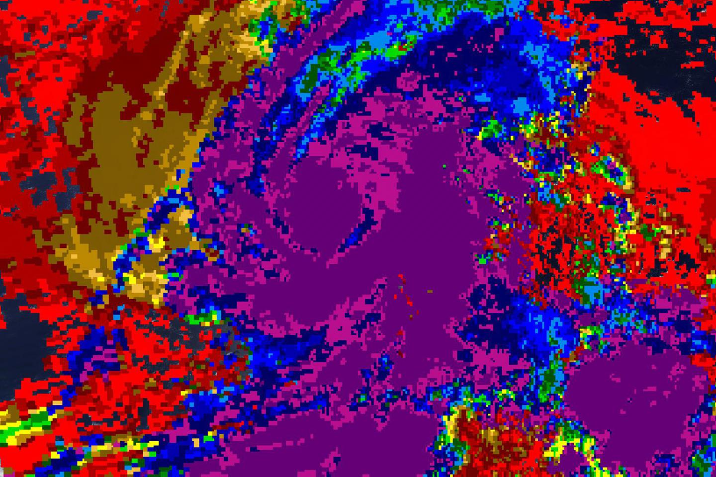
Tropical cyclones are made up of hundreds of thunderstorms. By analyzing the heights of thunderstorms the their cloud top temperatures, forecasters can tell if a storm is strengthening or weakening. The higher the cloud tops, the stronger the uplift in a storm. That rising air helps thunderstorms develop. As storms go higher, it is an indication that the storm is strengthening. Conversely, if over a period of time, satellite data shows cloud tops falling and warming, it is an indication the storm is weakening because there’s not as strong as an uplift or rising air in the storm.
On Sept. 23, the Moderate Imaging Spectroradiometer or MODIS instrument that flies aboard NASA’s Aqua satellite measured clouds heights and temperatures. Imagery showed the initial presence of an eye developing and strong thunderstorms developing around the southern quadrant. The imagery showed the highest cloud tops, higher than 12,000 meters (7.65 miles) were located around the developing eye and mostly south of the center. As the day progressed, high cirrus clouds covered the eye-like feature.
Aqua data also found that cloud top temperatures were as cold as or colder than 200 Kelvin (minus 99.6 degrees Fahrenheit/minus 73.1 degrees Celsius) around in those storms. NASA research has shown that cloud top temperatures that cold have the capability to generate heavy rainfall.
On Sept. 24, strong southwesterly wind shear between 40 and 45 knots caused Kiko’s convection and developing thunderstorms to become displaced from the low-level center by about 70 nautical miles. That has weakened the storm. The speed of that wind shear is expected to increase as Kiko moves westward, and that means the storm will weaken.
NOAA’s National Hurricane Center or NHC said at 11 a.m. EDT (1500 UTC) on Sept. 24 the center of Tropical Storm Kiko was located near latitude 17.9 degrees north and 138.9 degrees west longitude. That puts the center about 1,065 miles (1,715 km) east of Hilo, Hawaii. Kiko is moving toward the northwest at near 10 mph (17 kph), and this motion is expected to continue through the day. Maximum sustained winds are near 45 mph (75 kph) with higher gusts. Tropical-storm-force winds extend outward up to 70 miles (110 km) from the center. The estimated minimum central pressure is 1004 millibars.
On the forecast track, Kiko will move into the central Pacific basin later in the day on Sept. 24. Additional weakening is forecast, and Kiko is likely to become a tropical depression by tonight. It should then degenerate into a remnant low on Wednesday. Sept. 25.
The Aqua satellite cloud height and temperature data was provided by NASA’s Worldview product at NASA’s Goddard Space Flight Center, Greenbelt, Md.
###
Hurricanes are the most powerful weather event on Earth. NASA’s expertise in space and scientific exploration contributes to essential services provided to the American people by other federal agencies, such as hurricane weather forecasting.
For updated forecasts, visit: http://www.
By Rob Gutro
NASA’s Goddard Space Flight Center
Media Contact
Rob Gutro
[email protected]
Original Source
https:/


