Credit: NASA /NRL
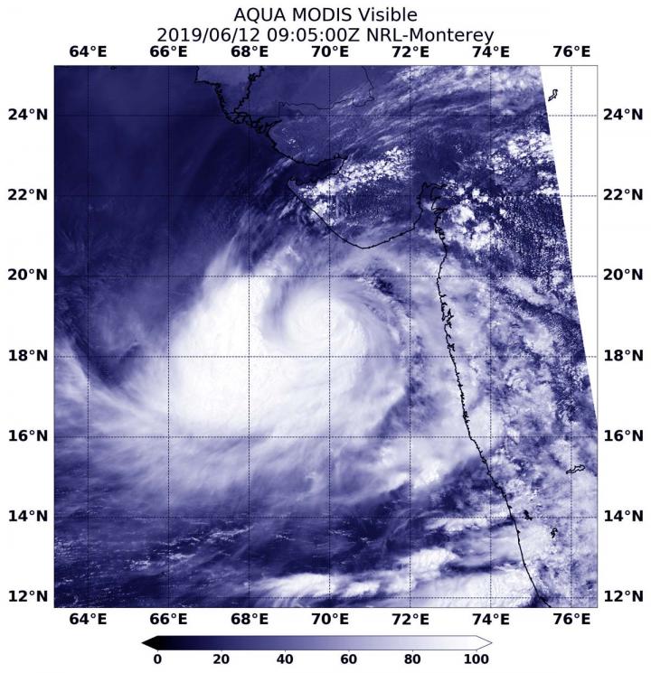
Visible imagery from NASA’s Aqua satellite showed Tropical Cyclone Vayu has a compact central dense overcast cloud cover. Vayu’s center was off-shore from India’s Gujarart coast.
On June 12 at 4:05 a.m. EDT (0905 UTC), the Moderate Resolution Imaging Spectroradiometer or MODIS instrument aboard NASA’s Aqua satellite provided a visible image of Vayu. Vayu’s center was off the western coast of India, in the Arabian Sea. Although hurricane-strength, the MODIS image showed a cloud-filled center of circulation and compact central dense overcast feature, approximately 90 to 100 nautical miles in diameter. The MODIS visible image also showed a thick band of thunderstorms wrapped into the low-level center from the western and southern quadrants. Meanwhile, satellite microwave imagery revealed a small eye beneath that overcast.
At 11 a.m. EDT (1500), the Joint Typhoon Warning Center reported that Tropical Cyclone Vayu was located near 19.4 degrees north latitude and 69.7 east longitude. That is 376 nautical miles south-southeast of Karachi, Pakistan. Vayu has tracked to the north-northwest. Maximum sustained winds were near 90 knots (104 mph/167 kph).
The Joint Typhoon Warning Center forecasts Vayu to strengthen slightly over the next day. Vayu is forecast to continue tracking north and turn to the northwest, with its center keeping off shore from India as it moves toward Pakistan. The latest forecast turns Vayu to the west, keeping it from a landfall through June 17.
###
Media Contact
Rob Gutro
[email protected]
Original Source
https:/


