Credit: NASA/NRL
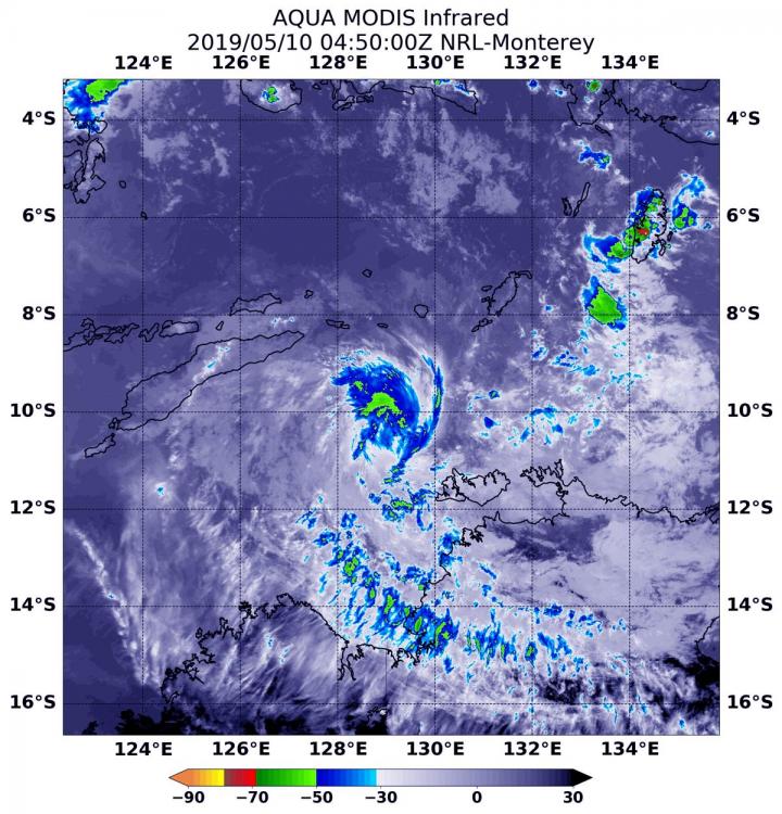
NASA’s Aqua satellite used infrared light to analyze the strength of storms in Tropical Cyclone Lili as it moved through the Southern Indian Ocean. Infrared data provides temperature information, and the strongest thunderstorms that reach high into the atmosphere have the coldest cloud top temperatures.
At 12:50 a.m. EDT (0450 UTC) on May 10, the Moderate Imaging Spectroradiometer or MODIS instrument that flies aboard NASA’s Aqua satellite gathered infrared data on Lili. Strongest thunderstorms were north of the center where MODIS found cloud top temperatures as cold as minus 50 degrees Fahrenheit (minus 45.5 Celsius).
At 11 a.m. EDT (1500 UTC), the Joint Typhoon Warning Center or JTWC noted that Lili’s maximum sustained winds were near 35 knots (40 mph/74 kph). At the time, Lili was centered near 9.3 degrees south latitude and 128.2 degrees east longitude, about 238 nautical miles northwest of Darwin, Australia. Lili has tracked to the west-northwest at 3 knots (3.4 mph/5.5 kph).
At 8 a.m. EDT (1248 UTC) animated enhanced infrared satellite imagery and a microwave satellite image showed a partially-exposed low-level circulation with isolated strong thunderstorms now over the southern quadrant. Satellite imagery shows that dry air has been feeding into the storm and sapping the storm’s ability to generate the thunderstorms it needs to be maintained. That dry air “entrainment” or movement into Lili is expected to continue. Lili is forecast to track to the west-northwest and dissipate in a day.
###
By Rob Gutro
NASA’s Goddard Space Flight Center
Media Contact
Rob Gutro
[email protected]
Original Source
https:/


