• HOME
  • NEWS
  • EXPLORE
    • CAREER
      • Companies
      • Jobs
    • EVENTS
    • iGEM
      • News
      • Team
    • PHOTOS
    • VIDEO
    • WIKI
  • BLOG
  • COMMUNITY
    • FACEBOOK
    • INSTAGRAM
    • TWITTER
Monday, October 6, 2025
BIOENGINEER.ORG
No Result
View All Result
  • Login
  • HOME
  • NEWS
  • EXPLORE
    • CAREER
      • Companies
      • Jobs
        • Lecturer
        • PhD Studentship
        • Postdoc
        • Research Assistant
    • EVENTS
    • iGEM
      • News
      • Team
    • PHOTOS
    • VIDEO
    • WIKI
  • BLOG
  • COMMUNITY
    • FACEBOOK
    • INSTAGRAM
    • TWITTER
No Result
View All Result
Bioengineer.org
No Result
View All Result
Home NEWS Science News

NASA-NOAA satellite sees Tropical Storm Bertha organizing

Bioengineer by Bioengineer
May 27, 2020
in Science News
Reading Time: 2 mins read
0
IMAGE
Share on FacebookShare on TwitterShare on LinkedinShare on RedditShare on Telegram

IMAGE

Credit: Credit: NASA Worldview, Earth Observing System Data and Information System (EOSDIS)

The second tropical storm of the North Atlantic Ocean hurricane season has formed off the coast of South Carolina. NASA-NOAA’s Suomi NPP satellite provided forecasters with a visible image of Tropical Storm Bertha as it was organizing.

On May 27, NOAA’s National Hurricane Center (NHC) issued a Tropical Storm Warning in effect from Edisto Beach, SC to South Santee River, SC.

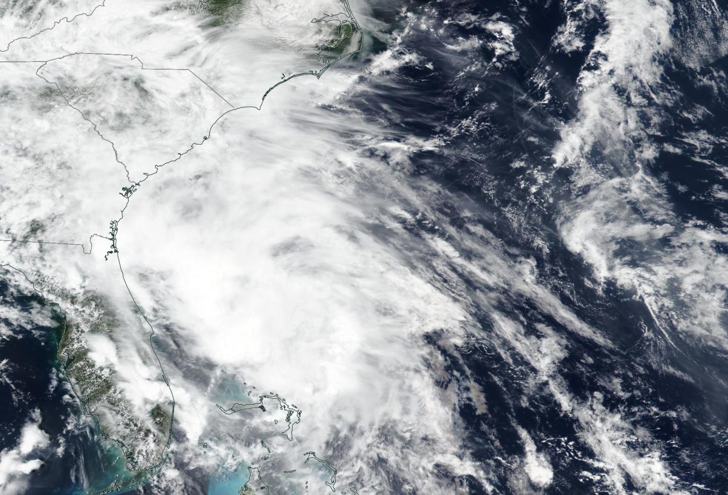
The Visible Infrared Imaging Radiometer Suite (VIIRS) instrument aboard Suomi NPP provided a visible image of developing Tropical Storm Bertha late on May 26. The imagery showed strong thunderstorms were circling the center of circulation.

Satellite imagery on May 27 at 8:30 a.m. EDT showed the area of disturbed weather that NHC has been tracking over the past day or so quickly became better organized. The circulation had become better defined and the center had reformed beneath the area of deep convection. Those strongest storms were located just off the South Carolina coast.

At 8:30 a.m. EDT (1230 UTC), the center of Tropical Storm Bertha was located near latitude 32.7 degrees north and longitude 79.4 degrees west. Bertha’s center of circulation was just 30 miles (50 km) east-southeast of Charleston, South Carolina.

Bertha is moving toward the northwest near 9 mph (15 kph) and this motion is expected to continue through tonight. Maximum sustained winds are near 45 mph (75 kph) with higher gusts. Bertha is expected to weaken to a tropical depression after moving inland and become a remnant low tonight. The estimated minimum central pressure is 1009 millibars.

Bertha is expected to produce total rain accumulation of 2 to 4 inches with isolated totals of 8 inches across eastern and central South Carolina into west central to far southeastern North Carolina and southwest Virginia.  This rainfall may produce life-threatening flash flooding.

NHC said, “The system will be moving inland very shortly and little, if any, additional strengthening is expected.  Once inland, the small tropical cyclone should weaken rapidly and dissipate over central North Carolina on Thursday [May 28].”

Tropical cyclones/hurricanes are the most powerful weather events on Earth. NASA’s expertise in space and scientific exploration contributes to essential services provided to the American people by other federal agencies, such as hurricane weather forecasting.

###

Media Contact
Rob Gutro
[email protected]

Original Source

https://blogs.nasa.gov/hurricanes/2020/05/27/bertha-atlantic-ocean/

Tags: Atmospheric ChemistryAtmospheric ScienceClimate ChangeClimate ScienceEarth ScienceMeteorologyTechnology/Engineering/Computer ScienceTemperature-Dependent PhenomenaWeather/Storms
Share12Tweet8Share2ShareShareShare2

Related Posts

PRDM6: A Key Protector Against PCOS

October 6, 2025
Bright Red-NIR Glow from Carbodicarbene Borenium Ions

Bright Red-NIR Glow from Carbodicarbene Borenium Ions

October 6, 2025

Co-Digestion Boosts Biomethane from Jatropha, Poultry, Food Waste

October 6, 2025

Transforming Biogas Waste into an Effective Solution for Ammonium Pollution Cleanup

October 6, 2025
Please login to join discussion

POPULAR NEWS

  • New Study Reveals the Science Behind Exercise and Weight Loss

    New Study Reveals the Science Behind Exercise and Weight Loss

    95 shares
    Share 38 Tweet 24
  • New Study Indicates Children’s Risk of Long COVID Could Double Following a Second Infection – The Lancet Infectious Diseases

    93 shares
    Share 37 Tweet 23
  • Ohio State Study Reveals Protein Quality Control Breakdown as Key Factor in Cancer Immunotherapy Failure

    73 shares
    Share 29 Tweet 18
  • New Insights Suggest ALS May Be an Autoimmune Disease

    71 shares
    Share 28 Tweet 18

About

We bring you the latest biotechnology news from best research centers and universities around the world. Check our website.

Follow us

Recent News

PRDM6: A Key Protector Against PCOS

Bright Red-NIR Glow from Carbodicarbene Borenium Ions

Co-Digestion Boosts Biomethane from Jatropha, Poultry, Food Waste

Subscribe to Blog via Email

Success! An email was just sent to confirm your subscription. Please find the email now and click 'Confirm' to start subscribing.

Join 63 other subscribers
  • Contact Us

Bioengineer.org © Copyright 2023 All Rights Reserved.

Welcome Back!

Login to your account below

Forgotten Password?

Retrieve your password

Please enter your username or email address to reset your password.

Log In
No Result
View All Result
  • Homepages
    • Home Page 1
    • Home Page 2
  • News
  • National
  • Business
  • Health
  • Lifestyle
  • Science

Bioengineer.org © Copyright 2023 All Rights Reserved.