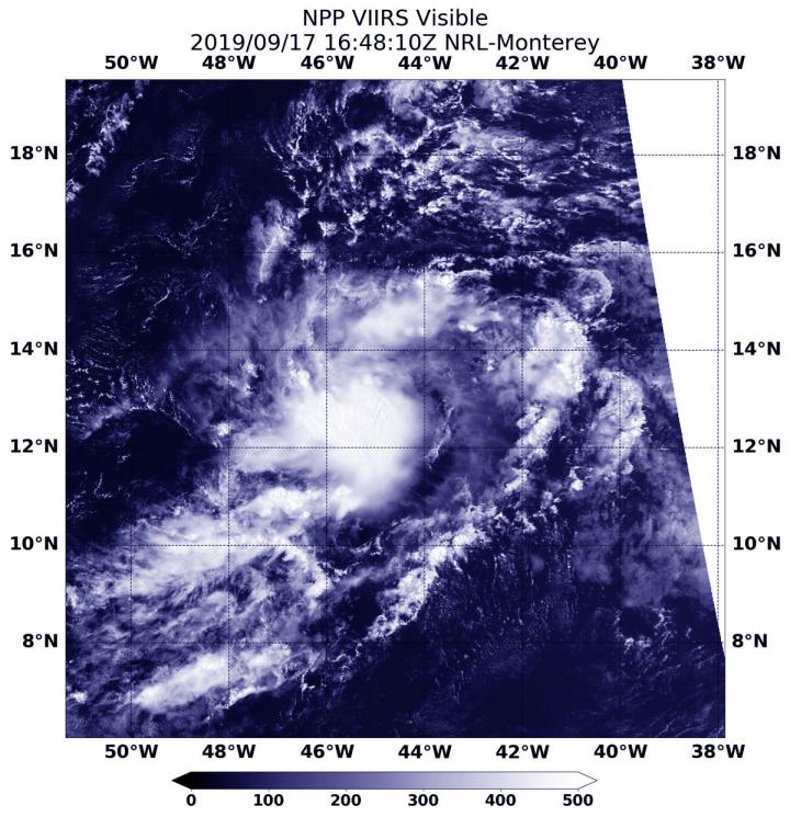
Credit: Credit: NASA/NOAA/NRL
Tropical Storm Jerry is the latest in a line of tropical cyclones to develop in the North Atlantic Ocean this season. NASA-NOAA’s Suomi NPP satellite passed overhead and provided forecasters with a view of its structure that helped confirm it was organizing.
Tropical Depression 10 formed in the Central Atlantic on Sept. 17 by 11 a.m. EDT. On Sept. 17, at 12:48 p.m. EDT (1648 UTC), the Visible Infrared Imaging Radiometer Suite (VIIRS) instrument aboard Suomi NPP provided a visible image of the Tropical Depression 10, which later became Tropical Storm Jerry. The VIIRS image showed that the storm had taken a more rounded circulation than previously in the day, indicating it had become better organized. The image showed strong bands of thunderstorms that were located over the southern and southwestern portions of the circulation, but were limited over the remainder of the cyclone.
Hurricanes are the most powerful weather event on Earth. NASA’s expertise in space and scientific exploration contributes to essential services provided to the American people by other federal agencies, such as hurricane weather forecasting.
By 5 a.m. EDT on Sept. 18, the depression strengthened enough to become a tropical storm. At that time, it was renamed as Tropical Storm Jerry.
NOAA’s National Hurricane Center or NHC said, “At 11 a.m. EDT (1500 UTC) on Sept. 18 the center of Tropical Storm Jerry was located near latitude 14.6 degrees North and longitude 49.2 degrees West. That puts Jerry’s center about 855 miles (1,375 km) east of the Leeward Islands. Jerry is moving toward the west-northwest near 14 mph (22 kph). Maximum sustained winds have increased to near 50 mph (85 kph) with higher gusts. Jerry is forecast to become a hurricane by late Thursday, with little change in strength anticipated on Friday and Saturday. The estimated minimum central pressure is 1002 millibars.
NASA and NOAA satellite data have shown that there are warm waters and light wind shear in Jerry’s path which will enable it to strengthen. However, there is also dry air around the tropical storm which is forecast to limit the intensification for now.
NHC said, “A west- northwest motion at a slightly faster forward speed is expected over the next few days. On the forecast track, the system will be near the northern Leeward Islands Friday and pass north of Puerto Rico on Saturday [Sept. 21].”
###
For updated forecasts. visit: http://www.
By Rob Gutro
NASA’s Goddard Space Flight Center
Media Contact
Rob Gutro
[email protected]
Original Source
https:/


