Credit: Credit: NASA Worldview, Earth Observing System Data and Information System (EOSDIS)
A new animation of night-time imagery from NASA-NOAA’s Suomi NPP satellite revealed how the Eastern Pacific Ocean’s Elida transformed into a hurricane over a three-day period.
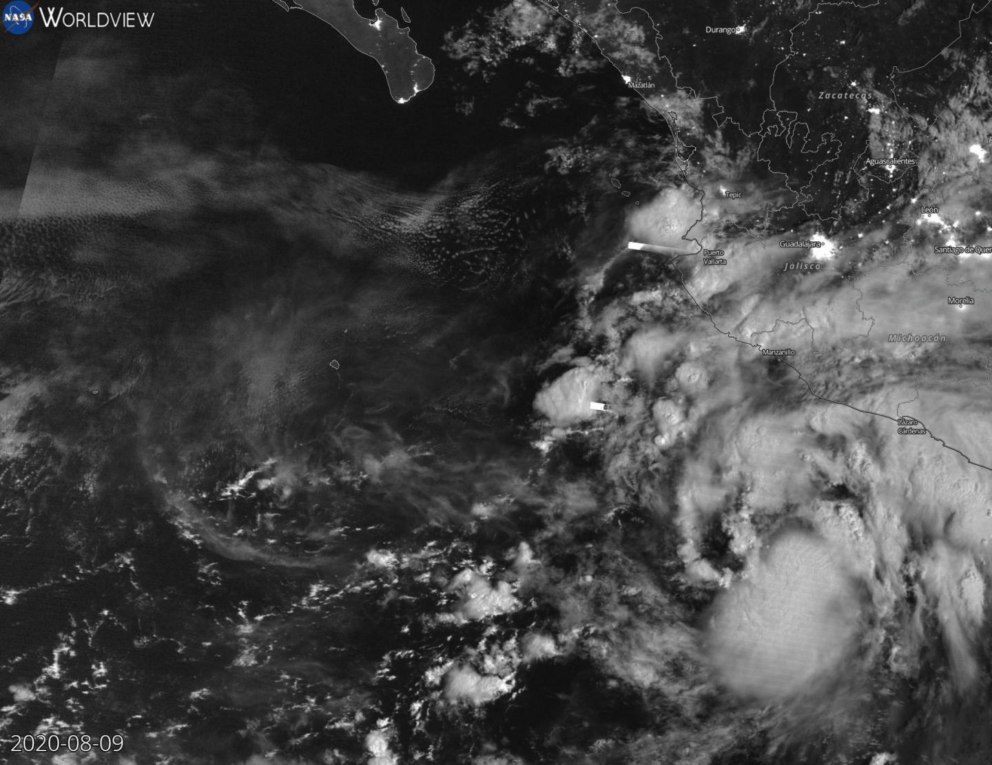
NASA’s Night-Time View of Elida’s Intensification
The Visible Infrared Imaging Radiometer Suite (VIIRS) instrument aboard Suomi NPP provided a night-time image of Hurricane Elida during the early morning hours of Aug. 11 (8 p.m. EDT on Aug. 10). The storm had intensified into a hurricane and an eye was clearly apparent, surrounded by powerful thunderstorms around it.
At NASA’s Goddard Space Flight Center in Greenbelt, Md. an animation of night-time imagery from NASA-NOAA’s Suomi NPP satellite shows the development and intensification of Hurricane Elida in the Eastern Pacific Ocean from Aug. 9 to 11, 2020 at 0000 UTC (which is 8 p.m. EDT Aug. 8 to 10). On Aug. 9, Elida appeared somewhat shapeless, and by the night-time hours of Aug.10, the storm took on a general tropical cyclone shape with bands of thunderstorms wrapping into the low-level center. Elida became a hurricane by 5 p.m. EDT (2100 UTC) on Aug. 10. By Aug. 11, Elida had a tight circulation of powerful thunderstorms around the center and an eye was apparent on the night-time imagery. The animation was created using the NASA Worldview application.
Hurricane Elida’s Status on Aug. 11
At 11 a.m. EDT (1500 UTC) on Aug. 11, the National Hurricane Center (NHC) noted the center of Hurricane Elida was located near latitude 21.3 degrees north and longitude 113.8 degrees west. That is about 275 miles (440 km) west-southwest of the southern tip of Baja California, Mexico.
Elida was moving toward the northwest near 14 mph (22 kph). A west-northwestward to northwestward motion with a decrease in forward seed is expected during the next several days. Maximum sustained winds have increased to near 100 mph (155 kph) with higher gusts. Elida is now a Category 2 hurricane on the Saffir-Simpson Hurricane Wind Scale. Hurricane-force winds extend outward up to 15 miles (30 km) from the center and tropical-storm-force winds extend outward up to 70 miles (110 km). The estimated minimum central pressure is 975 millibars.
Rapid weakening is expected to begin tonight as Elida moves over colder water, and the cyclone is expected to weaken to a tropical storm on Wednesday and degenerate to a remnant low pressure area on Thursday, Aug. 13.
###
About NASA’s EOSDIS Worldview
NASA’s Earth Observing System Data and Information System (EOSDIS) Worldview application provides the capability to interactively browse over 700 global, full-resolution satellite imagery layers and then download the underlying data. Many of the available imagery layers are updated within three hours of observation, essentially showing the entire Earth as it looks “right now.”
NASA Researches Earth from Space
For more than five decades, NASA has used the vantage point of space to understand and explore our home planet, improve lives and safeguard our future. NASA brings together technology, science, and unique global Earth observations to provide societal benefits and strengthen our nation. Advancing knowledge of our home planet contributes directly to America’s leadership in space and scientific exploration.
For updated forecasts, visit: http://www.
Rob Gutro
NASA’s Goddard Space Flight Center, Greenbelt, Md.
Media Contact
Rob Gutro
[email protected]
Original Source
https:/


