Credit: Credit: NASA /NRL
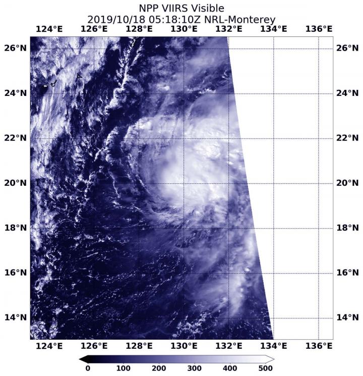
NASA-NOAA’s Suomi NPP satellite provided forecasters at the Joint Typhoon Warning Center with a visible image of Tropical Storm Neoguri that showed it had become more organized over the previous 24 hours.
Tropical Depression 21W lacked organization for a couple of days until early on Oct. 18 when the Suomi NPP satellite passed overhead and showed it had consolidated. The storm had strengthened from a depression to a tropical storm on Oct. 18.
The Visible Infrared Imaging Radiometer Suite (VIIRS) instrument aboard Suomi NPP provided a visible image of Neoguri that revealed powerful storms circled the low-level center. The image showed that bands of thunderstorms were also developing around the eastern quadrant.
On Oct. 19 at 11 a.m. EDT (1500 UTC) Tropical Storm Neoguri, known locally in the Philippines as Perla, was located near latitude 20.4 degrees north and longitude 129.2 degrees east. That is about 374 nautical miles south-southeast of Kadena Air Base, Okinawa Island, Japan. It was moving to the northwest and had maximum sustained winds near 45 knots (52 mph/83 kph).
Forecasters at the Joint Typhoon Warning Center expect Neoguri will strengthen to 50 knots (58 mph/92 kph), then weaken before becoming extra-tropical on its northward track.
Hurricanes are the most powerful weather event on Earth. NASA’s expertise in space and scientific exploration contributes to essential services provided to the American people by other federal agencies, such as hurricane weather forecasting.
###
Media Contact
Rob Gutro
[email protected]
Original Source
https:/


