Credit: Credit: NASA Worldview, Earth Observing System Data and Information System (EOSDIS)/NOAA
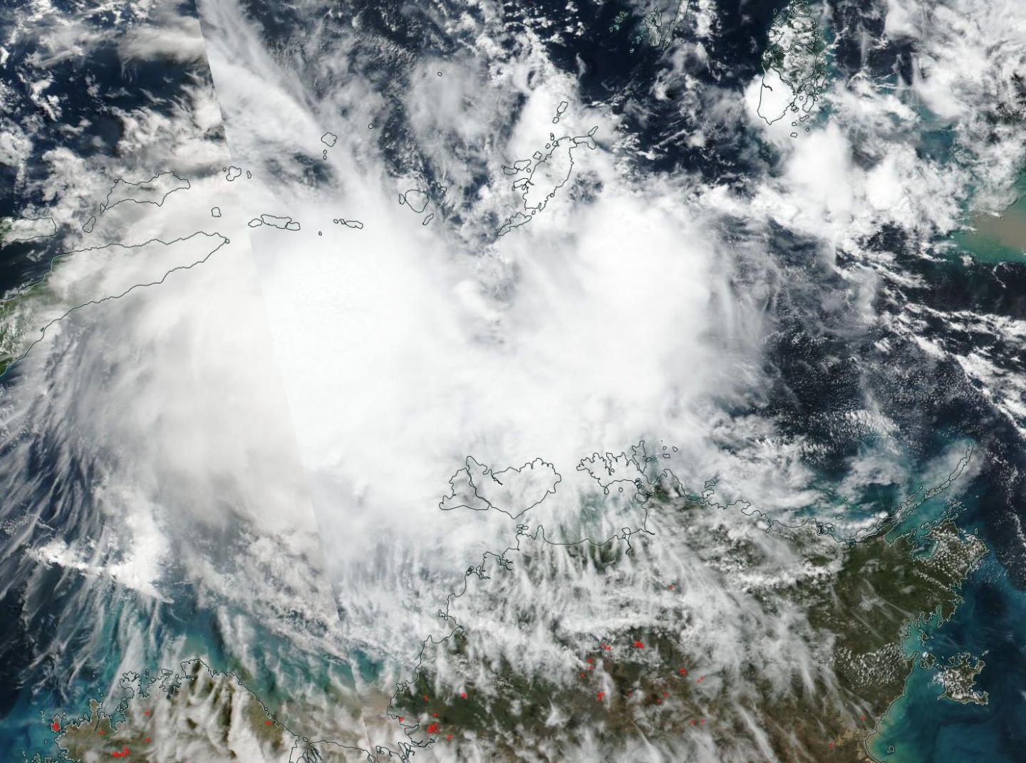
NASA-NOAA’s Suomi NPP satellite passed over the Southern Indian Ocean and captured a visible image of newly formed Tropical Cyclone Lili, located north of the coast of Australia’s Northern Territory.
The Australian Bureau of Meteorology or ABM issued a Strong Wind Warning for the following areas: Beagle Bonaparte Coast, North Tiwi Coast, Arafura Coast and Roper Groote Coast. There is no tropical cyclone warning currently in effect.
NASA-NOAA’s Suomi NPP satellite passed over Lili on May 9 and the Visible Infrared Imaging Radiometer Suite (VIIRS) instrument provided a visible image of the storm. The VIIRS image showed strong thunderstorms around the center of circulation and in a large band extending to the east of the storm. The satellite imagery shows a consolidating system in the Timor Sea.
At 11 a.m. EDT (1500 UTC) on May 9, the Joint Typhoon Warning Center or JTWC noted that Lili had maximum sustained winds near 40 knots (46 mph/74 kph). Lili is centered near 9.1 degrees south latitude and 128.8 degrees east longitude. Lili is located approximately 236 nautical miles north-northwest of Darwin, Australia and has tracked south-southwestward.
Lili is expected to strengthen slightly in the next day before weakening as it moves in a westerly direction toward Timor.
###
Media Contact
Rob Gutro
[email protected]
Original Source
https:/


