Credit: NASA/NRL
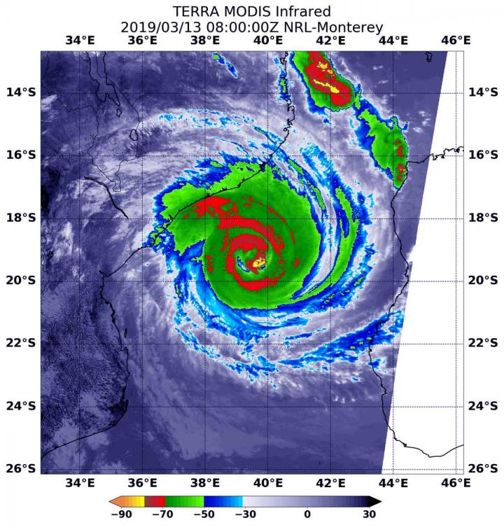
NASA’s Terra satellite captured an infrared image of Tropical Cyclone Idai approaching the coast of Mozambique. The infrared data provided cloud top temperatures that indicated powerful thunderstorms circled Idai’s center.
At 4 a.m. EDT (0800 UTC) on March 13 the Moderate Resolution Imaging Spectroradiometer or MODIS instrument that flies aboard NASA’s Terra satellite gathered infrared data on Idai. Infrared data provides temperature information. Strongest thunderstorms circled Idai’s center and contained cloud top temperatures as cold as minus 70 degrees Fahrenheit (minus 56.6 Celsius). NASA research has shown that cloud tops with temperatures that cold were high in the troposphere and have the ability to generate heavy rain.
MODIS infrared imagery also indicated Idai’s eye is about 20 nautical miles wide in diameter, although it was covered by high clouds.
At 11 a.m. EDT (1500 UTC), Idai’s center was located near latitude 19.5 degrees south and longitude 38.7 degrees east. That’s about 175 nautical miles north-northwest of Europa Island. Idai was moving to the west. Maximum sustained winds were near 103.6 mph (90 knots/166.7 kph) with higher gusts.
On March 13, the Mozambique National Meteorology Institute (INAM) noted that Idai is causing very heavy rains of more than 100 millimeters (4 inches) in 24 hours over the Mozambique Channel.
Idai is forecast to make landfall just north of Biera, Mozambique between March 14 at 1200 UTC and March 15 at 0000 UTC (on March 14 between 8 a.m. to 8 p.m. EDT). Beira is the fourth largest city in the country and is located in the Sofala Province, central region of the country. Heavy rains, thunderstorms and hurricane-force winds are expected as Idai comes ashore.
###
For the latest advisory from the Mozambique National Meteorology Institute (INAM), visit: http://www.
By Rob Gutro
NASA’s Goddard Space Flight Center
Media Contact
Rob Gutro
[email protected]
Original Source
https:/


