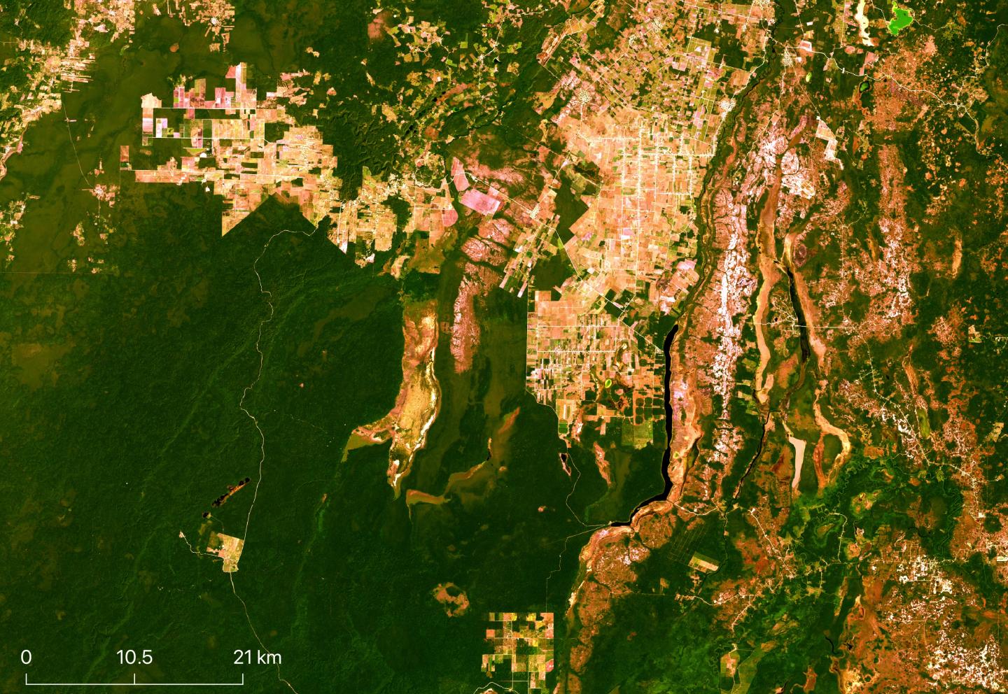
Credit: Image from the Landsat 8 archive, NASA/USGS.
AUSTIN, Texas — Using NASA satellite images and machine learning, researchers with The University of Texas at Austin have mapped changes in the landscape of northwestern Belize over a span of four decades, finding significant losses of forest and wetlands, but also successful regrowth of forest in established conservation zones that protect surviving structures of the ancient Maya.
The research serves as a case study for other rapidly developing and tropical regions of the globe, especially in places struggling to balance forest and wetland conservation with agricultural needs and food security.
“Broad-scale global studies show that tropical deforestation and wetland destruction is occurring rapidly, which contributes to climate change in multiple ways such as through greenhouses gas increases,” said Timothy Beach, the study’s co-author and professor in the Department of Geography and the Environment at UT Austin. “These also lead to more runoff and water pollution in much of the Global South. Belize has served as our long-term environmental research laboratory for this global dilemma.”
In a study published in Remote Sensing, the team led by UT Austin graduate student Colin Doyle used satellite images from NASA’s Landsat archive to quantify land-use and land-cover (LULC) changes that occurred in Belize’s Orange Walk District in 1984-1987, 1999-2001 and 2014-2016. The periods were chosen to correspond with rapid changes in the agricultural system and conservation initiatives.
The Landsat program, which has been recording images of Earth since 1972, is currently on its eighth satellite. To study such broad periods, the authors used images from Landsat 8 and earlier satellites and employed a multitemporal approach, creating composite images from wet and dry seasons over several years for each period. They then trained an algorithm to identify eight distinct land types, including several varieties of forest and wetlands. From this, they generated maps illustrating the LULC for each of the three periods.
During the first period (1984-1987), deforestation was limited to small patches resulting from milpa farming — a system of rotating crops and allowing previous plots to lie fallow in between use to maximize yields.
Several protected areas were established in the late 1980s and early 1990s. By the second period examined (1999-2001), forests in these protected areas had regrown but losses to wetlands continued, as did the conversion of nonprotected land to agriculture.
The third period mapped (2014-2016) followed a shift to industrial agriculture in the 2000s and showed “alarming” losses to both forest (7.5% loss) and wetlands (28.2% loss) outside of protected areas, said co-author Sheryl Luzzadder-Beach, the founding director of the university’s Water Quality & Environmental Hydrology Lab.
Population growth contributed to the increase in land used for agriculture. However, it was a greater factor between the first and second periods, when the population nearly doubled, than between the second and third periods, when population grew more slowly, indicating that changes in farming practices had a greater impact on land use.
The maps also revealed the importance of conservation efforts in maintaining forests. Of the remaining forest in the study area, 76% is estimated to be on protected lands. These habitats are crucial in housing native flora and fauna and also contain structures from the Maya civilization important to the region’s cultural heritage.
“These ecosystems provide many services such as aiding in the water cycle and preventing flooding,” Doyle said. “The conversion of forest to pastureland and industrial agriculture is also a major contributor to increasing greenhouse gas emissions across the tropics.”
###
Media Contact
Rachel White
[email protected]
Original Source
https:/


