Credit: NASA Worldview
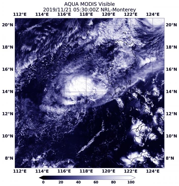
NASA’s Aqua satellite captured an image of Tropical Depression Kalmaegi in the South China Sea as it was dissipating.
On Nov. 20, Kalmaegi had crossed over Luzon, the northernmost island of the Philippines. The storm then moved into the South China Sea where it encountered stronger wind shear, winds that can tear a storm apart. Kalmaegi is known locally in the Philippines as Tropical Cyclone Ramon.
The Joint Typhoon Warning Center issued the final warning on the storm at 4 p.m. EST (2100 UTC) on Nov. 20. At that time, Kalmaegi was located near latitude 14.1 degrees north and longitude 119.2 degrees east. That is about 109 nautical miles west-southwest of Manila, Philippines. The storm was moving to the southwest, and maximum sustained winds were down to near 75 knots (29 mph/46 kph).
On Nov. 21, the Moderate Imaging Spectroradiometer or MODIS instrument that flies aboard NASA’s Aqua satellite provided a visible image of Kalmaegi. The MODIS image revealed a shapeless storm, indicating that the storm had weakened. Kalmaegi is dissipating over the South China Sea.
NASA’s Aqua satellite is one in a fleet of NASA satellites that provide data for hurricane research.
Typhoons and hurricanes are the most powerful weather event on Earth. NASA’s expertise in space and scientific exploration contributes to essential services provided to the American people by other federal agencies, such as hurricane weather forecasting.
###
Media Contact
Rob Gutro
[email protected]
Original Source
https:/


