Credit: Credit: NASA Worldview
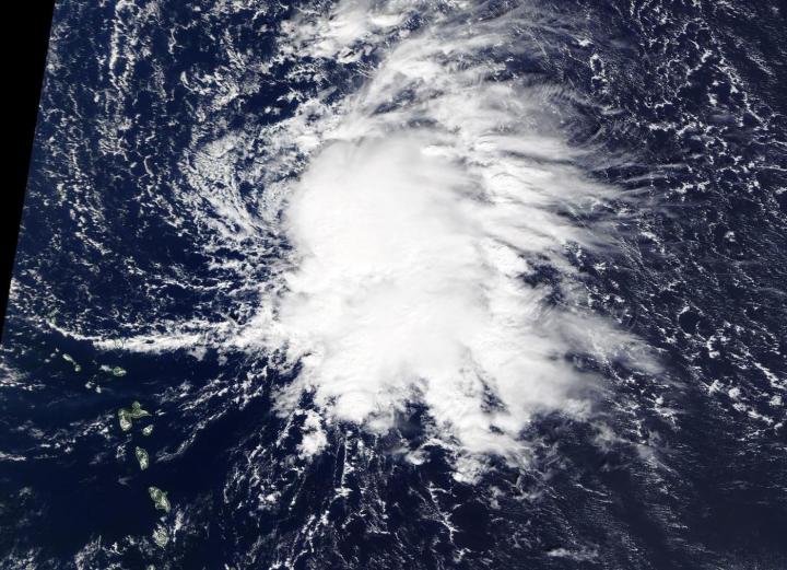
NASA’s Aqua satellite captured an image of newly formed Tropical Storm Sebastien, located northeast of the Leeward Islands in the Atlantic Ocean.
On Nov. 19, the Moderate Resolution Imaging Spectroradiometer or MODIS instrument that flies aboard NASA’s Aqua satellite provided a visible image of Sebastien. The MODIS image showed that the overall cloud pattern of the disturbance has improved since yesterday, Nov. 18, and that the low-pressure area has become well-defined.
NOAA’s National Hurricane Center or NHC noted at 11 a.m. EST (1500 UTC), the center of Tropical Storm Sebastien was located near latitude 20.1 north and longitude 58.7 west. That is about 275 miles (445 km) northeast of the Leeward Islands.
Sebastien is moving toward the north-northwest near 8 mph (13 kph). A turn to the north is expected on Wednesday followed by a turn to the northeast and an increase in forward speed Wednesday night. Maximum sustained winds are near 45 mph (75 kph) with higher gusts. Some slight strengthening is possible over the next day or so. The estimated minimum central pressure is 1008 millibars.
Sebastien is expected to become absorbed by a cold front in a couple of days.
NASA’s Aqua satellite is one in a fleet of NASA satellites that provide data for hurricane research.
Hurricanes are the most powerful weather event on Earth. NASA’s expertise in space and scientific exploration contributes to essential services provided to the American people by other federal agencies, such as hurricane weather forecasting.
For updated forecasts, visit: https:/
###
Media Contact
Rob Gutro
[email protected]
Original Source
https:/


