Credit: NASA Worldview
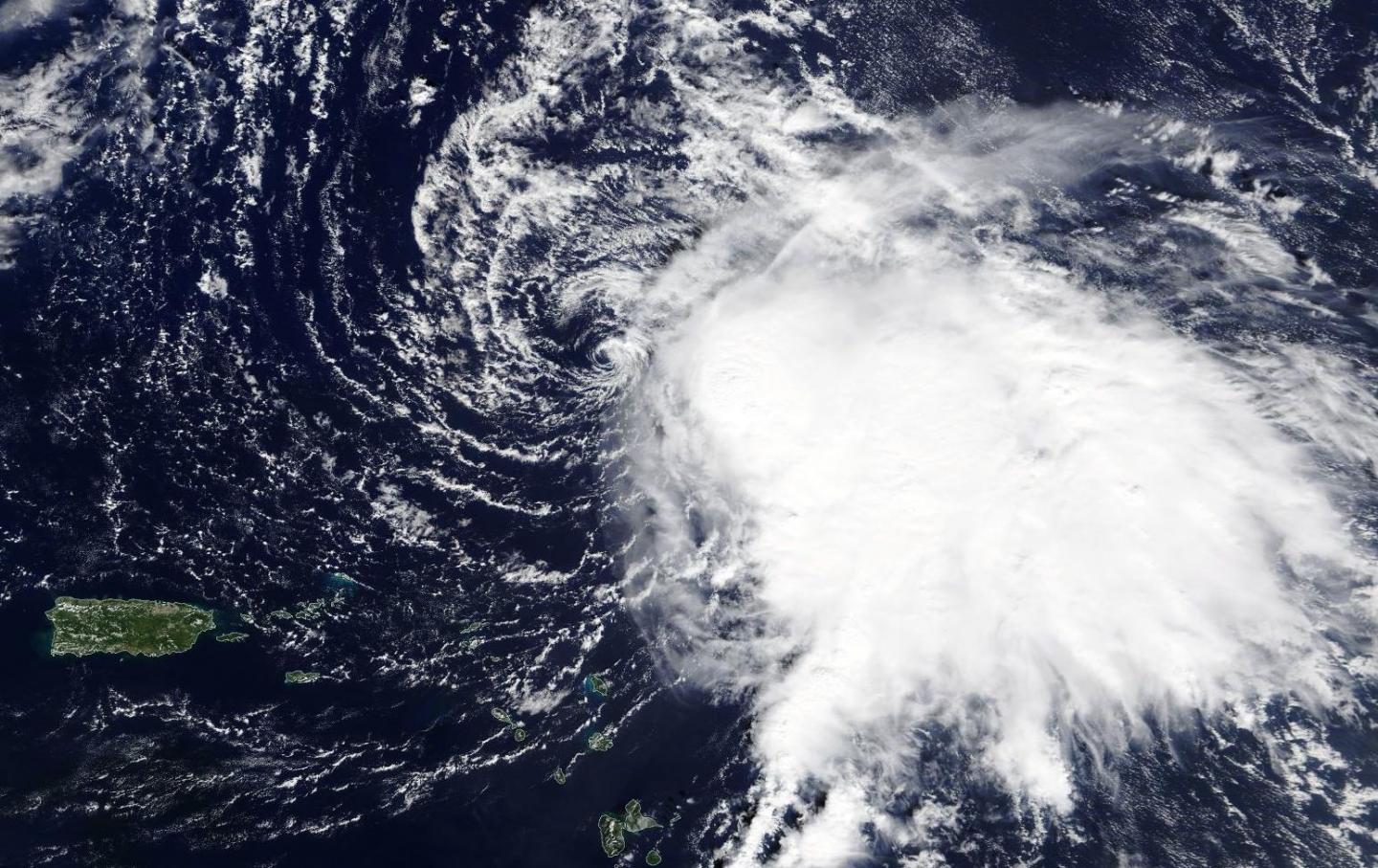
NASA’s Terra satellite captured a visible image of Tropical Storm Sebastien that showed wind shear had pushed the bulk of its clouds and showers to the southeast of the center.
In general, wind shear is a measure of how the speed and direction of winds change with altitude. Tropical cyclones are like rotating cylinders of winds. Each level needs to be stacked on top each other vertically in order for the storm to maintain strength or intensify. Wind shear occurs when winds at different levels of the atmosphere push against the rotating cylinder of winds, weakening the rotation by pushing it apart at different levels.
On Nov. 20, the Moderate Resolution Imaging Spectroradiometer or MODIS instrument that flies aboard NASA’s Terra satellite provided a visible image of Tropical Storm Sebastien. The MODIS image showed the center of circulation appeared to be surrounded by wispy clouds, and that northwesterly wind shear had pushed the bulk of Sebastien’s clouds and showers southeast of the center. In addition, the low-level center of circulation was exposed to outside winds.
On Nov. 21, the National Hurricane Center Sebastien said that the storm continues to produce a large area of deep convection over the eastern semicircle of the circulation, but the banding features are not very well defined.
On Nov. 21 at 10 a.m. EST (1500 UTC), the center of Tropical Storm Sebastien was located near latitude 23.5 degrees north and longitude 60.5 degrees west about 405 miles (650 km) north-northeast of the Northern Leeward Islands.
Sebastien is moving toward the north-northeast near 8 mph (13 kph). A faster northeastward motion is expected during the next few days. The estimated minimum central pressure is 999 millibars.
Maximum sustained winds are near 60 mph (95 kph) with higher gusts. Sebastien is forecast to become a hurricane by tonight, but a weakening trend is expected to begin by late Friday. The system is likely to become an extratropical cyclone by Saturday when it is forecast to become embedded in a frontal zone.
###
NASA’s Terra satellite is one in a fleet of NASA satellites that provide data for hurricane research.
Hurricanes and typhoons are the most powerful weather event on Earth. NASA’s expertise in space and scientific exploration contributes to essential services provided to the American people by other federal agencies, such as hurricane weather forecasting.
By Rob Gutro
NASA’s Goddard Space Flight Center
Media Contact
Rob Gutro
[email protected]
Original Source
https:/


