Credit: Credit: NASA/NRL
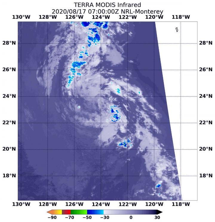
Post-Tropical Storm Fausto faded fast in the Eastern Pacific Ocean. NASA’s Terra satellite provided an infrared look at the storm, which showed no areas of heavy rainfall, and the storm was classified as a remnant low-pressure area.
Fausto developed from Tropical Depression 11E, which formed by 11 p.m. EDT on Saturday, Aug. 15. Twelve hours later, it strengthened into Tropical Storm Fausto at 11 a.m. EDT, Sunday, Aug. 16. A half day after that it had weakened back to a tropical depression. And by 11 a.m. EDT on Monday, Aug. 17, it weakened to a post-tropical cyclone, remnant low-pressure area.
NASA’s Terra satellite uses infrared light to analyze the strength of storms by providing temperature information about the system’s clouds. The strongest thunderstorms that reach high into the atmosphere have the coldest cloud top temperatures.
The Moderate Resolution Imaging Spectroradiometer or MODIS instrument that flies aboard NASA’s Terra satellite gathered infrared data on Fausto. Data showed Fausto devoid of strong storms. The coldest cloud top temperatures were as cold as minus 50 degrees Fahrenheit (minus 45.5 Celsius) in fragmented bands north and south of the center.
The National Hurricane Center (NHC) noted at 11 a.m. EDT on Aug. 17, “Fausto has been absent of deep convection for about 12 hours, and with the system over sea surface temperatures below 23 degrees Celsius (73.4 degrees Fahrenheit and tropical cyclones need at least 26.6C/80F to maintain intensity), it is unlikely organized deep convection will return. Therefore, Fausto has become a remnant low, and this will be the final NHC advisory on this system.”
###
By Rob Gutro,
NASA’s Goddard Space Flight Center
Media Contact
Rob Gutro
[email protected]
Original Source
https:/


