Credit: Credit: NASA/NRL
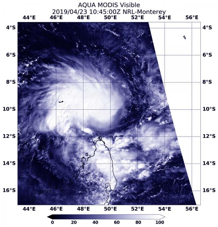
Visible satellite imagery from NASA’s Aqua satellite revealed the formation of Tropical Storm Kenneth in the Southern Indian Ocean. Kenneth formed north of Madagascar and east of the Aldabra Atoll.
An atoll is a ring shaped coral reef. The Aldabra is the world’s second-largest coral atoll. It is part of the Aldabra Group of islands and part of the Outer Islands of the Seychelles.
At 6:45 a.m. EDT (1045 UTC) on April 23, 2019, the Moderate Resolution Imaging Spectroradiometer or MODIS instrument aboard Aqua captured a visible image of Kenneth. The Joint Typhoon Warning Center or JTWC forecasters noted “Satellite imagery shows deep convection (rising air that forms thunderstorms that make up a tropical cyclone) beginning to wrap symmetrically around a low-level circulation center and forming the early stages of a central dense overcast.”
At 5 a.m. EDT (0900 UTC) on April 23, Tropical Storm Kenneth had maximum sustained winds near 35 knots (40 mph/65 kph). At that time, Kenneth was centered near 10.4 degrees south latitude and 49.4 degrees east longitude, approximately 727 nautical miles northwest of Port Louis, Mauritius. Kenneth was tracking to the west-southwest.
Kenneth is expected to move toward the border of Mozambique and Tanzania. The area in which the storm is forecast to track, has very warm sea surface temperatures that will allow the storm to strengthen over the next couple of days. Kenneth is forecast to make landfall in extreme northern Mozambique on April 25.
Residents along the Mozambique/Tanzania border should make preparations for storm surge along the coasts, heavy rainfall and hurricane-force winds.
On April 22, the Tanzania Meteorological Agency issued a broadcast about the development of Tropical Storm Kenneth and its possible effects: https:/
###
For updates from the Tanzania Meteorological Agency, visit: http://meteo.
Media Contact
Rob Gutro
[email protected]
Original Source
https:/


