Credit: NASA/JAXA/NRL
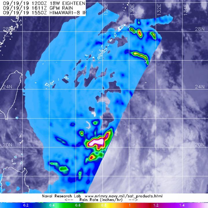
Tropical Storm Tapah formed quickly in the northwestern Pacific Ocean and as it was strengthening from a depression to a tropical storm, the Global Precipitation Measurement mission or GPM core satellite passed overhead from its orbit in space and measured rainfall rates throughout the storm.
NASA has the unique capability of peering under the clouds in storms and measuring the rate in which rain is falling. The GPM’s core satellite passed over Tropical Storm Tapah in the northwestern Pacific Ocean on Sept. 16 at 12:11 p.m. EDT (1611 UTC).
GPM found the heaviest rainfall around the storm’s center, where it was falling at a rate of as much as 1.6 inches (40 mm) per hour. Forecasters at the Joint Typhoon Warning Center incorporate the rainfall data into their forecasts.
Both the Japan Aerospace Exploration Agency (JAXA) and NASA manage GPM.
At 11 a.m. EDT (1500 UTC), the center of Tropical Storm Tapah was located near latitude 23.1 degrees north and longitude 127.9 degrees east. That puts Tapah’s center about 211 nautical miles south of Kadena Air Base, Okinawa, Japan. Maximum sustained winds remain near 40 mph (46 kph) with higher gusts. Tapah is forecast to strengthen but remain a tropical storm over the next several days.
###
Hurricanes are the most powerful weather event on Earth. NASA’s expertise in space and scientific exploration contributes to essential services provided to the American people by other federal agencies, such as hurricane weather forecasting.
For updated forecasts, visit: http://www.
By Rob Gutro
NASA’s Goddard Space Flight Center
Media Contact
Rob Gutro
[email protected]
Original Source
https:/


