
In recent years, outdoor navigation and safety have increasingly relied on advanced mapping techniques that utilize cutting-edge technology. A new research study has emerged that promises to revolutionize the way we navigate outdoor hiking trails. Published in the esteemed Journal of Geo-information Science, this innovative approach centers on constructing high-precision, three-dimensional (3D) road network maps using crowd-sourced trajectory data shared by hikers. This method presents a significant advancement in outdoor navigation by providing not just distance but also vital elevation details that are essential for safe and efficient travel in rugged landscapes.
Traditionally, mapping systems have been predominantly designed with urban vehicular routes in mind, often overlooking the unique challenges faced by hikers. The new study tackles this gap by focusing on the integration of elevation data into hiking maps, thereby addressing the limitations of existing mapping systems that prioritize convenience over precision. It underscores the growing importance of accurately representing outdoor trails, which can vary significantly in elevation and slope, making traditional flat, two-dimensional maps inadequate.
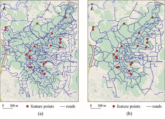
At the heart of this research is a two-layer mapping system developed by a team of researchers from Central South University in Changsha, China. The first layer, referred to as the “road network generation layer,” employs a sophisticated trajectory density stratification strategy to extract the geometric and topological structure of outdoor road networks from crowdsourced data. This innovative method allows for the creation of maps that accurately reflect the contours and turns inherent in hiking paths.
The second layer of the system, the “elevation extraction layer,” uses complex algorithms to estimate and optimize elevation information. By generating a high-resolution elevation grid that aligns with the two-dimensional road network, the researchers create an integrated 3D road network map. This detailed approach not only enriches the map’s informational content but also enhances its usability for hikers, providing them with crucial insights into the terrain they are likely to encounter.
To validate the effectiveness of this novel mapping method, the research team conducted extensive testing using 1,170 outdoor trajectories collected from the Yuelu Mountain Scenic Area. These data points were gathered in 2021 and reflect a variety of hiking experiences and routes. The results demonstrated an impressive average deviation of merely 4.201 meters in two-dimensional spatial positioning, alongside a vertical elevation error of 7.656 meters. Such precision exemplifies the enhancements this new method offers over traditional mapping techniques, reaffirming its potential influence on hiker safety and navigation.
Dr. Tang, the lead author of the study, emphasized the significance of integrating crowdsourced trajectory data into outdoor mapping. This advancement is seen as particularly revolutionary given the increasing availability of such data due to the popularity of social media and navigation apps used by hikers. By leveraging this data, the research promises to create more detailed and informative maps, which are crucial for effective route planning in complex outdoor environments.
The implications of this research extend beyond recreational hiking. Increased accuracy and the inclusion of elevation data could enhance search and rescue operations in mountainous or rugged terrains, aiding responders who rely on precise maps to locate missing individuals. The elevation information provided by the 3D maps can guide rescuers in navigating challenging hills and valleys, enabling them to approach locations that would otherwise be inaccessible with traditional 2D maps.
As outdoor recreational activities gain popularity, so does the necessity for improved navigation tools. The new 3D hiking maps developed through this research address the growing demands for more practical hiking aids. Unlike conventional maps, the enriched detail in these new models is expected to substantially improve hikers’ ability to plan their routes effectively. This could lead to safer trails and a more enjoyable outdoor experience overall, especially for those venturing into unfamiliar areas.
Moreover, the study’s findings highlight the potential for crowdsourced data to impact not just the hiking community but also other sectors. Engineers, urban planners, and conservationists can utilize accurate 3D mapping to assess land use, plan new trails, or evaluate environmental concerns based on terrain and slope.
The research also invites reconsideration of current data-sharing frameworks, suggesting that as more hikers contribute their trajectory data, the overall improvement in outdoor mapping could reach new heights. Enhancements in the mapping process can cultivate a thriving ecosystem of outdoor navigation tools tailored specifically for diverse hiking experiences. This collective effort to share data and improve mapping accuracy represents the future of outdoor recreation.
In conclusion, the advancements reported in this study signify a paradigm shift in how we understand outdoor navigation and mapping. By integrating crowd-sourced data to create enriched 3D hiking maps, researchers are paving the way for safer, more effective navigation for hikers across varied terrains. As these innovations develop further, they hold the promise of fundamentally transforming outdoor exploration and ensuring that hikers can traverse landscapes with confidence and assurance.
Subject of Research: Creation of high precision and enriched three-dimensional hiking road network maps using crowdsourced data.
Article Title: Outdoor Hiking Navigation Road Network Map Construction Based on Multi-source Trajectory Data
News Publication Date: 24-Jan-2025
Web References: Journal of Geo-information Science (Replace with actual URL)
References: Tang, D., et al. (2025). Outdoor Hiking Navigation Road Network Map Construction Using Crowd-Source Trajectory Data. Journal of Geo-information Science.
Image Credits: Beijing Zhongke Journal Publishing Co. Ltd.
Keywords
crowdsourced data, 3D mapping, hiking navigation, outdoor safety, trajectory data, elevation information.
Tags: 3D outdoor navigation technologyadvanced mapping techniques for hikerscomprehensive outdoor trail representationcrowdsourced hiking trail mapselevation data in hiking mapshigh-precision trail mapsintegration of trajectory data in mappinglimitations of traditional mapping systemsoutdoor safety and navigationresearch in geo-information sciencerugged landscape navigation solutionstwo-dimensional vs three-dimensional maps

