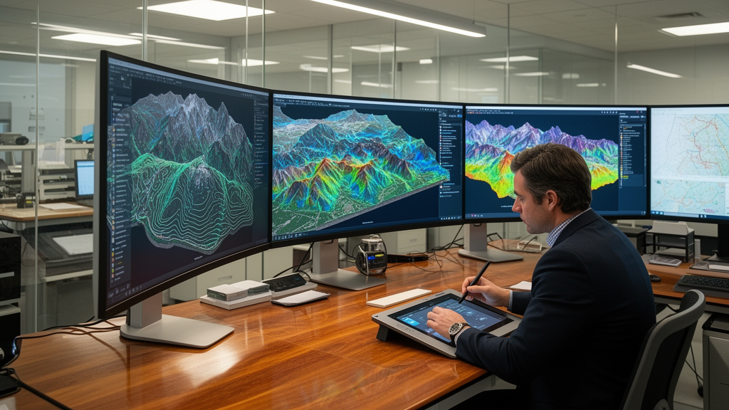
In an opinion article published in Frontiers in Artificial Intelligence, researchers Cláudia M. Viana and Jorge Rocha from the Centre of Geographic Studies, Institute of Geography and Spatial Planning, and the Associate Laboratory TERRA at the University of Lisbon analyze the methodological emergence and conceptual evolution of Geospatial Artificial Intelligence, commonly known as GeoAI. The authors trace the intellectual roots of this interdisciplinary synthesis back to 1986, when Geographic Information Science pioneer Helen Couclelis first highlighted the profound epistemological, theoretical, and methodological connections uniting geography and artificial intelligence. While Couclelis initially examined the logical and mathematical dimensions of early computing and their consequences for modeling, prediction, and scientific processes, four decades of technological acceleration have profoundly altered modern geographic analysis. Today, the discipline increasingly relies on advanced machine learning algorithms capable of processing vast, heterogeneous, and high-dimensional spatio-temporal datasets, frequently classified as Big Data. By bridging computational learning mechanisms with core spatial concepts, GeoAI provides unprecedented analytical capabilities for investigating territorial dynamics, human-environment interactions, and complex spatial phenomena across both physical and human systems.
The researchers clarify that GeoAI does not emerge in isolation, but rather operates across the intersecting disciplinary domains of geomatics, geocomputation, GIScience, and digital geographies. Geomatics traditionally encompasses a broad technical spectrum dedicated to the acquisition, management, analysis, and cartographic representation of geographically referenced information, including geographic information systems, photogrammetry, remote sensing, digital geodesy, and surveying. To maintain analytical rigor, the authors explicitly emphasize the term geospatial over spatial or geographical, noting that geospatial specifically designates processes, data, and phenomena referenced to locations on Earth, whereas spatial can denote non-geographical topologies. Alongside geomatics, geocomputation shifts the analytical focus toward computational simulation, spatial modeling, and automated data processing. Geocomputation provides algorithmic architecture to parse massive territorial archives, while modern artificial intelligence expands the scope of spatio-temporal discovery. Consequently, the authors present GeoAI as an interdisciplinary domain that builds directly on these technological precursors, creating a unified methodological platform capable of addressing sustainability, ecological risks, and societal challenges.
A critical contribution of the analysis is distinguishing traditional spatial analysis from the analytical mechanics introduced by GeoAI. Conventional spatial analytical frameworks—such as spatial econometrics, geostatistics, spatial interpolation, map algebra, multicriteria analysis, network modeling, cellular automata, Markov models, and supervised classifications—require the researcher to explicitly predefine variables, structural rules, spatial parameters, and functional forms. In these classical approaches, the analytical intelligence resides largely with the investigator, who dictates how geographical processes should be represented. In sharp contrast, GeoAI transfers a substantial proportion of this analytical specification to computational algorithms that automatically learn latent representations, high-dimensional interactions, and nonlinear boundaries directly from data lakes. The authors stress that this transition represents a fundamental paradigm shift rather than a mere acceleration of computational power. Crucially, they argue that GeoAI does not render conventional spatial statistics obsolete; rather, spatial analysis, geocomputation, and artificial intelligence form cumulative, interconnected methodological layers where data-driven discoveries must remain grounded in established geographic hypotheses.
The methodological transformation driven by GeoAI is already highly visible across physical geography, particularly in Earth observation, topographic mapping, and environmental risk analysis. National mapping agencies and physical geographers are rapidly adopting scalable algorithms to monitor dynamic natural phenomena. In remote sensing, traditional land-cover classification required analysts to manually identify spectral bands, compute specialized indices, and guide supervised classifiers along hand-crafted decision boundaries. GeoAI replaces these rigid classifications with deep learning architectures capable of extracting complex spatial, textural, and spectral representations directly from raw satellite imagery. Similarly, environmental hazard assessment has evolved from static multi-criteria weighting to sophisticated machine learning workflows. While conventional susceptibility studies rely on predefined conditioning factors such as elevation, slope, lithology, precipitation, and proximity to drainage networks, GeoAI models—including Random Forest, gradient boosting, and deep neural networks—model multi-scale nonlinear interactions directly from terrain representations. This algorithmic capability has enhanced automated landslide detection through transfer learning and enabled predictive flood-risk modeling and wildfire tracking.
Within human geography, the adoption of GeoAI is progressing through quantitatively oriented subdisciplines such as urban planning, transport analysis, and health geography. Traditionally, human geographic inquiry relied on static decennial censuses, structured demographic surveys, and relatively coarse administrative boundaries. GeoAI allows researchers to supplement these conventional sources with massive, passively collected data streams, including location-based social networks, mobile device telemetry, urban sensor feeds, and street-level imagery. By parsing these unstructured repositories, machine learning models uncover fine-grained spatio-temporal dynamics in everyday human mobility, public infrastructure access, and urban vitality. In health geography, which synthesizes human and physical perspectives, GeoAI improves the spatial surveillance of infectious disease transmission and illuminates disparities in healthcare infrastructure access. Urban researchers deploy these tools to predict future urbanization trajectories, simulate sustainable transport scenarios, and model complex demographic shifts. However, Viana and Rocha observe that qualitative and interpretive traditions in human geography remain hesitant to embrace GeoAI, citing legitimate concerns regarding model transparency, reproducibility, and the reductionist quantification of lived social space.
This divide reawakens a classic twentieth-century epistemological tension between macrogeography and microgeography, or nomothetic versus idiographic spatial science. Macrogeography historically sought general laws, universal governing equations, and broad spatial regularities, whereas microgeography emphasized localized, contextual, and descriptive spatial particulars. In contemporary spatial data science, this dichotomy resurfaces through the tension between algorithmic complexity models derived from the physical sciences and context-specific user-generated geographical information, such as Volunteered Geographic Information. Human geography has traditionally cautioned against uncritically applying mechanistic physical analogies to social phenomena. Nevertheless, complexity research demonstrates that interactions among individual system components generate aggregate complexity, producing emergent, counter-intuitive collective behaviors that cannot be deduced from isolated agents alone. Viana and Rocha observe that in modern geographic information science, this tension finds a structural resolution: macrogeographic principles are encoded into computational algorithms and foundational methods, while microgeographic specificity is supplied through rich, fine-grained empirical data.
The expansion of GeoAI intersects directly with digital geographies, a field that interrogates the cultural, political, and socio-economic ramifications of digital technologies. As digital platforms, mobile location trackers, and autonomous systems increasingly mediate daily life, spatial interactions are profoundly reshaped. Digital geographies examines emerging phenomena including digital gentrification, platform-mediated tourism, automated governance, and data-driven territorial planning. The ubiquity of connected handheld devices fundamentally alters how individuals perceive, navigate, and produce geographical space. Viana and Rocha argue that GeoAI serves as the primary computational engine transforming raw digital exhausts into contextual spatial knowledge. However, because digital footprints reflect societal structures, they inherently reflect digital divides. The authors warn that GeoAI systems trained on unrepresentative, skewed, or biased digital data inevitably reproduce and amplify spatial injustices. Furthermore, access to high-performance computing clusters and authoritative geospatial databases remains severely skewed globally, exacerbating scientific inequalities between well-resourced institutions and developing countries.
Beyond structural data biases, GeoAI inherits and frequently exacerbates long-standing spatial methodological complications that conventional statistics have struggled with for generations. Machine learning architectures applied to geographical phenomena must constantly confront spatial dependence, spatial heterogeneity, edge effects, uneven spatial sampling, and the modifiable areal unit problem, where analytical conclusions shift depending on the spatial aggregation scale. Furthermore, spatial models frequently suffer from limited geographic transferability, meaning an algorithm calibrated successfully in one climatic, topographic, or urban context may fail dramatically when deployed across a different landscape. Concurrently, the pervasive collection of high-resolution mobile telemetry and street imagery introduces critical ethical vulnerabilities surrounding geoprivacy, state and corporate surveillance, and algorithmic accountability. The researchers emphasize that these spatial and ethical challenges cannot be resolved solely through statistical tuning; they require rigorous spatial validation, methodological transparency, and acute sensitivity to the socio-institutional frameworks governing data generation and deployment.
A major barrier hindering the widespread adoption of GeoAI, particularly in high-stakes public policy and territorial administration, is the notorious black-box problem. Complex architectures, notably deep neural networks, process inputs through millions of latent parameters, obscuring internal decision-making trajectories from public officials, planners, and affected citizens. To overcome this algorithmic opacity, researchers are increasingly integrating explainable artificial intelligence, or xAI, into geospatial workflows. Explainable methods aim to clarify which specific spatial features, environmental variables, or topological interactions govern model predictions, fostering institutional accountability and civic trust. Post-hoc, model-agnostic explanation tools, such as Local Interpretable Model-agnostic Explanations and SHapley Additive exPlanations, evaluate variable contributions across diverse predictive architectures without requiring internal modifications. Other practical strategies involve deploying transparent surrogate models that mimic complex neural predictions or establishing rule-based decision frameworks that express predictions through recognizable spatial associations, enabling planners to audit algorithmic reasoning.
Despite these technological advances, Viana and Rocha emphasize that explainable artificial intelligence is not an automated panacea for spatial governance. Methodological hurdles persist, particularly the fundamental trade-off between model interpretability and predictive precision, where oversimplifying explanations can distort underlying analytical fidelity. Furthermore, explanations must be tailored to distinct audiences, ranging from algorithmic programmers and regulatory bodies to lay citizens lacking technical training. Crucially, the authors conclude that explainability alone cannot ensure spatial justice or procedural fairness, which fundamentally depend on data governance, representative sampling, and institutional accountability. Ultimately, GeoAI should not be perceived as an autonomous replacement for human geographic understanding, nor as a purely data-driven substitute for hypothesis-driven science. Its genuine intellectual significance lies in synthesizing advanced computational learning with rigorous geographical theory, spatial context, and ethical reflexivity, ensuring that computationally identified patterns translate into meaningful, socially responsible geographical knowledge.
Subject of Research: The methodological integration, epistemological tensions, and ethical challenges of Geospatial Artificial Intelligence in spatial analysis
Article Title: Geography, geospatial analysis and artificial intelligence: between traditional methods and new spatial paradigms
Article References: Viana, C. M., & Rocha, J. (2026). Geography, geospatial analysis and artificial intelligence: between traditional methods and new spatial paradigms. Frontiers in Artificial Intelligence, 9, Article 1969037. https://doi.org/10.3389/frai.2026.1969037
Image Credits: AI Generated
DOI: 10.3389/frai.2026.1969037
Keywords: Geospatial Artificial Intelligence, GeoAI, GIScience, Geocomputation, Spatial Analysis, Explainable AI, Digital Geographies, Remote Sensing, Geography, geospatial, analysis, artificial
News Source: Blake Davidson. (November 12, 2026). Geospatial Artificial Intelligence Reshapes Geographic Methods and Theory, Researchers Conclude. Scienmag.