
In an unprecedented collaborative effort aimed at advancing environmental oversight in the global cocoa sector, the World Cocoa Foundation (WCF) and the Alliance of Bioversity International and CIAT have jointly conducted a groundbreaking evaluation of the remote sensing maps widely used to monitor deforestation, reforestation, agroforestry, and greenhouse gas (GHG) emissions related to cocoa production. This assessment is pivotal, setting a new benchmark for the quality and reliability of spatial data that cocoa companies increasingly depend upon to fulfill stringent regulatory demands, especially under the European Union’s evolving compliance frameworks that target sustainability and net-zero emission goals.
At the core of this initiative lies a critical recognition: high fidelity in environmental reporting hinges on the use of precise and verifiable geospatial data. Remote sensing technologies serve as key tools for mapping land use changes, capturing the extent of cocoa plantation expansion, and quantifying reforestation or afforestation activities. However, these methodologies are only as robust as the input data underpinning them. The absence of comprehensive validation had previously raised concerns that inaccurate or incomplete data could compromise decision-making, leading to erroneous reporting, regulatory risks, and potential sanctions affecting both producers and their market access.
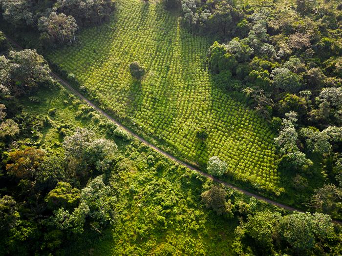
This landmark assessment breaks new ground by introducing a set of stringent, sector-specific criteria tailored to the unique characteristics and challenges of cocoa landscapes in West Africa, specifically Ghana and Côte d’Ivoire. These criteria evaluate multiple dimensions of map quality: the ability to accurately distinguish cocoa plantations from surrounding natural forest areas; the spatial completeness and resolution within the critical cocoa-growing zones; and transparency regarding the methodologies and data sources used to generate these maps. Importantly, the study underscores the necessity of incorporating smallholder farmers, whose plots often escape detection in large-scale remote sensing analyses but represent a substantial component of cocoa production and livelihoods in the region.
The implications of data accuracy extend beyond regulatory compliance and into the realms of environmental integrity and social equity. Misclassification of land cover can obscure the extent of deforestation or afforestation, thereby skewing assessments of greenhouse gas emissions resulting from land use change. For cocoa companies and governments striving to eradicate deforestation-linked commodities, this translates to a pressing need for data products that are not only accurate but also subjected to independent verification. Michael Matarasso, Impact Director of WCF, articulates the gravity of this issue, emphasizing that inaccuracies propagate systemic risks for all stakeholders – from corporate entities to farming communities – that depend on trustworthy metrics to guide sustainability strategies.
Notably, the evaluation reveals significant limitations in existing open-access global maps, whose performance falls short for the granular analysis required within cocoa production landscapes. These datasets, while indispensable and often the first point of reference, suffer from accuracy deficits when applied to complex agricultural mosaics characteristic of West African cocoa regions. The research advocates a multi-source integration approach, recommending that practitioners blend several of the highest-performing global maps to compensate for individual shortcomings. When opting for commercial data providers, the work insists on rigorous, independent third-party validation to ascertain and confirm accuracy claims.
The study further highlights a promising trend: maps developed by national governments in Ghana and Côte d’Ivoire frequently surpass the accuracy of global counterparts. Such findings spotlight the critical role of national agencies in producing localized, high-resolution geospatial products that better capture on-the-ground realities. Consequently, the report calls for enhanced collaboration, resource allocation, and capacity building directed at bolstering national forest monitoring infrastructure. By fostering such partnerships, the cocoa sector can generate a harmonized system where science-based standards and operational monitoring converge, enabling transparent and reliable reporting that aligns with international sustainability agendas.
Dr. Serge Kotchi from Côte d’Ivoire’s Bureau National d’Études Techniques et de Developpment (BNETD) eloquently articulates this vision, stressing that raising collective awareness about data quality will underpin the sector’s progress toward high-accuracy environmental monitoring. Standardizing data methodologies, documentation, and verification processes ensures that national monitoring efforts dovetail seamlessly with global benchmarks, creating shared languages and frameworks essential for comparative analysis and policy enforcement.
Beyond reflecting current capabilities, the report situates itself as a catalyst for systemic transformation within the cocoa industry. WCF, representing a broad coalition of stakeholders—including farmers, processors, manufacturers, and traders—reiterates its commitment to championing the continuous improvement of environment-related tools and data. The new criteria and assessment outputs complement existing instruments such as deforestation risk evaluation frameworks and greenhouse gas accounting tools. Together, these resources empower both corporate actors and producing country governments to establish and maintain traceability and monitoring systems that are grounded in rigorous science and transparency.
The stakes at hand are monumental. Cocoa production underpins the livelihoods of millions and is intimately tied to the health of critical tropical ecosystems threatened by land degradation and climate change. Ensuring that sustainability claims rest on solid, scientifically credible foundations is essential not only for regulatory compliance but for safeguarding the future of the sector and its environmental setting. The WCF and CIAT’s collaborative assessment marks a significant stride toward this objective by clarifying standards and exposing gaps that must be addressed through investment and innovation in data acquisition and interpretation.
In light of evolving regulatory landscapes and growing consumer scrutiny, the cocoa sector faces unparalleled pressure to demonstrate measurable progress toward deforestation-free and net-zero commitments. This research provides a pathway by which the entire supply chain—from smallholder farmers to multinational corporations—can align around verifiable environmental performance indicators. Ultimately, such alignment supports a more equitable and transparent cocoa economy, facilitating market access and reinforcing the sector’s role in global sustainability agendas.
The comprehensive report, complete with detailed criteria and quality assessments, is publicly available for stakeholders seeking to deepen their understanding of best practices in spatial data use for cocoa sustainability. It encapsulates a vital message: data integrity is the backbone of credible environmental action, and only through collective dedication to high-quality mapping and monitoring can the cocoa sector meet its ambitious environmental and social goals.
Subject of Research: Environmental monitoring and spatial data quality assessment in the global cocoa sector
Article Title: (Not provided in source content)
News Publication Date: (Not provided in source content)
Web References:
– https://worldcocoafoundation.org/storage/files/041525-ciat-wcf-assessment-best-practices.pdf
– https://worldcocoafoundation.org/
– https://alliancebioversityciat.org/
References: Not explicitly listed in source content
Image Credits: World Cocoa Foundation
Keywords: cocoa sustainability, environmental monitoring, remote sensing, deforestation, greenhouse gas emissions, spatial data quality, West Africa, Ghana, Côte d’Ivoire, World Cocoa Foundation, Alliance of Bioversity International and CIAT, national forest monitoring, smallholder inclusion
Tags: cocoa industry environmental compliancecocoa plantation expansion trackingcollaboration in cocoa sustainability initiativesdeforestation monitoring in cocoa productionenvironmental reporting accuracyEuropean Union sustainability regulationsgeospatial data validation for cocoa companiesgreenhouse gas emissions assessmentreforestation and agroforestry practicesremote sensing technology in agriculturespatial data quality in cocoa sectorWorld Cocoa Foundation partnerships


