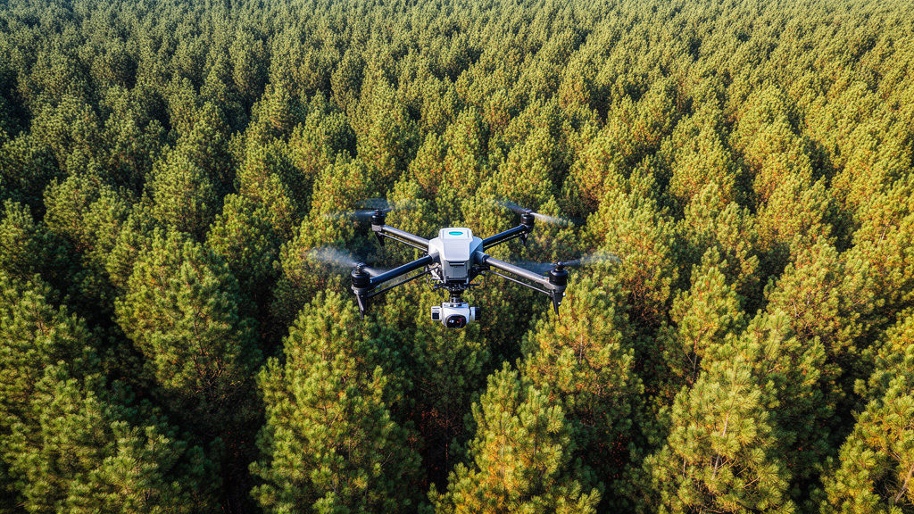
A multi-year investigation combining airborne remote sensing and quantitative genetics has demonstrated that pairing unmanned aerial vehicle multispectral imagery with three-dimensional point clouds can reconstruct fine-scale canopy water potential distributions across slash pine crowns. Conducted between 2021 and 2024 in a subtropical seed orchard in eastern China, the investigation mapped midday canopy water potential as a spatially explicit continuous field rather than a flattened planar average. By applying a random forest machine learning algorithm to fused spectral and structural datasets, researchers quantified vertical hydraulic gradients, tracked seasonal within-crown variations over four consecutive years, and derived crown-level indices to evaluate genetic heritability across twenty half-sibling families. The modeling framework successfully linked crown structural stratification to physiological water status, demonstrating that upper crown layers experience significantly greater hydraulic tension during active growing seasons while simultaneously identifying specific pine families with superior, temporally stable breeding values for drought-resilience breeding programs.
Understanding canopy water status is essential for assessing forest productivity and resilience under intensifying climatic extremes, as water availability fundamentally limits perennial tree growth and survival. Under water-limited conditions, canopy water potential integrates soil water availability, atmospheric vapor pressure deficit, and internal plant hydraulic resistance. In particular, midday canopy water potential, measured during peak daily transpiration and maximum atmospheric evaporative demand, serves as an exceptionally sensitive physiological indicator because it captures the most hydraulically constrained condition of the forest canopy. Variations in this metric directly govern stomatal closure, carbon assimilation, transpiration rates, and photosynthetic capacity across individual trees. Although traditional Scholander-type pressure chambers provide highly accurate measurements that remain the physiological benchmark, the technique is destructive, labor-intensive, and inherently restricted in spatial coverage. Consequently, conventional manual sampling cannot feasibly provide repeated, longitudinal assessments across hundreds of individual trees, vertical crown strata, and multiple successive growing seasons.
To overcome these sampling constraints, researchers established an extensive remote sensing experiment within an open-pollinated slash pine (Pinus elliottii) seed orchard at Matou National Forest in Jing County, Xuancheng, Anhui Province, China. Positioned at 30°45′N and 118°29′E, the experimental site experiences a northern subtropical monsoon climate characterized by a mean annual temperature of 15.7 degrees Celsius and an average annual precipitation of 1525 millimeters. The trial plantation, originally established in 2013 on flat terrain with minimal topographic variation and managed under biannual understory weeding, comprises twenty half-sibling families structured within an incomplete randomized block design. The orchard spans approximately six hectares and contains 600 trees distributed across thirty experimental plots of twenty trees each, spaced at six by eight meters. This standardized spatial arrangement provided ideal conditions for individual-tree canopy development, geometric alignment, and high-precision aerial data collection over extended temporal intervals.
Aerial data acquisition spanned from 2021 through 2024 using three standardized unmanned aerial vehicle platforms deployed sequentially under clear, low-wind conditions between 10:30 and 12:30 local solar time. Aerial surveys deployed a DJI Phantom 4 RTK equipped with a 20.48-megapixel RGB camera for high-resolution photogrammetry, a Phantom 4 Multispectral platform carrying a six-band sensor array covering blue, green, red, red-edge, and near-infrared spectral wavelengths, and a Matrice 300 RTK carrying a Zenmuse L1 airborne LiDAR sensor operating at 240 kilohertz with up to three returns per pulse to generate dense point clouds averaging 5000 points per square meter. Ground radiometric calibration utilized a two-square-meter gray panel with 60 percent reflectance. During the 2024 growing season, concurrent ground-truth physiological measurements were collected monthly from April through September using a portable pressure chamber, yielding 174 paired field-image records across five monthly campaigns from April to August to calibrate and evaluate empirical prediction models.
Raw aerial datasets were preprocessed using DJI Terra and scripted pipelines in R using the lidR, terra, raster, and caret packages. For LiDAR point clouds, ground and vegetation points were classified using a Cloth Simulation Filter, allowing the construction of Digital Elevation Models and Digital Surface Models at 0.5-meter spatial resolution, from which Canopy Height Models were calculated. Individual tree crowns were delineated using a watershed segmentation algorithm, with each crown polygon inwardly buffered by 0.2 meters to eliminate edge interference and background soil contamination. Dense structural point clouds were voxelized, and horizontal nearest-neighbor assignment projected multispectral reflectance from orthomosaics directly onto three-dimensional voxel centroids. From five calibrated reflectance bands, fourteen vegetation indices were computed, generating nineteen candidate spectral predictors per tree. Sensitivity analyses tested voxel edge lengths of 0.3, 0.5, 1.0, and 2.0 meters, ultimately selecting a 1.0-meter voxel edge as the reference resolution balancing fine architectural detail against computational point density.
Using the paired field dataset, the team evaluated four machine learning algorithms to predict midday canopy water potential: random forest, support vector machines, partial least squares regression, and extreme gradient boosting. Random forest demonstrated superior predictive performance on the retained internal test set of 41 observations, achieving a squared Pearson correlation of 0.697 and a root mean square error of 0.242 megapascals, outperforming support vector machines, partial least squares regression, and extreme gradient boosting, which yielded validation correlation values of 0.60, 0.56, and 0.58, and root mean square errors of 0.26, 0.28, and 0.26 megapascals, respectively. Variable importance analyses identified the modified anthocyanin reflectance index (MARI), near-infrared reflectance, green reflectance, and red-edge reflectance as the primary predictors. Independent spatial validations were also conducted; holding out entire site-block groups resulted in a predictive coefficient of determination of 0.347 with a root mean square error of 0.411 megapascals, while repeated five-fold tree-grouped cross-validation yielded a predictive coefficient of determination of 0.433 and an error of 0.383 megapascals, establishing realistic operational transfer boundaries for unsampled forest plots.
The trained random forest model was subsequently applied to reconstruct three-dimensional voxel water potential distributions across all surveyed trees from 2021 to 2024. Point clouds below one meter were excluded to eliminate understory interference. To summarize spatial patterns within each tree crown, crown volume was divided into an upper 25 percent layer, a middle 50 percent layer, and a lower 25 percent layer based on observed crown extents. From the predicted voxel distributions, researchers formulated three crown-level distribution metrics: upper-quartile water potential (representing the 75th percentile of crown voxel values), a vertical hydraulic gradient metric calculated as lower-layer minus upper-layer mean water potential, and within-crown standard deviation reflecting internal physiological heterogeneity. Comparative sensitivity evaluations in July 2024 revealed that family-level rankings based on upper-quartile water potential correlated strongly with whole-canopy voxel averages, exhibiting a Spearman rank correlation coefficient of 0.941 and identifying identical top-performing families, indicating that three-dimensional reconstructions retain consistent family rankings while providing unique vertical stratification details.
Analysis of multi-temporal aerial surveys revealed pronounced seasonal oscillations and distinct vertical stratification in canopy water potential throughout the four-year monitoring period. Annual mean canopy water potential values derived from the model remained relatively steady across years, recording -1.279 megapascals in 2021, -1.269 megapascals in 2022, -1.271 megapascals in 2023, and -1.250 megapascals in 2024. However, the coefficient of variation increased from 0.981 percent in 2022 to 2.087 percent in 2024, indicating greater physiological divergence during later observation periods. Vertically, the upper canopy layer consistently exhibited significantly more negative water potentials than the middle and lower layers during active growing months from April through September, with vertical differentials frequently approaching 0.1 megapascals. This vertical tension gradient attenuated substantially during winter and early spring, when evaporative demand was minimal, indicating that vertical hydraulic contrasts in slash pine respond dynamically to seasonal atmospheric forcing rather than remaining rigidly fixed by static structural height resistance.
Statistical evaluation of environmental drivers demonstrated that crown water potential metrics responded selectively to atmospheric demand. Bivariate Pearson correlation analyses and random forest permutation importance assessments revealed that the upper-quartile water potential index showed no statistically significant correlation with maximum air temperature, vapor pressure deficit, or the standardized precipitation index. Conversely, the vertical hydraulic gradient and within-crown standard deviation exhibited significant positive correlations with vapor pressure deficit (correlation coefficients of 0.484 and 0.550, respectively) and maximum air temperature (correlation coefficients of 0.428 and 0.437, respectively). Associations with the standardized precipitation index were weak and non-significant. Random forest regression confirmed that vapor pressure deficit and maximum air temperature exerted the greatest predictive importance on within-crown variability. The weak association with precipitation reflects the coarse monthly temporal resolution of meteorological metrics, unmeasured plot-level soil moisture, and potential rooting depth buffering, rather than complete independence from soil moisture availability.
Quantitative genetic parameters for the upper-quartile water potential trait were estimated across the twenty half-sibling families using restricted maximum likelihood linear mixed modeling implemented in the sommer package. Narrow-sense heritability point estimates for upper-quartile water potential fluctuated across months and years, ranging from approximately 0.15 to 0.55, with moderate-to-high values concentrated in specific mid-to-late growing season periods. Operational screening criteria requiring an average breeding value of at least 65 percent of the population mean, an interannual standard deviation of 35 percent or less, and a 25 percent selection intensity successfully identified five superior families annually. Notably, family 1 and family 14 consistently recurred across multiple years as the top candidates for drought resilience, exhibiting elevated water status and remarkable temporal stability throughout fluctuating environmental conditions.
Despite these promising findings, the researchers noted several methodological constraints that require cautious interpretation before operational deployment in commercial forestry. Field calibration data were restricted to a single seed orchard during the 2024 growing season, meaning multi-year predictions between 2021 and 2023 represent temporal transfers that may encompass sensor calibration discrepancies, illumination shifts, and atmospheric variations alongside genuine biological differences. Furthermore, residual spatial autocorrelation remained statistically significant across 38 of the 39 fitted monthly genetic models, suggesting that unmodeled micro-environmental site variation could influence genetic parameter estimates. Additional uncertainties stem from top-view horizontal reflectance assignments to lower crown voxels, shadow effects, and crown occlusion. The authors conclude that while high-resolution drone phenotyping offers a non-destructive, scalable platform for forest genetics, future implementations must integrate multi-site field validation, contemporaneous sensor cross-calibrations, and spatial mixed modeling to verify physiological traits across diverse forest environments.
Subject of Research: UAV remote sensing and 3D canopy water potential modeling for slash pine drought breeding
Article Title: Multi-temporal UAV remote sensing of three-dimensional canopy water potential dynamics in slash pine and its application to drought breeding
Article References: Niu, X., Guo, S., Li, Y., Jiang, J., Xu, C., Tomasetto, F., Porth, I., & Liang, H. (2026). Multi-temporal UAV remote sensing of three-dimensional canopy water potential dynamics in slash pine and its application to drought breeding. Information Processing in Agriculture. https://doi.org/10.1016/j.inpa.2026.10.001
Image Credits: AI Generated
DOI: 10.1016/j.inpa.2026.10.001
Keywords: UAV remote sensing, slash pine, canopy water potential, drought breeding, multispectral imagery, LiDAR point cloud, random forest, three-dimensional phenotyping, Pinus elliottii, tree hydraulics, vapor pressure deficit, narrow-sense heritability, breeding values, vegetation indices, crown stratification, quantitative genetics, spatial modeling
News Source: Alan Morgan. (November 22, 2026). Drone Imaging Reconstructs Three-Dimensional Pine Canopy Water Dynamics for Drought Breeding. Scienmag.