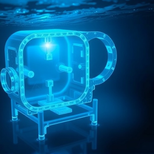
Underwater exploration has long faced a formidable adversary in murky, sediment-filled waters. Remotely operated vehicles (ROVs) find their underwater cameras often blinded when sediment clouds the water, compelling operators to pause missions until visibility returns. Researchers at the Massachusetts Institute of Technology (MIT) and Woods Hole Oceanographic Institution (WHOI) have developed a groundbreaking solution: a real-time underwater mapping technique integrating optical imaging with sonar sensing, promising to revolutionize navigation and observation in turbid underwater environments.
This novel approach—named Sonar-MASt3R—leverages the complementary strengths of sonar and optical systems. Sonar excels in low-visibility conditions by emitting acoustic waves that bounce off objects and return to sensors, revealing the shapes and distances of submerged features even in dense sediment. Conversely, optical cameras provide richly detailed visuals but falter in steamy, sand-laden waters. By fusing sonar’s broad but crude depth data with the detailed images from optical cameras, Sonar-MASt3R creates precise 3D maps, enabling vehicles to first orient themselves using sonar, then zoom in using cameras to discern intricate structures.
The inspiration behind this method draws from nature’s own navigators: dolphins use echolocation to detect objects from afar, while sea turtles rely on sharp, close-up vision. The Sonar-MASt3R system mimics this synergy by using sonar for distant sensing and optical cameras for detailed inspection once proximity is established, facilitating navigation through obscured waters in real-time. Tank experiments simulating different water clarities demonstrated the system’s ability to map centimeter-scale details even in the cloudiest conditions.
Sonar-MASt3R builds upon prior advances in monocular depth estimation methods, specifically the MASt3R algorithm developed by French researchers. MASt3R rapidly generates 3D spatial maps from 2D camera inputs by evaluating relative pixel depths. However, MASt3R alone cannot determine real-world scale, discerning only whether one pixel is closer than another without specifying actual distances. Sonar overcomes this limitation by providing absolute distance measurements based on acoustic wave travel time. Integration of sonar data corrects MASt3R’s scale ambiguities, resulting in highly accurate, real-world 3D environmental reconstructions.
Experiments were conducted in controlled tanks filled with objects such as rocks, coffee mugs, and crates, with a robotic arm holding both a camera and sonar sensor performing coordinated sweeps. Sonar first compiled a coarse environmental map highlighting large shapes and contours. Then the system used keyframe comparison algorithms on subsequent optical images to selectively enhance the resolution of the sonar map with detailed visual data, dynamically discarding redundant frames. This process occurred in real time, allowing immediate situational awareness and navigational decision-making.
The researchers systematically varied water turbidity by stirring sediment, simulating natural murkiness. Sonar-MASt3R excelled compared to existing opti-acoustic fusion methods, generating clearer 3D maps with finer detail, particularly in difficult visibility conditions. Even at the densest sediment concentrations, where optical cameras were rendered blind, sonar’s acoustic readings provided the initial environmental layout. This coarse sonar map enabled the robotic arm to safely approach objects, allowing cameras to then acquire fine visual details as the vehicle closed in.
Richard Camilli, senior scientist of applied ocean physics and engineering at WHOI and co-author of the research, likened the ability to navigate using Sonar-MASt3R to moving carefully through a dark china shop in search of a specific coffee mug without shattering anything. The system’s combined acoustic and optical sensing brings such finesse to previously inaccessible underwater scenarios, opening new frontiers for robotic exploration, underwater construction, and deep-sea recovery operations.
Beyond tanks, the team anticipates even fewer challenges deploying Sonar-MASt3R in natural ocean environments. Unlike experimental tanks—which behave as echo chambers rife with reverberations and ghost images—open waters generally provide cleaner sonar feedback, potentially simplifying signal processing and enhancing mapping fidelity. This expectation sets the stage for field tests that could validate the system’s efficacy in truly unstructured settings.
The practical applications of Sonar-MASt3R extend broadly. The technology promises to empower robotic missions in turbid coastal and surf-zone environments where visibility is compromised and human presence risky. One salient use case involves safe disposal and recovery of unexploded underwater mines, a critical endeavor complicated by sediment churn and murky conditions. Sonar-MASt3R’s precise 3D mapping could guide autonomous devices safely and effectively where conventional methods falter.
This fusion of sensory modalities transcends previous attempts hampered by asynchronous data fusion and limited resolution. Prior techniques often required time-intensive processing and were unable to produce real-time 3D reconstructions. Sonar-MASt3R overcomes these barriers, ensuring seamless integration of data streams and immediate environmental rendering. Its success underscores a broader trend in robotics and marine sensing toward multi-modal perception systems capable of functioning robustly in complex, low-visibility domains.
The research was supported in part by NASA and the National Science Foundation, reflecting its high relevance to space and marine robotics, where reliable sensory input is critical under challenging conditions. Amy Phung, the lead MIT graduate student driving the project, envisions Sonar-MASt3R as a key enabler for mission scenarios today deemed untractable due to observational constraints. “There are plenty of challenging underwater missions,” she notes, “and this technology can unlock new operational capabilities fundamentally limited by perception.”
The team’s paper, “Sonar-MASt3R: Real-Time Opti-Acoustic Fusion in Turbid, Unstructured Environments,” was presented at the IEEE International Conference on Robotics and Automation (ICRA), marking a significant milestone in underwater robotics. With its successful demonstration of near real-time 3D environmental mapping under variable turbidity, Sonar-MASt3R establishes a new baseline for underwater robotic perception and paves the way for safer, smarter navigation in opaque and complex marine environments.
This breakthrough heralds a future where robotic explorers no longer capitulate to murky waters but confidently traverse sediment clouds to unveil the mysteries concealed beneath, expanding humanity’s knowledge and capability in the underwater realm.
Subject of Research: Underwater robotic perception and mapping in turbid environments using opti-acoustic sensor fusion.
Article Title: “Sonar-MASt3R: Real-Time Opti-Acoustic Fusion in Turbid, Unstructured Environments”
News Publication Date: Not specified
References: Phung, A., Camilli, R., et al., “Sonar-MASt3R: Real-Time Opti-Acoustic Fusion in Turbid, Unstructured Environments,” IEEE International Conference on Robotics and Automation (ICRA).
Image Credits: Courtesy of Amy Phung
Keywords
Oceanography, Computer Vision, Computer Modeling, Technology, Sensors, Robotic Sensors, Robotics, Oceans
Tags: 3D underwater mapping techniquesbiomimicry in underwater navigationMIT underwater researchoptical camera limitations underwaterreal-time underwater mappingROV navigation in murky watersediment-filled water explorationsonar and optical fusionsonar-based object detectionturbid water exploration solutionsunderwater imaging technologyWoods Hole Oceanographic Institution innovations

