Water mills in the central Italian region of Umbria are being reinterpreted not as isolated relics of a preindustrial past but as nodes of a territorial energy system whose traces still shape landscapes, economies and settlement patterns. A research article published in Built Heritage on 20 August 2026 proposes an analytical framework for assessing how these hydraulic structures, which once ground grain and pressed olives across the region, could be regenerated as multifunctional territorial infrastructures serving cultural, educational, productive, tourism-related and energy functions.
The study, conducted by Fabio Fatichenti, builds on two research projects funded by the Umbria Region between 2010 and 2013, one on rural landscapes and the heritage of rural settlements and the other dedicated exclusively to water mills. The author argues that the existing literature, while rich in regional and thematic studies, has rarely treated mills as components of an integrated territorial system. The research gap identified concerns the interpretative scale: a conceptual framework capable of reconceptualising water mills as territorial infrastructures and assessing their potential within broader territorial dynamics remains only partially developed.
To reconstruct the historical distribution of mills, the research integrated heterogeneous sources. Archival land registers, including the 18th-century Ghelli and Chiesa registers and the Gregorian Land Register of 1816 to 1835, provided documentation of mill numbers and locations. The Carta Idrografica del Regno d’Italia, a map series published by the Ministry of Agriculture, Industry, and Commerce between 1889 and 1893 at a scale of 1:100,000, proved to be the richest single source. According to the article, this document represents the first organic and systematic cartographic census of hydraulic structures in Italy before steam and electric engines disrupted the preindustrial economy. The Umbria-Marches area recorded more than 2,000 plants in total, with 869 in Umbria alone.
A second cartographic source, the 1:25,000 topographic maps of the Italian Military Geographical Institute, published mainly between the end of the 19th century and the first half of the 20th century, allowed a survey across 97 map sheets. These maps mark mills with a small toothed circle symbol, although the same symbol was used for all small hydraulic structures, including fulling mills and paper mills, so identification without a toponym remains uncertain. In total, the cartographic source shows 418 mills in Umbria, 342 in the province of Perugia and 76 in the province of Terni, a figure that testifies to the significant decline of these structures in the first half of the 20th century. Field surveys then verified the continued existence of structures identified on historical maps and documented hydraulic features often invisible in archival sources, such as canals, intake structures and small artificial basins.
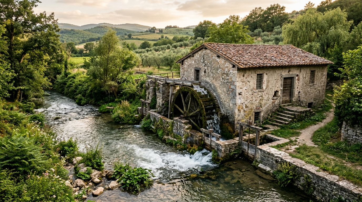
The technical description of the mills is central to the framework. Umbrian water mills are exclusively of the horizontal-wheel type, also known as Greek or Scandinavian mills, which were prevalent in central and southern Italy for two reasons: a hydrogeological factor, because the system suits rapid watercourses with modest flow, and an economic factor, namely relatively low installation and maintenance costs. The torrential regime of the watercourses also explains the high density of milling installations within small areas, since low summer flow limits productivity and additional downstream mills, called resumption mills, were often constructed. Water was drawn from a river or stream through an intake, channelled along a canal, collected in a basin known as the bottaccio and led through an inclined pipeline onto the paddles of a horizontal wooden wheel, the ritrecine, whose rotation was transmitted through a wooden shaft to the millstones.
The mills operated within a broader agricultural and social system. By the 16th century, almost every village possessed a mill, as attested by toponymy. In the 1960s, the Umbrian countryside was still dominated by polyculture, with vines married to support trees in the alberata or piantata landscape established under the sharecropping system. The crisis of traditional milling dates to the early 20th century, driven by reduced water availability and flour quality considered inferior to that of industrial mills. The most decentralised mills ceased activity first, while more efficient ones continued until roughly the middle of the century, when rural depopulation disrupted the balance between local supply and demand. A near-general abandonment was recorded almost everywhere between 1950 and 1980.
Three case studies apply the framework. The first is an itinerary of approximately 10 kilometres along the Tiber in the municipality of Perugia, touching the hamlets of Villa Pitignano, Ponte Felcino, Pretola, Ponte Valleceppi and Ponte San Giovanni. Most mills on this stretch drew power directly from the river without a catchment basin. The Rivolta Mill, documented since the end of the 14th century, ceased milling activity at the beginning of the 20th century and was converted into a hydroelectric power plant in 1986, which currently produces approximately 4.5 million kWh per year. The Catasta Mill at Ponte Felcino was also transformed into a hydroelectric power station, later decommissioned in the 1960s, and served the Lanificio di Ponte Felcino, a wool mill founded in 1862 that employed up to 300 workers before ceasing operations in 1996. The adjacent Baldelli Tower, converted into an 80-bed international hostel, has been undergoing further restoration since 2023 supported by €4.18 million in PNRR funding, with the project aiming to convert the mill into a nature education centre within the roughly 5-hectare Ponte Felcino Educational Forest.
The contrast within the Tiber itinerary is stark. The Pretola Mill, documented since the 14th century and owned by the Municipality of Perugia, is undergoing structural deterioration: the dam is present but unusable, the feed channel, catchment basin and discharge channel are missing, and the motor and grinding equipment have disappeared. The Sapienza Mill at Ponte Valleceppi ceased functioning definitively in 1961, and nothing remains today of its hydraulic works and grinding apparatus, although the distillery that now contains its ruins still holds a concession for a possible hydroelectric power station. At Ponte San Giovanni, a new hydroelectric power plant has been operational since 2006 and is capable of producing approximately 5.5 million kWh annually near the abandoned Ospedale del Colle mill.
The second case study concerns the marcite area near Norcia, within the Monti Sibillini National Park, where springs at a constant temperature of 10 to 12 °C feed marshy meadows. Reclamation of this area, probably by Benedictine monks in the sixth century or, according to others, at the end of the 13th century, created irrigated strips called cortinelle that yielded six crops of fodder a year. Seven mills were present in the marcite area at the beginning of the 19th century according to the Gregorian land register, and milling activity gradually ceased around the 1960s, with the last mill working until 1962. Six mills dating to the 13th and 14th centuries are the focus of preservation and enhancement: the Lanzi Mill is completely restored and included in the Marcite Eco-museum Project, the Amici and De Sanctis-Naticchioni mills are also restored, the Cecconi Mill operates as the Museum of Milling Art with milling mechanisms still in perfect working order, while the Viola and Petrini mills remain in ruins, the latter still housing its milling apparatus.
The third case, the Piergentili or Renzetti Mill in the municipality of San Giustino, is described as the most advanced example of multifunctionality. Operating since the late 17th century, it is one of the oldest working mills in Umbria, located on the Parnacciano ditch in an area where the survey on IGMI maps revealed 26 mills, a density of 3 mills per square kilometre, one of the highest in the region. Since 2016 it has been used for commercial production of flour, bread, pasta and focaccia and for tourist accommodation in two holiday flats, while restoration of the bottaccio increased working capacity from 25 to 50 kilograms per hour. A museum room with milling equipment and a historical library, a conference room and year-round school visits complete the offer. The author concludes that no universally applicable reuse pathway exists; the most promising approaches integrate multiple functions within coherent territorial strategies, and the results should be understood primarily as an assessment of potential rather than a rigorous measurement of performance, since a full quantification based on standardised indicators would require complete restoration and dedicated monitoring campaigns.
Subject of Research: An analytical framework for regenerating water mills in Umbria, central Italy, as multifunctional territorial infrastructures
Article Title: Water mills as territorial infrastructures in Umbria (Central Italy): towards an analytical framework for multifunctional regeneration
Article References: Fatichenti, F. (2026). Water mills as territorial infrastructures in Umbria (Central Italy): towards an analytical framework for multifunctional regeneration. Built Heritage, 10(1), Article 53. https://doi.org/10.1186/s43238-026-00296-2
Image Credits: AI Generated
DOI: 10.1186/s43238-026-00296-2
Keywords: water mills, Umbria, territorial infrastructure, hydraulic heritage, multifunctional regeneration, horizontal-wheel mills, Tiber River, marcite, Norcia, Piergentili Mill, industrial heritage, rural landscape
News Source: Denise Maddox. (November 6, 2026). Umbria’s water mills reframed as territorial infrastructure for multifunctional regeneration. Scienmag.