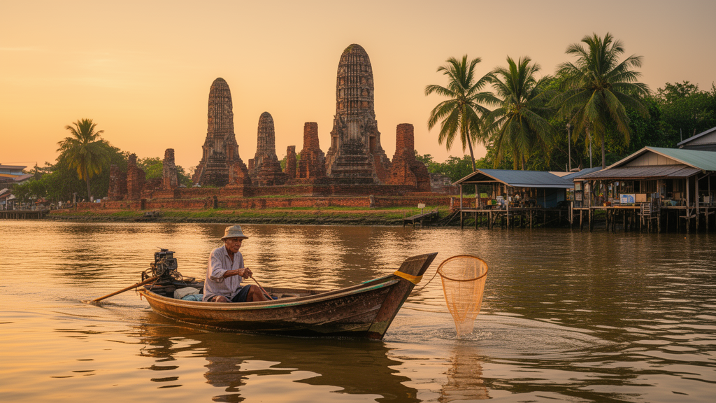
Ayutthaya, the former royal capital of Siam, sits on an island formed by three converging rivers some eighty kilometers north of Bangkok, and for centuries its urban life was organized around water. Canals, or khlongs, carried transport, trade, drainage and daily domestic use, alongside moats, basins and floodplains. Since the mid-twentieth century, that relationship has been reshaped not by one process but by four distinct undertakings: the terrestrial modernization begun in the 1930s, a 1967 master plan, the inscription of the historic center on the UNESCO World Heritage List in 1991, and successive regional flood-management programs after the major floods of 1995 and 2011. A new open-access study in the journal City, Territory and Architecture dissects how these projects combined, and reaches a finding that inverts a familiar assumption about heritage cities: the areas placed under conservation are precisely those where the water relation has ceased to be practiced, while the unprotected peripheries are where it continues to be renegotiated.
The research, based on 181 interviews with residents and 12 with public agencies across four sites, together with architectural surveys and archival plans covering 1932 to 2023, distinguishes two fundamentally different ways in which projects combine. On the historic island, the author argues, successive interventions do not truly entangle; they converge. Each layer extends the direction of the last in a cumulative march toward what the study calls the monumentalization of water: canals are dredged, banks landscaped, the waterway photographed and interpreted, but no longer used for transport, fishing, washing or trade. Water becomes present as representation while absent as practice. In the peripheries, by contrast, projects with unrelated rationales interfere, and the study specifies the conditions under which this constitutes genuine project entanglement.
Those conditions are two and must hold together. First, divergent rationalities: the projects must be driven by different actors, at different scales, pursuing goals that are unrelated or incompatible, rather than being successive instruments of a single program. Second, trans-temporal alteration: an earlier project must have changed the conditions in which a later and unrelated project takes effect, sometimes only after a long delay. The author contrasts this with a dialectical reading of the water-society relation, which he accepts for water and society themselves but rejects for projects. The Royal Irrigation Department did not act with reference to the Department of Fine Arts, and the floating market did not act with reference to the locks; these are externally related interventions that meet in the same territory, and no synthesis follows. Entanglement is preferred because it does not promise resolution; what it produces is emergence, configurations none of the constituent projects anticipated.
The island’s trajectory illustrates the alternative. The modernization carried out between 1932 and 1957 under the Khana Ratsadorn, the People’s Party that established Thailand’s constitutional monarchy, transferred land within the city walls from the royal domain to the Ministry of Finance and developed it into streets, bridges and administrative centers. A 1946 map shows road alignments intersecting and filling in the canals: two of the four north-south axial canals disappeared, the transverse canals were entirely filled, and only the khlong Thor and khlong Makham Rieng survived, along with the khlong Mueang outside the walls. In 1967, the architect Sumet Jumsai drew up a comprehensive rehabilitation plan calling for the dredging of fifty kilometers of ancient canals and the restoration of lost ponds. Implementation, however, would have required relocating public institutions built since 1938 and overhauling the road network, so the final master plan retained only the dredging and landscaping of two surviving canals. The material conditions created by the first layer had already eliminated the possibility of functional restoration, leaving only symbolic and landscape options open.
The 1991 UNESCO inscription then reclassified canals, moats and basins as heritage elements to be preserved, and landscaping projects turned riverbanks into showcase spaces for tourist contemplation. The effect is legible at the scale of single buildings. Along the khlong Mueang, the waterside pavilion of one monastery had served as its principal entrance, reached by boat from an adjoining landing stage; by 2022 the landing had been removed, the pavilion’s stairs demolished, the spaces between its stilts walled in, and the building converted into a storeroom, the monastery’s entrance having shifted to the road. Twenty residents interviewed along the khlong Mueang in 2023 reported that any alteration to their houses affecting the water’s edge now requires municipal authorization, and one abandoned a planned adaptation because the procedure made it unworkable; seven of the twenty noted that sluice gates had closed off the khlong Thor and khlong Makham Rieng entirely. The author describes a circular logic: residents’ disengagement from the water, produced by terrestrial modernization, justified placing the canals under heritage protection, and that protection in turn severed the remaining functional link between water and ways of living.
Three peripheral cases then show what genuine entanglement produces, and why the outcome is settled not by the entanglement itself but by what residents can bring to it. Along the khlong Khao-Mao east of the city, households before the 1960s lived from the canal in a material sense: they travelled to the island by boat, fished from the bank, sold the fish from the boat and gathered in pavilions built out over the water. The Rojana Road, built five hundred meters to the south in the 1960s, reoriented the local economy toward land, and from the late 1980s the axis became the spine of Ayutthaya’s industrial estates. In 1996 the khlong was incorporated into the Nakhon Luang regional irrigation project: locks interrupted river transport and the diversion of the Pasak River’s waters caused increasing bank erosion. One family, studied across three generations, built a concrete dike and erosion-control wall in 1997, demolishing the last elements connecting the household to the khlong.
The third layer reactivated what the first two had devalued. In 2011 the Ayothaya Floating Market opened near the khlong, and in its wake a member of that family and his siblings converted their grandparents’ house into a café and small family museum in 2015, building a terrace on stilts and displaying antique aquatic artifacts. Reopening the view required undoing the 1997 defenses, and the family did not agree on how far to go; after many discussions they decided collectively to keep the concrete dike and demolish only the wall above it, down to ground level, so that it would not block the view. The structure that had severed the household from the water was retained as protection and cut down as obstruction. Field observations in 2023 revealed about ten similar establishments along the khlong, nine created after the floating market opened and eight belonging to long-time residents. Yet the reinvention proved socially selective: half a kilometer upstream, a landowning household with an equally long riverine history was left on the wrong side of the same 1996 works, changed occupation, and never re-established the connection. Spatial capital, the study concludes, requires not only inherited land and memory but a property that remains physically re-openable, proximity to the tourist economy, and a returning generation with capital and market knowledge.
The khlong Ta-Kian, south of the island, followed a different path. A provincial road built five hundred meters south of the canal in 1974 gradually redirected commercial activity toward the land network, but water-based practices persisted for decades because the distance allowed them to continue. After the great flood of 2011, the most devastating in Thailand’s modern history, the Royal Irrigation Department installed two locks in 2012, halting all river traffic and converting a partial displacement into a decisive break. In 2012, residents of Wat Sam-Pao-Lom gathered in assembly and collectively decided to abandon their connection to the khlong, requesting the Subdistrict Administrative Organization to build concrete footbridges. What the assembly weighed was not water against roads but one form of land take against another: as one resident explained, a walkway over the water would be fast, simple, work for motorcycles and affect houses less than a road, which might otherwise have brought expropriation. The khlong was given up because building over it was the option that left tenure intact, and the village chief’s local governance capacity transformed a potentially fragmented shift into an organized decision. By 2023, all residents interviewed stated they no longer had any interaction with the khlong.
The third case, the thung Phukhao-Thong, a seasonally inundated floodplain in the north-west inhabited by long-established Muslim communities, shows adaptation rather than reinvention or relinquishment. Roads, a 1986 land-use plan converting the lower area into a temporary industrial zone, and the royal Kaem Ling flood-retention program, whose two commemorative reservoirs added more than 3.5 million cubic meters of retention capacity, produced conflicting yet cumulative effects. When the water rose to 4.5 meters in 2011 and left houses uninhabitable for nearly two months, residents of the Darus Sunnah Mosque village responded between 2012 and 2013 with the deed-baan, raising entire dwellings onto new concrete piles from 3.5 to 5 meters up to 5 to 7 meters, calibrated to the 2011 maximum, using construction knowledge circulated through mutual-aid networks organized around the mosque. The response was uneven because each pillar cost about 5,000 baht; one household that could not afford it spent another month sleeping on the road in the 2021 flood and only raised the house in 2024. The study offers the three-term relation between entanglement, resident resources and forms of negotiation as a comparative hypothesis rather than a general model, noting that whether it holds where designation is absent, tenure insecure or the state unitary remains an empirical question.
Subject of Research: How conservation, infrastructure and resident resources reshape the urban-water relationship in Ayutthaya, Thailand
Article Title: Project entanglement in a heritage waterscape: conservation, infrastructure and resident resources in Ayutthaya, Thailand
Article References: Seemak, P. (2026). Project entanglement in a heritage waterscape: conservation, infrastructure and resident resources in Ayutthaya, Thailand. City, Territory and Architecture, 13(1), Article 27. https://doi.org/10.1186/s40410-026-00331-w
Image Credits: AI Generated
DOI: 10.1186/s40410-026-00331-w
Keywords: Ayutthaya, heritage conservation, urban water, project entanglement, Chao Phraya, UNESCO World Heritage, flood management, vernacular adaptation, spatial capital, floating market, hydrosocial territory, Thailand
News Source: Denise Maddox. (October 28, 2026). When heritage protection ends the practice it meant to save: lessons from Ayutthaya’s waters. Scienmag.