• HOME
  • NEWS
  • EXPLORE
    • CAREER
      • Companies
      • Jobs
    • EVENTS
    • iGEM
      • News
      • Team
    • PHOTOS
    • VIDEO
    • WIKI
  • BLOG
  • COMMUNITY
    • FACEBOOK
    • INSTAGRAM
    • TWITTER
Thursday, August 14, 2025
BIOENGINEER.ORG
No Result
View All Result
  • Login
  • HOME
  • NEWS
  • EXPLORE
    • CAREER
      • Companies
      • Jobs
        • Lecturer
        • PhD Studentship
        • Postdoc
        • Research Assistant
    • EVENTS
    • iGEM
      • News
      • Team
    • PHOTOS
    • VIDEO
    • WIKI
  • BLOG
  • COMMUNITY
    • FACEBOOK
    • INSTAGRAM
    • TWITTER
No Result
View All Result
Bioengineer.org
No Result
View All Result
Home NEWS Science News Science

New developments with Chinese satellites over the past decade

Bioengineer by Bioengineer
July 11, 2019
in Science
Reading Time: 3 mins read
0
Share on FacebookShare on TwitterShare on LinkedinShare on RedditShare on Telegram

IMAGE

Credit: National Satellite Meteorological Center of the China Meteorological Administration

To date, 17 Chinese self-developed FengYun (FY) meteorological satellites have been launched, which are widely applied in weather analysis, numerical weather forecasting and climate prediction, as well as environment and disaster monitoring. Currently, seven satellites are in operation.

“The FY series satellite program has gone through four main stages,” according to Dr. Peng Zheng, Deputy Director at the National Satellite Meteorological Center of the China Meteorological Administration, and the first author of a recently published review (https://link.springer.com/article/10.1007/s00376-019-8215-x) . (Note: When the article was submitted for review in late 2018, eight FY satellites were in operation. One of them retired in March 2019.)

“The first stage primarily focused on research and development (R&D) of satellite technology. FY-1A operated for 39 days and FY-1B for 158 days. Meanwhile, FY-2A operated for about six months and FY-2B for about eight months.

In the second stage, the R&D satellites were transformed to operational ones. Since FY-1C in 1999 and FY-2C in 2004, FY satellites have been stable in orbit and capable of supporting continuous measurements in an operational manner.

In the third stage, the first-generation satellites were transformed to second-generation satellites. During the past decade, the new-generation FY polar and GEO satellites, FY-3A in 2008 and FY-4A in 2016, have been in operation. Advanced instruments capable of multiple types of measurements have been mounted on the platform of the new-generation FY satellites, including multiband optical imaging, atmospheric sounding, microwave imaging, hyperspectral trace gas detection, and full-band radiation budget measurement. The new epoch for comprehensive earth observations has begun.

The latest and current stage is focused on the accuracy and precision of satellite measurements. High performance in image navigation and radiometric calibration is essential to support various quantitative data applications, such as quantitative remote sensing and satellite data assimilation.”

Dr. Zhang and his team–a group of researchers from the National Satellite Meteorological Center of China Meteorological Administration–have had their summary of Chinese meteorological satellites published in a special issue(https://link.springer.com/journal/376/36/9/page/1) of Advances in Atmospheric Sciences on the National Report (2011-2018) to the International Union on Geophysics and Geodesy (IUGG) Centennial by the China National Committee for IAMAS.

In this review paper, they report the latest progress, major achievements and future plans of Chinese meteorological satellites; particularly, the improvements in core data processing techniques including image navigation, radiometric calibration and validation, are addressed.

China has become one of few countries that maintain polar and geostationary meteorological satellites operationally. With the associated open data policy and stable and accurate measurements, the FY satellites are becoming an important component of the space-based global observing system. FY satellite data delivery services support direct broadcasting users, CMACAST users, and web portal users. Web portal users can obtain the data through an FTP push service, FTP pull service, or manual service. Users can access the data online (http://satellite.nsmc.org.cn/portalsite/default.aspx) after a quick and free-of-charge registration process.

###

Media Contact
Zheng Lin
[email protected]

Original Source

http://english.iap.cas.cn/news/201907/t20190708_212706.html

Related Journal Article

http://dx.doi.org/10.1007/s00376-019-8215-x

Tags: Atmospheric ScienceClimate ChangeEarth ScienceMeteorologySatellite Missions/ShuttlesTechnology/Engineering/Computer Science
Share13Tweet8Share2ShareShareShare2

Related Posts

Five or more hours of smartphone usage per day may increase obesity

July 25, 2019
IMAGE

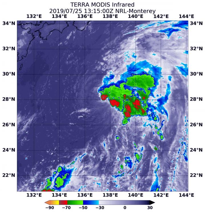
NASA’s terra satellite finds tropical storm 07W’s strength on the side

July 25, 2019

NASA finds one burst of energy in weakening Depression Dalila

July 25, 2019

Researcher’s innovative flood mapping helps water and emergency management officials

July 25, 2019
Please login to join discussion

POPULAR NEWS

  • blank

    Molecules in Focus: Capturing the Timeless Dance of Particles

    140 shares
    Share 56 Tweet 35
  • Neuropsychiatric Risks Linked to COVID-19 Revealed

    79 shares
    Share 32 Tweet 20
  • Modified DASH Diet Reduces Blood Sugar Levels in Adults with Type 2 Diabetes, Clinical Trial Finds

    58 shares
    Share 23 Tweet 15
  • Predicting Colorectal Cancer Using Lifestyle Factors

    47 shares
    Share 19 Tweet 12

About

We bring you the latest biotechnology news from best research centers and universities around the world. Check our website.

Follow us

Recent News

Nationwide Study Links Environment to Activity

Microplastics’ Vertical Movement in Rhine Floodplain Soils

Cancer Imaging Technique Enhances Monitoring and Treatment of Atherosclerosis

  • Contact Us

Bioengineer.org © Copyright 2023 All Rights Reserved.

Welcome Back!

Login to your account below

Forgotten Password?

Retrieve your password

Please enter your username or email address to reset your password.

Log In
No Result
View All Result
  • Homepages
    • Home Page 1
    • Home Page 2
  • News
  • National
  • Business
  • Health
  • Lifestyle
  • Science

Bioengineer.org © Copyright 2023 All Rights Reserved.