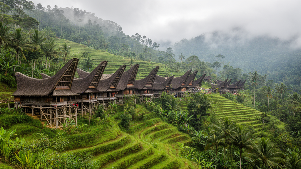
Researchers from Indonesia have applied a modified Landscape Character Assessment (LCA) framework to the Tongkonan Sa’pang indigenous settlement in Tana Toraja, South Sulawesi, to identify the cultural landscape character of the community. The study, published in the journal Built Heritage, demonstrates how a method originally developed within European contexts can be reinterpreted to capture the tangible and intangible dimensions of a living cultural landscape. By integrating physical and symbolic data through GIS-based spatial mapping, ethnographic fieldwork, and participatory validation with customary leaders, the team identified seven landscape character units structured into three main zones. This approach reflects the interconnection between ecological, spiritual, and social systems that define the Toraja cultural landscape.
The Toraja cultural landscape represents a living system that unites people, land, and ancestors within an ecological and spiritual continuum transmitted across generations. Tongkonan Sa’pang, located within the Tondok Lepongan Bulan Tana Matarik Allo confederation, exemplifies this unity through a spatial order grounded in kinship, cosmology, and customary ecological management. The settlement is organized through the kaparengesan system, a kin-based governance structure that maintains ecological balance while reinforcing social hierarchy and ancestral legitimacy. In recent decades, however, modernisation, economic pressures, land-use changes, heritage codification, and tourism have begun to disrupt this balance, threatening the continuity of both physical structures and intangible cultural meanings.
Conventional LCA methods, which focus mainly on visual and morphological aspects, often fail to represent the ritual symbolism, kinship-based spatial logic, and cosmological order that underpin indigenous landscapes. The study addresses this limitation by adopting a decolonial perspective that redefines LCA from a technocratic tool into an interpretative framework grounded in indigenous knowledge. The modified framework integrates emic values, ritual mapping, and participatory validation with customary leaders, ensuring that interpretations reflect indigenous epistemologies and territorial governance. This methodological shift is essential for developing preservation strategies that protect not only material integrity but also the symbolic and spiritual values sustaining indigenous life systems.
The study area covers approximately 583.683 square meters, comprising an ancestral house (tongkonan), rice barns (alang), rice fields (uma), ritual fields (rante), forests (tanete), springs, and burial sites (liang). Data collection aimed to provide a comprehensive understanding of the cultural landscape character through four complementary methods: desk study, physical–ecological survey, GIS-based spatial mapping, and interpretative ethnography. Fieldwork was conducted in two stages, from July to August 2024 and March to April 2025, to document current landscape conditions and verify spatial data. The survey was implemented under the guidance of the Head of the Tongkonan Sa’pang customary territory, ensuring that research activities followed cultural protocols and maintained social legitimacy.
Physical-ecological surveys documented the biophysical structure of the landscape, including topography, geology, soil, hydrology, and vegetation. Tongkonan Sa’pang lies at an altitude between 790 and 870 meters above sea level, characterized by steep terrain forming a tiered spatial pattern. The main tongkonan is positioned on the highest ridge, symbolizing the highest social status while serving as a ritual and surveillance centre. Steep slopes prone to erosion are designated as tanete, or sacred forests, where construction is prohibited due to both ecological and spiritual considerations. In contrast, gentle slopes and lowland areas are used for rice fields and fishponds, establishing a land-use zoning pattern shaped by morphology and land capability.
Geologically, the upper ridge consists of stable volcanic rock, providing a strong foundation for ancestral houses, while lower layers of shale are fragile and prone to landslides. Soil analysis indicates dominance of Af-Ferric Acrisols, a type of iron-rich clay soil with low agricultural productivity. To adapt, the community has developed a terracing system as a strategy for soil conservation and water management. Hydrologically, the settlement relies on natural springs located at the foot of the hills, with water channelled by gravity through traditional irrigation systems that follow the land contours. This system reflects the community’s deep understanding of slope dynamics and water management, supporting both subsistence and ritual offerings.
The cultural character of the settlement is defined by the interconnection between spatial and symbolic elements. Seven principal elements were identified as forming this cultural structure: tongkonan, alang, rante, tanete, uma, liang, and natural springs. Each element holds complementary social, ecological, and spiritual functions. The tongkonan and alang act as centres of social authority and food security, while the rante and liang are spaces for life-cycle rituals. The tanete serves as a sacred forest and source of ritual materials, and the uma and springs ensure subsistence and symbolise fertility and ancestral presence. These elements are connected through ritual pathways and kinship networks that organise spatial and social relationships.
Participatory validation was conducted through a Focus Group Discussion involving 12 participants representing customary authority, government institutions, residents, and the research team. The session included four customary informants, four government representatives, two residents, and two researchers. Preliminary findings were shared with customary elders to ensure genealogical consistency and territorial accuracy. During the 90 to 120-minute discussion, conducted in Toraja and Indonesian languages, participants corrected assumptions using GIS-based maps and short video documentation. This process ensured consistency between mapped boundaries, ritual zoning, and community knowledge, reinforcing indigenous authority and supporting the formal recognition of customary governance.
Through the modified LCA process, seven interconnected Landscape Character Units were identified and grouped into three major zones: the Customary Core Zone, the Ritual–Sacred Zone, and the Eco-Cultural Buffer Zone. The Customary Core Zone, centred on the tongkonan and alang, embodies the ancestral system that governs social hierarchy and subsistence. The Ritual–Sacred Zone includes the rante, tanete, and liang, forming a sacred spatial system linking death, rebirth, and spiritual transformation. The Eco-Cultural Buffer Zone comprises terraced rice fields, customary forests, and natural springs, reflecting the interdependence between livelihood, ritual, and ecology. These zones demonstrate how Toraja identity persists through the unity of space, ritual, and ancestral authority.
The study highlights the need for preservation strategies that protect both tangible structures and intangible cultural frameworks. Modernisation and shifting economic priorities are beginning to influence spatial and social changes within the settlement, with expanding infrastructure, outmigration, and the commodification of cultural symbols threatening to transform living traditions into staged performances. The adapted LCA method offers a community-based, value-driven preservation model that can be contextually applied to other indigenous territories across Southeast Asia. By incorporating customary law, genealogical authority, and ritual practices into a comprehensive analysis, the research advances a decolonial perspective that restores epistemic authority to indigenous communities.
The findings suggest that sustainability in cultural landscapes is not only ecological but also deeply rooted in social and spiritual systems. The model supports community resilience against heritage commodification and external tourism pressures by mapping sacred boundaries and reinforcing collective authority over which spaces may adapt to change. For policy integration in Indonesia, the model offers a technical foundation for embedding cultural landscape values into Regional Spatial Plans and Detailed Spatial Plans. This alignment bridges indigenous customary governance with state administration, ensuring that cultural landscapes are preserved as dynamic living systems rather than static tourist-oriented monuments.
The research demonstrates that the LCA method can be reinterpreted and locally adapted to support preservation strategies that respond to ongoing socio-ecological change. Its main contribution lies in developing a community-based, value-driven preservation model that captures ritual performance, symbolic order, and culturally embedded spatial knowledge. However, the study notes that future implementation in other indigenous contexts must remain flexible, respecting variations in social structure, cosmology, leadership legitimacy, and ritual norms to ensure ethical adaptation. This approach enriches international discourse on landscape resilience and heritage conservation by recognising the living relationship between community, land, and ancestors.
Subject of Research: Application of modified Landscape Character Assessment to the Toraja indigenous settlement of Tongkonan Sa’pang
Article Title: Identifying the cultural landscape character of the Toraja indigenous settlement using the landscape character assessment (LCA) method: a case study of Tongkonan Sa’pang
Article References: Allo, I. P. R., Firmansyah, & Kusuma, B. N. (2026). Identifying the cultural landscape character of the Toraja indigenous settlement using the landscape character assessment (LCA) method: a case study of Tongkonan Sa’pang. Built Heritage, 10(1), Article 34. https://doi.org/10.1186/s43238-026-00279-3
Image Credits: AI Generated
DOI: 10.1186/s43238-026-00279-3
Keywords: Landscape Character Assessment, Toraja, Cultural Landscape, Indigenous Knowledge, GIS Mapping, Heritage Conservation, Spatial Planning, Southeast Asia, Identifying, cultural, landscape, character
News Source: Denise Maddox. (November 9, 2026). Toraja Settlement Study Adapts Landscape Assessment to Indigenous Values. Scienmag.