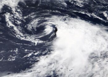
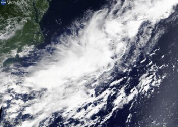
NASA’s Terra Satellite provides clear picture of wind shear battering Omar
Credit: Image Courtesy: NASA Worldview, Earth Observing System Data and Information System (EOSDIS). NASA's Terra satellite provided a visible image ...
Credit: Image Courtesy: NASA Worldview, Earth Observing System Data and Information System (EOSDIS). NASA's Terra satellite provided a visible image ...
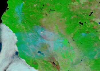
Credit: Credits: NOAA/NASA Imagery from the VIIRS instrument aboard NASA/NOAA's Suomi NPP satellite highlights the burn scars from the Elkhorn ...

Credit: ERC What can be done to improve the efficacy of vaccines? How can we predict our future climate? What ...
Credit: Credits: NASA/NRL When NASA's Terra satellite passed over the Northwestern Pacific Ocean, it gathered water vapor data on recently ...
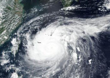
Credit: Credit: NASA/NRL Typhoon Maysak was moving north through the East China Sea early on Sept. 2 when NASA-NOAA's Suomi ...
Credit: Credit: NASA/NRL The storm was a potential tropical depression on Sept. 1, but by Sept. 2, the area of ...
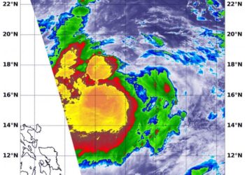
Credit: Courtesy: NASA Worldview, Earth Observing System Data and Information System (EOSDIS). Tropical Depression 15 strengthened into a tropical storm ...
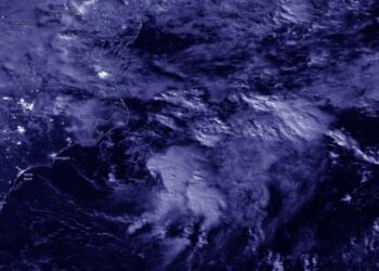
Credit: Credit: NASA Worldview, Earth Observing System Data and Information System (EOSDIS) NASA-NOAA's Suomi NPP satellite provided a nighttime view ...

University of Utah engineers to design and test real-time air pollution warning system for school, hospital parking lotsCredit: Dan Hixson/University ...
Credit: NOAA/NASA NOAA/NASA's Suomi NPP satellite captured two images that tell the story about the smoke coming off the fires ...
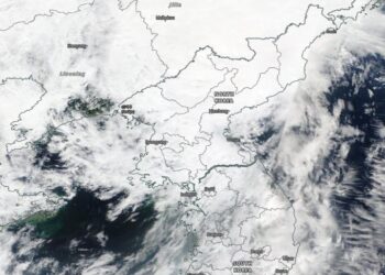
Credit: Image Courtesy: NASA Worldview, Earth Observing System Data and Information System (EOSDIS). Typhoon Maysak continued to move through the ...
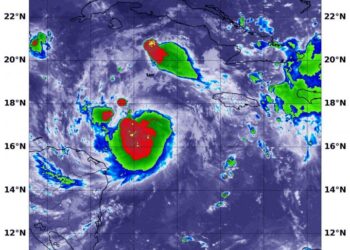
Credit: NASA/NRL NASA infrared imagery revealed several areas of strong thunderstorms around the center of the recently organized Tropical Storm ...
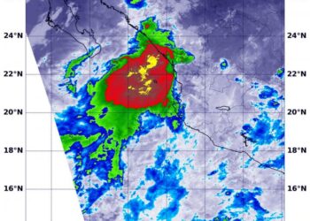
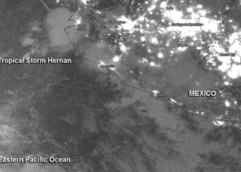
Credit: NASA/NRL NASA infrared imagery revealed a burst of strength in Tropical Storm Hernan, located over the Gulf of California. ...
Credit: NASA Worldview, Earth Observing System Data and Information System (EOSDIS) A new animation of nighttime imagery from NASA-NOAA's Suomi ...
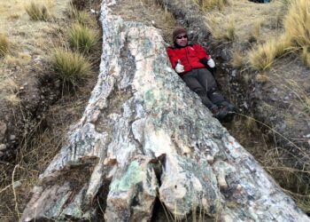
Credit: Carlos Jaramillo, Smithsonian Tropical Research Institute On an expedition to the Central Andean Plateau, researchers from the Smithsonian Tropical ...
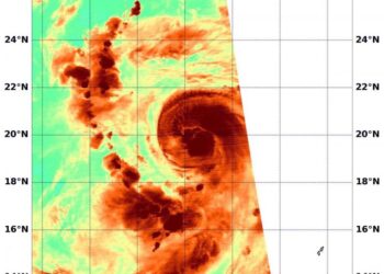
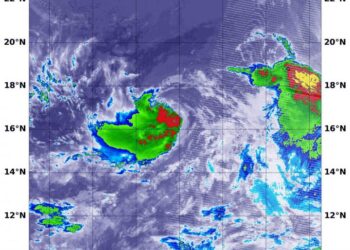
Credit: Credit: NASA/NRL NASA infrared imagery shows wind shear continued to batter Tropical Storm Iselle in the Eastern Pacific Ocean ...
Credit: NASA Worldview, Earth Observing System Data and Information System (EOSDIS) Nighttime imagery from NASA-NOAA's Suomi NPP satellite revealed the ...
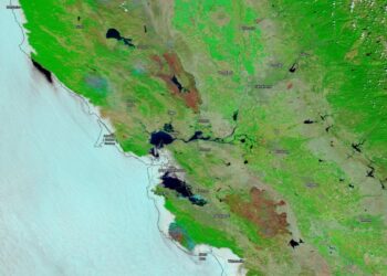
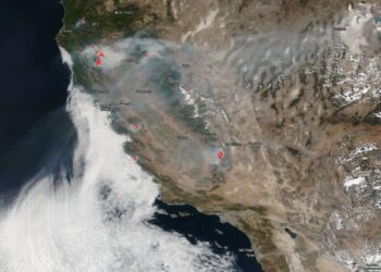
Credit: NASA On Aug. 26, 2020, NASA's Terra satellite was able to image the two areas in California where the ...
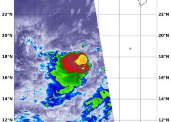
Credit: NASA/NRL NASA infrared imagery shows that newly formed Tropical Storm Iselle is already battling for its life under wind ...
Credit: Image Courtesy: NASA Worldview, Earth Observing System Data and Information System (EOSDIS). NASA's Terra satellite captured visible imagery as ...
