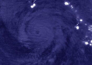
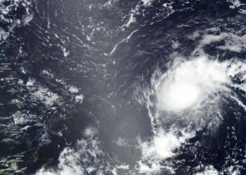
NASA gathers nighttime images of Laura becoming a Hurricane
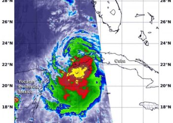
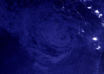
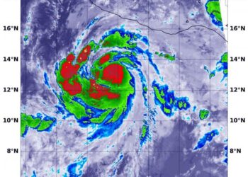
Credit: NASA/NRL Tropical Storm Laura strengthened to a hurricane in the morning hours of Aug. 25, and NASA provided infrared ...
Credit: NASA/NRL Tropical Storm Laura strengthened to a hurricane in the morning hours of Aug. 25, and NASA provided infrared ...
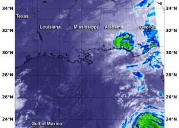
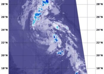
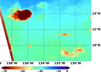
Credit: Credit: NASA/NRL NASA's Terra satellite passed over the Gulf of Mexico early on Aug. 25 and found a very ...
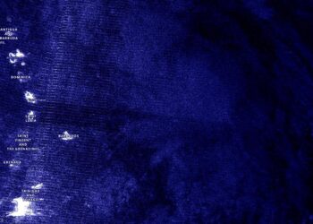
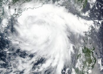
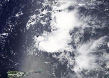
Credit: NASA Worldview As Tropical Storm Laura continues to move through the Caribbean Sea NASA satellites are providing forecasters with ...
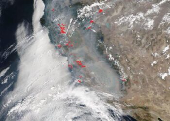
Credit: NASA Worldview More than 650 wildfires are blazing in California after unprecedented lightning strikes, storms, and a heatwave that ...
Credit: Credit: NASA Worldview, Earth Observing System Data and Information System (EOSDIS) NASA-NOAA's Suomi NPP satellite provided forecasters with a ...
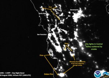
Credit: Credits: NOAA/NASA/William Straka U of W-Madison/CIMSS/SSEC Striking images of the California wildfires are seen in these nighttime satellite images ...
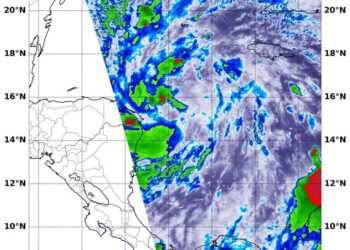
Credit: Credit: NASA/NRL NASA's Terra satellite gathered infrared data on Tropical Depression 14 as it moves through the Caribbean Sea. ...
Credit: Credit: NASA Worldview, Earth Observing System Data and Information System (EOSDIS) Nighttime imagery from NASA-NOAA's Suomi NPP satellite found ...
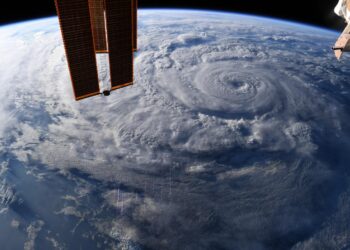
Credit: Credit: NASA/ISS/Chris Cassidy NASA provided a series of photos of Hurricane Genevieve as it affected Mexico's southern Baja California ...

Credit: Arend Kuester/Flickr Atmospheric scientists have analyzed how the February near-total shutdown of mobility affected the air over China. Results ...

A unique New Zealand deposit opens insights into how modern climate change may proceedCredit: Jennifer Bannister/University of Otago Scientists studying ...
Credit: Credit: NASA Worldview, Earth Observing System Data and Information System (EOSDIS) NASA-NOAA's Suomi NPP satellite kept an eye on ...
Credit: Credit: NASA Worldview, Earth Observing System Data and Information System (EOSDIS) NASA-NOAA's Suomi NPP satellite provided forecasters with a ...
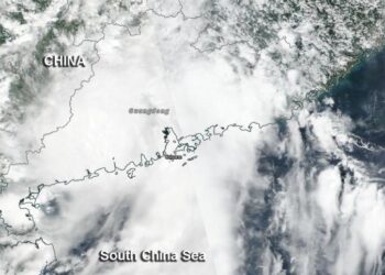
Credit: Credit: NASA Worldview, Earth Observing System Data and Information System (EOSDIS) NASA-NOAA's Suomi NPP satellite passed over the South ...
Credit: Credit: NASA/NRL Post-Tropical Storm Fausto faded fast in the Eastern Pacific Ocean. NASA's Terra satellite provided an infrared look ...
Credit: redit: NASA/NRL NASA's Terra satellite used infrared light to identify strongest storms and coldest cloud top temperatures and found ...
Credit: Credits: NASA/NRL Tropical Depression 10E weakened to a remnant low-pressure area in the Eastern Pacific Ocean. NASA's Terra satellite ...
Credit: Image: NASA Worldview NASA's Terra satellite provided a visible image of the end of Post-tropical Storm Kyle in the ...
Credit: Image Courtesy: NASA Worldview, Earth Observing System Data and Information System (EOSDIS). Tropical Storm Josephine weakened on Aug. 16 ...
Credit: Credit: NASA Worldview, Earth Observing System Data and Information System (EOSDIS) NASA-NOAA's Suomi NPP satellite provided forecasters with a ...
