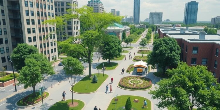
In a remarkable stride towards enhancing urban sustainability, a research team spearheaded by Rumi Chunara, an esteemed associate professor at NYU, has developed an innovative artificial intelligence system that significantly improves the accuracy of tracking urban green spaces through satellite imagery. Chunara, who holds appointments in both the Tandon School of Engineering and the School of Global Public Health, recognizes the critical nature of this development in fostering healthier cities amid rising environmental challenges.
The research team selected Karachi, Pakistan’s largest city, as the testing ground for their advanced AI model. This choice is particularly notable due to Karachi’s complex urban structure, which comprises densely populated areas interspersed with varied vegetation conditions. The diverse landscape of the city offered a unique opportunity to assess the efficacy of the new technology in accurately mapping urban greenery, an essential factor in urban planning and public health.
What sets this AI system apart from previous methodologies is its ability to overcome the significant limitations of traditional satellite analysis, which has historically failed to capture as much as 37% of urban vegetation. As cities across the globe grapple with the dual pressures of rapid urbanization and climate change, effective monitoring and enhancement of green spaces has become imperative. Urban greenery is known to mitigate climate-related impacts by cooling environments, filtering pollution, and providing invaluable spaces for physical and mental well-being.
The researchers employed an enhanced version of AI segmentation architectures, specifically utilizing DeepLabV3+. The system was trained using high-resolution satellite imagery sourced from Google Earth, and the researchers innovatively integrated a technique they termed “green augmentation.” This process involved generating diverse variations of green vegetation data under different lighting and seasonal conditions, ultimately improving their model’s accuracy in detecting vegetation by an impressive 13.4% compared to existing methods. Such progress represents a significant leap forward in the application of AI to environmental monitoring.
Indeed, when evaluated for its precision in identifying urban vegetation, the new system achieved an accuracy rate of 89.4% alongside a reliability of 90.6%. This performance starkly contrasts with traditional methods, which exhibit considerably lower accuracy and reliability figures—63.3% and 64.0% respectively. Chunara highlighted the transformative potential of their approach, pointing out that earlier methods primarily relied on simplistic light wavelength measurements. The current AI system, however, is trained to discern more nuanced patterns, enabling it to differentiate between grass and trees, even in challenging urban contexts.
This increased accuracy in detecting green spaces is essential for urban planners as they work to identify neighborhoods requiring additional vegetation to bridge the existing disparities in urban green space distribution. The analysis of Karachi presented a concerning picture: the average availability of green space stood at a mere 4.17 square meters per person, significantly lower than the World Health Organization’s recommended minimum of 9 square meters per capita. Furthermore, the stark variability between neighborhoods, with some experiencing upwards of 80 square meters per person, while others saw as little as 0.1 square meters, underscores the need for targeted interventions.
The research findings established a clear link between economic indicators and the presence of urban greenery. Areas with denser networks of paved roads—often associated with economic development—were noted to have higher instances of trees and lush grass cover. Remarkably, the study also found that neighborhoods possessing greater vegetation reported lower surface temperatures, reinforcing the essential role green spaces play in cooling urban environments.
A comparative analysis with Singapore further elucidated the potential outcomes of intentional urban planning. Despite a similar population density, Singapore manages to provide 9.9 square meters of green space per individual, thereby surpassing the WHO’s target and demonstrating the benefits of dedicated efforts in urban greening initiatives.
The research team made their methodology publicly available, paving the way for other cities to apply these strategies. However, it is important to note that utilizing this system in different geographical contexts would necessitate retraining the model on local satellite imagery to ensure its effectiveness. Chunara’s dedication to advancing the understanding of urban health disparities through computational and statistical methods is evident in this latest undertaking, aligning with her previous work that addressed systemic issues in health access and social determinants.
With the study’s findings not only illuminating the urgent need for equitable access to green spaces but also showcasing the power of modern AI technologies in addressing urban challenges, there is a compelling call to action for city planners and policymakers around the globe. As metropolitan areas continue to grow, this research serves as a critical reminder of the importance of integrating nature into urban design to foster climates that are not only sustainable but also supportive of public health and community well-being.
In conclusion, as urban centers evolve, leveraging data-driven approaches such as this new AI system will be vital in shaping cities that fundamentally prioritize the health and well-being of their residents. The implications of this research resonate well beyond Karachi, offering a roadmap for cities worldwide striving to rebalance their urban ecosystems and ensure equitable access to the benefits of green spaces.
Subject of Research: Tracking Urban Green Spaces Using Satellite Imagery
Article Title: Unveiling Advanced AI Capabilities in Urban Green Space Tracking
News Publication Date: 8-Feb-2025
Web References: Link to ACM Journal
References: Funding provided by National Science Foundation and National Institutes of Health; study conducted by NYU and Aga Khan University teams.
Image Credits: Satellite imagery sourced from Google Earth.
Keywords: Artificial Intelligence, Urban Green Spaces, Satellite Imagery, Karachi, Environmental Sustainability, Urban Planning, Public Health, Climate Change, Data Augmentation.
Tags: addressing urbanization and climate changeadvanced methodologies for satellite analysisAI system for urban green space analysischallenges of tracking urban vegetationdisparities in urban greenery accessenhancing urban health through green spacesenvironmental inequities in urban planningimproving accuracy of green space monitoringinnovative technology in public healthKarachi urban vegetation mappingRumi Chunara research on green spacessatellite imagery for urban sustainability


